Chippewas of Georgina Island First Nation

Last updated
Chippewas of Georgina Island First Nation
Waaseyaagmiing Anishinaabek
Chippewas of Georgina Island First Nation Indian Reserve
Canada Southern Ontario location map 2.png
Red pog.svg
Chippewas of Georgina Island First Nation
Coordinates: 44°20′N79°17′W / 44.333°N 79.283°W / 44.333; -79.283 Coordinates: 44°20′N79°17′W / 44.333°N 79.283°W / 44.333; -79.283
Country Flag of Canada (Pantone).svg  Canada
Province Flag of Ontario.svg  Ontario
Regional municipality York
First NationChippewas of Georgina Island
Area
[1]
  Land14.55 km2 (5.62 sq mi)
Population
 (2020) [1]
  Total923
  Density18.9/km2 (49/sq mi)
Website georginaisland.com
Map of York Region showing Fox, Snake, and Georgina islands. York-georginaisland.PNG
Map of York Region showing Fox, Snake, and Georgina islands.
Georgina Island, Lake Simcoe, Ontario Lake Simcoe Ontario.png
Georgina Island, Lake Simcoe, Ontario

The Chippewas of Georgina Island First Nation (Ojibwe : Waaseyaagmiing Anishinaabek) are an Ojibwa (or Anishinaabeg) people located on Georgina Island in Lake Simcoe, Ontario, Canada. In 2008, of the First Nation's registered population of 666 people, 181 lived on, and 485 lived outside, their reserve. [2] As of 2020, the band has a total population of 923 members. [3] They are one of a handful of First Nations in the Toronto Census Metropolitan Area. [4]

Contents

Geography

The First Nation has three reserves: the Chippewas of Georgina Island First Nation Indian Reserve, the Chippewas of Georgina Island First Nation 33A Indian Reserve 44°20′N79°17′W / 44.333°N 79.283°W / 44.333; -79.283 and the shared Chippewa Island Indian Reserve.

The main reserve consists of a small parcel of land near Virginia Beach and three islands on the southern shores of Lake Simcoe:

The Chippewas of Georgina Island First Nation 33A reserve is a 1.3-hectare (3.2-acre) parcel of land [5] separated from the mainland portion of the Chippewas of Georgina Island First Nation reserve by Black River Road and the private properties along it.

The Chippewa Island reserve is a 3.1-hectare (7.7-acre) reserve consisting of two islands near the Moose Deer Point First Nation in Twelve Mile Bay of Georgian Bay. It is shared with the Chippewas of Rama First Nation and the Beausoleil First Nation.

Government

The reserve government consists of a five-member band council with four councillors and a Chief.

Fire and emergencies services consists of a single fire truck and ambulance. The department is staffed by two full time firefighters (one is the chief) and volunteer responders. [6]

Policing is provided by Georgina Island Police Service with assistance from the Ontario Provincial Police. [7] The force has three officers, and replaced the community officers from the Royal Canadian Mounted Police (primarily from Orillia Detachment and secondary from Toronto) in 1978. GIPS are part of the First Nations Police Service.

Transportation

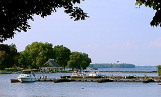
Access to Georgina Island is by boat to and from the mainland. A marina is located on the southern tip of the island for the ferry and smaller vessels. Built in 1999, the ferry Aazhaawe can carry 18 cars and 50 passengers. [8] Ferry service is seasonal and not provided when Lake Simcoe is frozen over. Fan boats provide access to Georgina (Fox and Snake) during the winter. Georgina Water Taxi's Ahneen provides alternate travel to Georgina Island. [9]

There are a few paved roads on Georgina Island (nine in total) with residents using personal vehicles. There are only unpaved roads on Snake Island and no roads on Fox Island. Primary means of transport to Fox and Snake Islands is by vessels docking on private docks around the islands.

Roads are maintained by the band. There is no airport or heliport on any of the islands.

Economy

The main employers on the reserve beyond the band are geared to tourism on the island. [10] The island has a driving range, bed and breakfast and marina facilities.

Education

Primary education (from kindergarten to Grade 6) is found at a single school, Waabgon Gamig, on Georgina Island. York Region District School Board (YRDSB) provides staffing and assistance. [11] Students from Grades 6 to 12 are required to attend schools on the mainland with YRDSB.

Health

Basic health services are provided at the Georgina Island Health Building by local staff and medical staff visiting from York Region.

See also

Related Research Articles

<span class="mw-page-title-main">Orillia</span> City in Ontario, Canada

Orillia is a city in Ontario, Canada. It is in Simcoe County between Lake Couchiching and Lake Simcoe. Although it is geographically located within Simcoe County, the city is a single-tier municipality. It is part of the Huronia region of Central Ontario. The population in 2021 was 33,411.

<span class="mw-page-title-main">Regional Municipality of York</span> Regional municipality in Ontario, Canada

The Regional Municipality of York, also called York Region, is a regional municipality in Southern Ontario, Canada, between Lake Simcoe and Toronto. The region was established after the passing of then Bill 102, An Act to Establish The Regional Municipality of York, in 1970. It replaced the former York County in 1971, and is part of the Greater Toronto Area and the inner ring of the Golden Horseshoe. The regional government is headquartered in Newmarket.

<span class="mw-page-title-main">Lake Simcoe</span> Lake in Ontario, Canada

Lake Simcoe is a lake in southern Ontario, Canada, the fourth-largest lake wholly in the province, after Lake Nipigon, Lac Seul, and Lake Nipissing. At the time of the first European contact in the 17th century the lake was called Ouentironk by the native Wendat/Ouendat (Huron) people. It was also known as Lake Taronto until it was renamed by John Graves Simcoe, the first Lieutenant-Governor of Upper Canada, in memory of his father, Captain John Simcoe of the Royal Navy. In Anishinaabemowin, the ancestral language of the First Nations living around this lake, namely Anishinaabek of Rama and Georgina Island First Nations, Lake Simcoe is called Zhooniyaang-zaaga'igan, meaning "Silver Lake".

<span class="mw-page-title-main">Keswick, Ontario</span> Community in Ontario, Canada

Keswick (/ˈkɛzˌwɪk/) is a community located in the Canadian province of Ontario. Situated in Cook's Bay on Lake Simcoe, 72 km (45 mi) north of Toronto. Keswick is part of the Town of Georgina, the northernmost municipality in the Regional Municipality of York. In the Canada 2016 Census, the municipal population of Keswick was 26,757.

<span class="mw-page-title-main">Simcoe County</span> County in Ontario, Canada

Simcoe County is located in the central portion of Southern Ontario, Canada. The county is just north of the Greater Toronto Area, stretching from the shores of Lake Simcoe in the east to Georgian Bay in the west. Simcoe County forms part of the Greater Golden Horseshoe area, a densely populated and industrialized region, centred on the Greater Toronto Area.

<span class="mw-page-title-main">Ramara</span> Township in Ontario, Canada

Ramara is a lower-tier township municipality in Simcoe County, Ontario, Canada.

Munsee-Delaware Nation is a Lenape First Nations band government located 24 kilometres (15 mi) west of St. Thomas, in southwest Ontario, Canada. Known previously as the Munsee of the Thames, their land base is the 1,054 hectares Munsee-Delaware Nation 1 reserve, with the unincorporated community of Muncey as their main community. The reserve is splintered into several non-contiguous areas, made up of individual lots within the Chippewas of the Thames reserve. As of January 2014, their registered population was 612 people, though only 148 lived on their own reserve.

<span class="mw-page-title-main">York—Simcoe</span> Federal electoral district in Ontario, Canada

York—Simcoe is a federal electoral district in Ontario, Canada, that has been represented in the House of Commons of Canada from 1968 to 1979, from 1988 to 1997 and since 2004.

<span class="mw-page-title-main">York Region District School Board</span> School board in Ontario, Canada

The York Region District School Board (YRDSB) is the English-language public school board for the Regional Municipality of York in Ontario, Canada. The York Region District School Board is the province's third-largest school board after Toronto's TDSB and Peel's PDSB, with an enrollment of over 122,000 students. It is in the fastest-growing census division in Ontario and the third-fastest growing in Canada.

<span class="mw-page-title-main">York Regional Police</span>

The York Regional Police (YRP) are a law enforcement organization that serves over 1.1 million residents in the York Region of Ontario, Canada, located north of Toronto. YRP was formed in 1971 from the police forces maintained by the nine municipalities which amalgamated into York Region at the time.

<span class="mw-page-title-main">Snake Island (Lake Simcoe)</span>

Snake Island is a lake island located in Lake Simcoe, Ontario, Canada. After the War of 1812, these islands, along with Fox Island and Georgina Island were purchased by Chief Joseph Snake from the British. The islands used to be headquarters to his father Chief Renatus Snake.
<span class="mw-page-title-main">Chippewas of Rama First Nation</span>

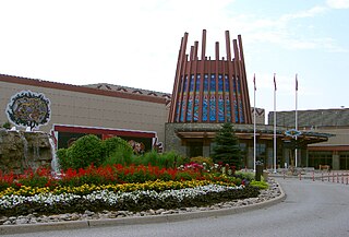
Chippewas of Rama First Nation, also known as Chippewas of Mnjikaning and Chippewas of Rama Mnjikaning First Nation, is an Anishinaabe (Ojibway) First Nation located in the province of Ontario in Canada. The name Mnjikaning, or fully vocalized as Minjikaning, refers to the fishing weirs at Atherley Narrows between Lake Simcoe and Lake Couchiching and it means "in/on/at or near the fence".
<span class="mw-page-title-main">Beausoleil Island</span>

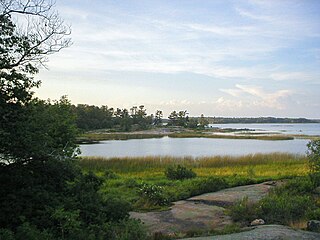
Beausoleil Island; Île Beausoleil; is an 8-kilometre (5.0 mi) long island in the municipality of Georgian Bay, District Municipality of Muskoka in Central Ontario, Canada. The island is named after Louis Beausoleil, a Métis settler whose 1819 homestead stood at the island's southern tip. The name of the island in the Huron-Wendat language is Skiondechiara which means "The land to appear floating afar". Located in the Thirty Thousand Islands in Georgian Bay on Lake Huron, it is the largest island in Georgian Bay Islands National Park and is the only place in the park where camping is allowed. Beausoleil Island is also part of the Georgian Bay Littoral UNESCO Biosphere reserve.

<span class="mw-page-title-main">Georgina Island</span>

Georgina Island is the largest of the lake islands of Lake Simcoe, located in southern Ontario, Canada. The island is a Native reserve populated by the Chippewas of Georgina Island First Nation, a band of Ojibwa people. It is also within the Town of Georgina and in the Regional Municipality of York.

Beausoleil First Nation(Ojibwe: G'Chimnissing) is an Ojibwe First Nation band government located in Simcoe County, Ontario, Canada. The main settlement of the Beausoleil First Nation is on Christian Island, Ontario, Canada in southern Georgian Bay. As of 2018, the total number of status Native Americans registered with the First Nation is 2,587. The on-reserve population is 614.

<span class="mw-page-title-main">York—Simcoe (provincial electoral district)</span> Provincial electoral district in Ontario, Canada

York—Simcoe is a provincial electoral district in Ontario, Canada, that has been represented in the Legislative Assembly of Ontario since the 2007 provincial election.

Chippewas of Georgina Island First Nation 33A is a First Nations reserve near the shores of Lake Simcoe. It is one of three reserves of the Chippewas of Georgina Island First Nation. It is an enclave within Georgina, Ontario, surrounded by the unincorporated community of Virginia Beach. It is separated from the mainland portion of the Chippewas of Georgina Island First Nation reserve by Black River Road and the private properties along it.

Joseph Snake was an Ojibwe chief belonging to the Chippewas of Lakes Huron and Simcoe from sometime before 1842 until his death in 1861.

References

  1. 1 2 "Chippewas of Georgina Island First Nation census profile". 2011 Census of Population . Statistics Canada. 8 February 2012. Retrieved 23 May 2015.
  2. "General Information". Archived from the original on 2008-03-07. Retrieved 2004-10-26.
  3. "First Nations Land Management Resource Centre" . Retrieved 2020-12-20.
  4. "SGC Metropolitan areas - 535 - Toronto, census subdivisions, 2006". Archived from the original on 2013-11-20. Retrieved 2014-01-16.
  5. Indigenous and Northern Affairs Canada profile – Chippewas of Georgina Island First Nation 33A
  6. Georgina Island Archived 2013-01-24 at archive.today
  7. Georgina Island Archived 2013-06-11 at the Wayback Machine
  8. Georgina Island Tourism ~ Escape Archived 2012-11-19 at the Wayback Machine
  9. GEORGINA ISLAND TOURISM ~ Ferry Information Archived 2012-07-29 at the Wayback Machine
  10. Georgina Island Archived 2013-04-11 at the Wayback Machine
  11. Georgina Island Archived 2013-01-24 at archive.today