Cimitarra

Last updated
Cimitarra
Municipality and town
Flag of Cimitarra (Santander).svg
Colombia - Santander - Cimitarra.svg
Location of the municipality and town of Cimitarra in the Santander Department of Colombia.
CountryFlag of Colombia.svg  Colombia
Department Santander Department
Population
 (2020 est. [1] )
  Total50,892
Time zone UTC-5 (Colombia Standard Time)

Cimitarra is a town and municipality in the Santander Department in northeastern Colombia.

Climate

Cimitarra has a tropical rainforest climate (Köppen: Af). [2]

Climate data for Cimitarra (1991–2020)
MonthJanFebMarAprMayJunJulAugSepOctNovDecYear
Mean daily maximum °C (°F)32.21
(89.98)
32.46
(90.43)
32.21
(89.98)
32.15
(89.87)
32.13
(89.83)
32.18
(89.92)
32.39
(90.30)
32.6
(90.7)
32.38
(90.28)
31.71
(89.08)
31.5
(88.7)
31.65
(88.97)
32.13
(89.83)
Mean daily minimum °C (°F)22.6
(72.7)
22.66
(72.79)
22.78
(73.00)
22.58
(72.64)
22.57
(72.63)
22.4
(72.3)
22.2
(72.0)
22.2
(72.0)
22.26
(72.07)
22.2
(72.0)
22.25
(72.05)
22.49
(72.48)
22.43
(72.37)
Average precipitation mm (inches)152.05
(5.99)
172.09
(6.78)
282.62
(11.13)
302.2
(11.90)
286.62
(11.28)
189.77
(7.47)
170.94
(6.73)
193.06
(7.60)
279.77
(11.01)
372.95
(14.68)
359.62
(14.16)
202.25
(7.96)
2,963.95
(116.69)
Average precipitation days (≥ 1.0 mm)8.599.7613.6115.3817.7414.4814.2715.1915.9517.216.3211.46169.95
Source: NOAA [3]

Related Research Articles

<span class="mw-page-title-main">Enterprise, Utah</span> City in Utah, United States

Enterprise is a city in northwestern Washington County, Utah, United States. The population was 1,711 at the 2010 census.

<span class="mw-page-title-main">Pembroke, Virginia</span> Town in Virginia, United States

Pembroke is a town in Giles County, Virginia, United States. The population was 1,128 at the 2010 census. It is part of the Blacksburg–Christiansburg Metropolitan Statistical Area.

<span class="mw-page-title-main">Pennington Gap, Virginia</span> Town in Virginia, United States

Pennington Gap is a town in Lee County, Virginia, United States. The population was 1,624 at the 2020 census.

<span class="mw-page-title-main">Basse Santa Su</span> Place in Upper River Division, The Gambia

Basse Santa Su, usually known as Basse, is a town in the Gambia, lying on the south bank of the River Gambia. The easternmost major town in the nation, it known for its important market. Basse is the capital of the Upper River Division, which is coterminous with the Basse Local Government Area. As of 2009, the town has an estimated population of 18,414. According to the 2013 census, the Basse LGA has 243,791 residents.

<span class="mw-page-title-main">Tangamandapio</span> Place in Michoacán, Mexico

Santiago Tangamandapio, known as Tangamandapio, is a municipality located in the northwest part of the Mexican state of Michoacán, WSW of Zamora, Michoacán, 165 km from the state capital of Morelia. The geographic coordinates are: 19° 57' North latitude and 102° 26' West longitude. Tangamandapio Municipality also includes the community of Tarécuato.

Barberena is a town, with a population of 47,093, and a municipality in Santa Rosa department of Guatemala. Filled with local vendors and stores selling American goods, Barberena is a small town typical of the Guatemalan countryside.

<span class="mw-page-title-main">Porlamar</span> Place in Nueva Esparta, Venezuela

Porlamar is a city and major seaport in the state of Nueva Esparta, Venezuela. It is situated on the southern coast of Margarita Island, one of three islands in the Caribbean Sea off the South American mainland which make up the state of Nueva Esparta, at a distance of 6 miles (10 km) from the state capital of La Asunción. Porlamar is the capital of Mariño, the most populous of the eleven municipalities into which the state of Nueva Esparta is divided.

Eston is a town in the Rural Municipality of Snipe Lake No. 259, Saskatchewan, Canada. The population was 1061 at the 2016 Census. The town is located at the junction of Highway 30 and Highway 44 approximately 70 kilometres (43 mi) south-east of Kindersley. Eston Riverside Regional Park is 21 kilometres (13 mi) south of town on the north bank of the South Saskatchewan River.

<span class="mw-page-title-main">Chiriguaná</span> Place in Caribbean, Colombia

Chiriguaná is a city and municipality in the Department of Cesar, Colombia.

<span class="mw-page-title-main">La Playa de Belén</span> Municipality and town in Norte de Santander Department, Colombia

La Playa or La Playa de Belén is a Colombian municipality in the department of North Santander.

<span class="mw-page-title-main">Bolívar, Santander</span> Municipality and town in Santander Department, Colombia

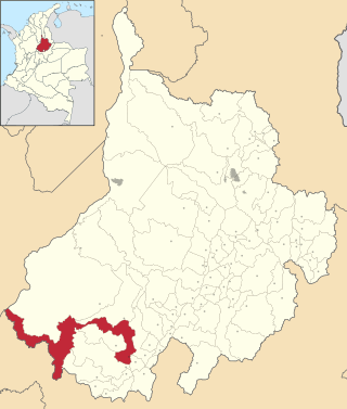
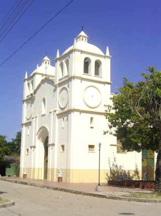
Bolívar is a town and municipality in the Santander Department in northeastern Colombia.

<span class="mw-page-title-main">Charalá</span> Municipality and town in Santander Department, Colombia

Charalá is a town and municipality in the south of the department of Santander in northeastern Colombia. Its antipode is located within the capital of Indonesia, Jakarta.

<span class="mw-page-title-main">Gámbita</span> Municipality and town in Santander Department, Colombia

Gámbita is a municipality in the department of Santander, Colombia, is part of the Comunera province. The municipality has a land area of 606.1 km2 and is formed by the corresponding municipal seat to the urban area, 20 villages and district of La Palma.

<span class="mw-page-title-main">El Guacamayo</span> Municipality and town in Santander Department, Colombia

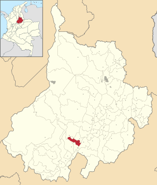
El Guacamayo is a town and municipality in the Santander Department in northeastern Colombia.

<span class="mw-page-title-main">Palmar, Santander</span> Municipality and town in Santander Department, Colombia

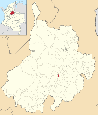
Palmar is a town and municipality in the Santander Department in northeastern Colombia.

<span class="mw-page-title-main">Campohermoso</span> Municipality and town in Boyacá Department, Colombia

Campohermoso is a town and municipality in the Colombian Department of Boyacá, part of the subregion of the Lengupá Province.

<span class="mw-page-title-main">Cubarral</span> Municipality and town in Meta Department, Colombia

Cubarral is a town and municipality in the Meta Department, Colombia. The municipality of Guamal borders Cubarral to the north, to the west is bordered by the department of Cundinamarca, to the east by the municipality of San Martín and to the south by the municipality of El Dorado. Furthermore, According to DANE projections from the 2005 census, Cubarral would have a population of approximately 5946 people by 2015.

<span class="mw-page-title-main">El Calvario</span> Municipality and town in Meta Department, Colombia

El Calvario is a town and municipality in the Meta Department, Colombia. It was the epicenter of the 2008 Colombia earthquake.

<span class="mw-page-title-main">Restrepo, Meta</span> Municipality and town in Meta Department, Colombia

Restrepo is a town and municipality in the Meta Department, Colombia.

Korićna is a village in the municipality of Glamoč in Canton 10, the Federation of Bosnia and Herzegovina, Bosnia and Herzegovina.

References

  1. "Resultados y proyecciones (2005-2020) del censo 2005" . Retrieved 12 April 2020.
  2. "Table 1 Overview of the Köppen-Geiger climate classes including the defining criteria". Nature: Scientific Data. 23 October 2023.
  3. "World Meteorological Organization Climate Normals for 1991-2020 — Cimitarra". National Oceanic and Atmospheric Administration. Retrieved January 25, 2024.

6°19′N73°57′W / 6.317°N 73.950°W / 6.317; -73.950