
The Arctic Archipelago, also known as the Canadian Arctic Archipelago, is an archipelago lying to the north of the Canadian continental mainland, excluding Greenland and Iceland.

Kenitra is a city in northwestern Morocco. It is a port on the Sebou River with a population of 431,282 as of 2014. It is one of the three main cities of the Rabat-Salé-Kénitra region and the capital of the similarly named Kénitra Province. During the Cold War, the US Naval Air Station Port Lyautey served as a stopping point in North Africa.

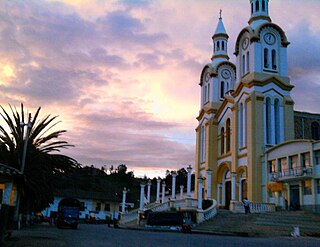
Otanche is a town and municipality in Boyacá Department, Colombia, part of the subregion of the Western Boyacá Province.

Sutatenza is a town and municipality in the Eastern Boyacá Province of the department of Boyacá, Colombia. It is located 125 kilometres (78 mi) from the Colombian capital Bogotá and 118 kilometres (73 mi) from the department capital Tunja. Sutatenza borders Somondoco, Guateque, Tenza and Garagoa.

La Playa or La Playa de Belén is a Colombian municipality in the department of North Santander.
Bolívar is a town and municipality in the Santander Department in northeastern Colombia.

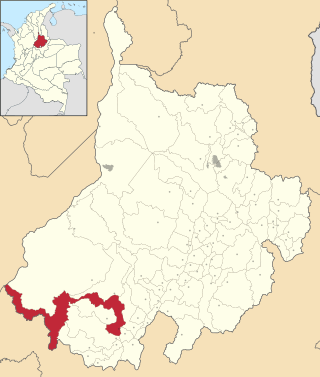
Charalá is a town and municipality in the south of the department of Santander in northeastern Colombia. Its antipode is located within the capital of Indonesia, Jakarta.
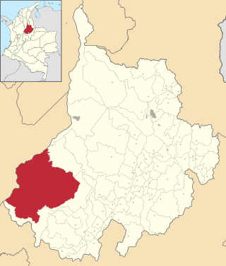
Cimitarra is a town and municipality in the Santander Department in northeastern Colombia.

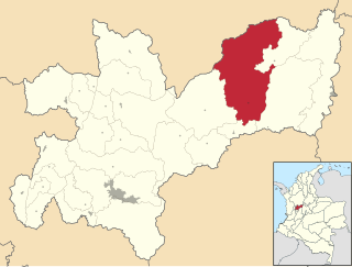
Gámbita is a municipality in the department of Santander, Colombia, is part of the Comunera province. The municipality has a land area of 606.1 km2 and is formed by the corresponding municipal seat to the urban area, 20 villages and district of La Palma.
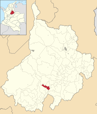
El Guacamayo is a town and municipality in the Santander Department in northeastern Colombia.

Sucre is a town and municipality in the Santander Department in northeastern Colombia.

Sácama is a town and municipality in the Department of Casanare, Colombia.
Samaná is a town and municipality in the Colombian Department of Caldas.
Boavita is a town and municipality in the Colombian Department of Boyacá, part of the subregion of the Northern Boyacá Province. The urban centre of Boavita is situated in the Eastern Ranges of the Colombian Andes at an altitude of 2,114 metres (6,936 ft) and a distance of 184 kilometres (114 mi) from the department capital Tunja. The municipality borders Capitanejo, Santander, and the Nevado River in the north, San Mateo and La Uvita in the east, Tipacoque and Soatá in the west and Susacón in the south.

Campohermoso is a town and municipality in the Colombian Department of Boyacá, part of the subregion of the Lengupá Province.

Puerto Guzmán is a town and municipality located in the Putumayo Department, Republic of Colombia.

El Calvario is a town and municipality in the Meta Department, Colombia. It was the epicenter of the 2008 Colombia earthquake.

Restrepo is a town and municipality in the Meta Department, Colombia.
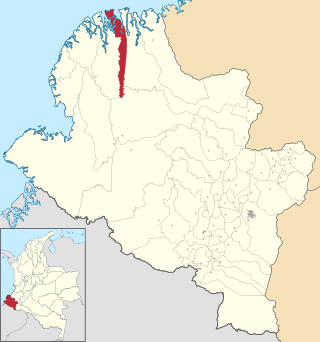
La Tola is a town and municipality in the Nariño Department, Colombia.

Boghé is a town and commune in the Brakna Region of southern Mauritania, located on the border with Senegal.
