Related Research Articles

Reading is a city in Hamilton County, Ohio, United States. The population was 10,600 at the 2020 census. It is an inner suburb of Cincinnati and is included as part of the Cincinnati metropolitan area.

Loveland is a city in Hamilton, Clermont, and Warren counties in the southwestern part of the U.S. state of Ohio. The population was 13,307 at the 2020 census. Considered part of the Cincinnati metropolitan area, Loveland is located near exit 52 off Interstate 275, about 15 miles (24 km) northeast of the Cincinnati city limits. It borders Symmes, Miami and Hamilton townships and straddles the Little Miami River. Once a busy railroad town, Loveland is now a major stop along the Little Miami Scenic Trail.

Columbia Township is one of the twelve townships of Hamilton County, Ohio, United States. The 2020 census found 4,446 people in the township. Originally one of Ohio's largest townships by area at its inception in 1791, it gradually shrank to one of the smallest by the early 1950s.

Springfield Township is one of the twelve townships of Hamilton County, Ohio, United States. The population was 35,862 as of the 2020 census. Springfield Township is home to the largest private school in Ohio, the largest lake in Hamilton County, and the Cincinnati area's annual Greek Festival.
Millcreek Township is a survey township in south-central Hamilton County, Ohio, that also existed as a civil township from 1810 until 1943. Once the most important township in the county, it was largely absorbed by Cincinnati and its suburbs, nominally remaining as a paper township from 1943 until 1953. It was abolished when the rest of its unincorporated territory, consisting of Wesleyan Cemetery, became part of Cincinnati. As the original survey township covers a large portion of present-day Cincinnati, references to it are frequently encountered by genealogists.

Hamilton Township is one of the eleven townships of Warren County, Ohio, United States. It is located in the south central portion of the county. The population was 30,587 at the 2020 census.

Fairfield Township is one of thirteen townships in Butler County, Ohio, United States. It is located in the south central portion of the county. The population was 22,645 at the 2020 census. Before annexations by the cities of Hamilton and Fairfield, it had an area of about 50 square miles (130 km2).
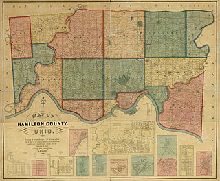
The term paper township refers to a civil township under Ohio law that nominally exists for certain purposes but does not act as a functioning unit of civil government. Such townships usually exist on paper as a legal fiction due to municipal annexation.
Ronald Reagan Cross County Highway, formerly and locally known as Cross County Highway, is a west-east freeway in Hamilton County, Ohio, United States. It stretches 16.4 miles (26.4 km) from southern Colerain Township to Montgomery, connecting many of Cincinnati's northern suburbs to Interstate 71 and Interstate 75. State Route 126 is routed over most of the highway, while the remainder is a county-maintained road.

Columbia-Tusculum is the oldest neighborhood in Cincinnati, Ohio, and is located on the East Side of the city. The population was 1,523 at the 2020 census.
Northwest Local School District is a public school district in Hamilton County, Ohio, near Cincinnati, Ohio. It primarily serves Colerain Township, but also includes parts of neighboring Green Township, Springfield Township, and Ross Township.

Wesleyan Cemetery is a prominent cemetery in Cincinnati, Ohio. It is the oldest continuously operating cemetery in Hamilton County, Ohio.

Riverside is a neighborhood in Cincinnati, Ohio. The West Side neighborhood is contained in a narrow strip of land along the Ohio River between Sayler Park and Sedamsville. It is a community that is more industrial than residential. It is home to St. Vincent De Paul Catholic Church. Riverside is also home to the Mount St. Joseph University ball fields.

U.S. Route 27 (US 27) in Ohio runs for 40.58 miles (65.31 km) between the Kentucky and Indiana state lines: 18.5 miles (29.8 km) in Hamilton County and another 22.1 miles (35.6 km) in Butler County. The route crosses into Ohio and Downtown Cincinnati via the Taylor–Southgate Bridge over the Ohio River. US 27 follows Mehring Way, Central Avenue, Ezzard Charles Drive, and Central Parkway through Downtown Cincinnati. US 27 briefly duplexes with Interstate 75 (I-75), exiting at I-74 for another brief duplex before exiting onto Colerain Road. US 27 then continues northwest eventually to Oxford and then reaches the Indiana border another six miles (9.7 km) northwest at College Corner.

The siege of Dunlap's Station was a battle that took place on January 10–11, 1791, during the Northwest Indian War between the Northwestern Confederacy of American Indians and European-American settlers in what became the southwestern region of the U.S. state of Ohio. This was one of the Indians' few unsuccessful attacks during this period. It was shortly after the Harmar Campaign attacks and unprecedented defeat of U.S. Army forces.
Israel Ludlow was a government surveyor who helped found Cincinnati, Dayton and Hamilton in southwest Ohio.

The seal of Cincinnati is the official insignia of the city of Cincinnati, Ohio, in the United States. Adopted in 1819, the seal incorporates scales, a sword, and a caduceus. The seal is featured prominently in the flag of Cincinnati and the insignia of city agencies and institutions.
Storrs Township was a civil township in south-central Hamilton County, Ohio. It was established in 1835 and annexed to Cincinnati in 1870 but remained in nominal form until at least 1890 due to an oversight.
Spencer Township was a civil township in southeastern Hamilton County, Ohio. It was established in the early 1840s and annexed to Cincinnati in stages from 1855 to 1909.
Ethan Stone (1767–1852) was an American lawyer, banker, politician, and philanthropist from Cincinnati, Ohio. A major property investor, he became influential in state politics, but his fortunes waxed and waned with the local property market. His considerable wealth at the time of his death produced the first elections open to local women as part of the longest trust case in state history.
References
- ↑ Nelson & Runk 1894, pp. 40, 387.
- 1 2 Ford & Ford 1881, p. 347.
- 1 2 Hale, Harry L. (October 26, 1958). "Cincinnati Township Second Of First Three In County". The Cincinnati Enquirer . p. 8C – via Newspapers.com.
- 1 2 3 Ford & Ford 1881, pp. 50–51.
- ↑ "The History of Montgomery County, Ohio, Containing a History of the County". W. H. Beers & Company. 1882. pp. 278–279 – via Google Books.
- ↑ Ford & Ford 1881, pp. 333–339.
- ↑ Planning for a Sustainable Future of the Cincinnati Union Terminal. Cincinnati Museum Center. April 30, 2012. p. 2.1. doi:10.2172/1064404 – via UNT Digital Library.
- 1 2 Hale, Harry L. (July 19, 1959). "Incorporation Of 1834 End Of Historic Cincinnati Township". The Cincinnati Enquirer. p. 7D – via Newspapers.com.
- ↑ Greve 1904, p. 510.
- ↑ Cincinnati: A Guide to the Queen City and Its Neighbors. Cincinnati: The Wiesen-Hart Press. 1979 [1943]. p. 470 – via Google Books.
- ↑ "Fulton". The Cincinnati Pictorial Enquirer. February 18, 1968. pp. 8, 13–14 – via Newspapers.com.
- 1 2 Greve 1904, p. 19.
- 1 2 "Escaped Notice: A Fractional Township in the State of Ohio". Aurora Daily Express. Aurora, Illinois. September 12, 1890. p. 2 – via Google News Archive.
- ↑ "Omitted a Whole Township: a Mistake That May Invalidate the Ohio Gerrymander". Chicago Tribune . September 19, 1890. p. 9 – via Newspapers.com.
- ↑ "Perplexed Are County Officials By the Question of Township Location of Annexed Villages". The Cincinnati Enquirer. April 7, 1904. p. 12 – via Newspapers.com.