
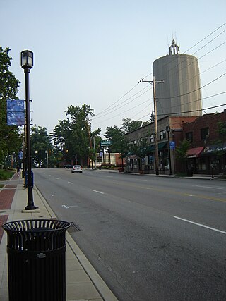
Reading is a city in Hamilton County, Ohio, United States. The population was 10,600 at the 2020 census. It is an inner suburb of Cincinnati and is included as part of the Cincinnati metropolitan area.

Columbia Township is one of the twelve townships of Hamilton County, Ohio, United States. The 2020 census found 4,446 people in the township. Originally one of Ohio's largest townships by area at its inception in 1791, it gradually shrank to one of the smallest by the early 1950s.

Delhi Township is one of the twelve townships of Hamilton County, Ohio, United States. The 2020 census found 28,760 people in the township. It is the only Delhi Township statewide.

Evanston is one of the 52 neighborhoods of Cincinnati, Ohio. A mostly African-American neighborhood since the 1960s, it is known as "the educating community," and is bordered by the neighborhoods of East Walnut Hills, Hyde Park, North Avondale, and Walnut Hills, as well as the City of Norwood. The population was 8,838 at the 2020 census.
Mount Washington is one of the 52 neighborhoods of Cincinnati, Ohio, United States.. It borders the neighborhoods of California and the East End, as well as Anderson Township, Hamilton County, Ohio. The population was 20,540 at the 2020 census.

Clifton is is one of the 52 neighborhoods of Cincinnati, Ohio. The population was 8,408 in the 2020 census.

California, Cincinnati is one of the 52 neighborhoods of Cincinnati, Ohio. Located at the confluence of the Little Miami River and Ohio River, it is the southeastern-most neighborhood in the city. California borders the Cincinnati neighborhoods of Mt. Washington and the East End, as well as Anderson Township. The population was 944 at the 2020 census.

Pleasant Ridge is one of the 52 neighborhoods of Cincinnati, Ohio. Annexed in 1911, the neighborhood is predominately residential. The population was 8,895 at the 2020 census.

Columbia-Tusculum is one of the 52 neighborhoods of Cincinnati, Ohio. Founded in 1788 and annexed in 1871, it is the city's oldest neighborhood. The population was 1,523 at the 2020 census.

Hyde Park is one of the 52 neighborhoods of Cincinnati, Ohio. Originally established as a retreat for the city's wealthy, the neighborhood is predominately residential, with a central business district known as Hyde Park Square. The population was 14,193 at the 2020 census.

Camp Washington is a neighborhood of Cincinnati, Ohio, United States. Located next to the Mill Creek, it is north of Queensgate, east of Fairmount, and west of Clifton and University Heights. The community is a crossing of 19th-century homes and industrial space The population was 1,234 at the 2020 census.

Carthage is one of the 52 neighborhoods of Cincinnati, Ohio. Established in 1791 or 1792 and annexed in 1911, it is located in the northern part of the city's Mill Creek valley. The neighborhood is predominately residential, and is center of the city's Hispanic community. It shares a border with Elmwood Place, Ohio, which, with adjacent St. Bernard, Ohio, forms an enclave in the middle of Cincinnati. The population was 2,781 at the 2020 census.

College Hill is one of the 52 neighborhoods of Cincinnati, Ohio. Established in 1813 and annexed in 1911, 1915, and 1923, it is located in the northwestern part of the city. It was originally called Pleasant Hill due to its prime location, but was later renamed College Hill because of the two colleges that were established there in the mid-nineteenth century. The neighborhood is not to be confused with North College Hill, which borders College Hill to the north but is not part of Cincinnati. The population was 16,039 at the 2020 census.

Corryville is one of the 52 neighborhoods of Cincinnati, Ohio. It is located immediately east of the University of Cincinnati, southeast of Clifton, south and west of Avondale, northwest of Walnut Hills, and north of Mount Auburn. The population was 4,373 at the 2020 census.

Linwood is one of the 52 neighborhoods of Cincinnati, Ohio, United States. Annexed in 1893, it is located in the eastern part of the city. The population was 705 at the 2020 census.
Madisonville is one of the 52 neighborhoods of Cincinnati, Ohio. Established in 1809 and annexed in 1911, it is located in the northeastern part of the city. The population was 17,898 at the 2020 census.

Mount Airy is one of the 52 neighborhoods of Cincinnati, Ohio. The neighborhood is home to Mount Airy Forest, one of the oldest urban reforestation projects in the country. The population was 9,210 at the 2020 census.

Sayler Park is one of the 52 neighborhoods of Cincinnati, Ohio. Situated along the Ohio River, it is the westernmost neighborhood in the city. The population was 2,825 at the 2020 census.

Sedamsville is one of the 52 neighborhoods of Cincinnati, Ohio. Established in 1795 and annexed in 1870, the neighborhood lies along the Ohio River in the western part of the city. The population was 1,256 at the 2020 census.

Hartwell is one of the 52 neighborhoods of Cincinnati, Ohio. Established in 1868 and annexed in 1912, it is the city's northernmost neighborhood, centered roughly on the intersections of I-75 and Ronald Reagan Cross County Highway. Its boundaries are a combination of Caldwell Park and Ronald Reagan Cross County Highway to the south, I-75 to the east, and a combination of Millsdale Street and Compton Road to the North. The population was 5,806 at the 2020 census.


