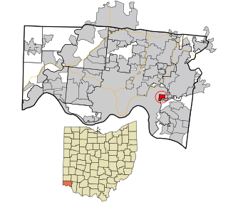
Hamilton County is located in the southwestern corner of the U.S. state of Ohio. As of the 2020 census, the population was 830,639, making it the third-most populous county in Ohio. The county seat and largest city is Cincinnati. The county is named for the first Secretary of the Treasury, Alexander Hamilton. Hamilton County is part of the Cincinnati-Middletown, OH-KY-IN Metropolitan Statistical Area.
Fairfax is a village in Hamilton County, Ohio, United States. It is a suburb of Cincinnati. The population was 1,768 at the 2020 census.

Northside is one of the 52 neighborhoods of Cincinnati, Ohio. It was originally known as Cumminsville, but renamed to "Northside" several decades ago after I-74 divided the neighborhood into Northside and South Cumminsville. Northside has a racially and socio-economically diverse population, with concentrations of college students, artists, young professionals, and many members of the creative class. It is also the city's gay village, hosting several local LGBT organizations and events. The population was 8,096 at the 2020 census.

Spring Grove Village is one of the 52 neighborhoods of Cincinnati, Ohio. Annexed in 1903, the neighborhood was known as Winton Place until 2007. It is located off Interstate 75 in the Mill Creek Valley. The population was 1,916 at the 2020 census.

The city of Kalamazoo, Michigan consists of multiple neighborhoods. While the number, borders, and naming of neighborhoods can vary by source, the list below gives the most widely agreed upon arrangement, as defined by the City of Kalamazoo. Many of the neighborhoods have a corresponding neighborhood association.

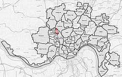
Carthage is one of the 52 neighborhoods of Cincinnati, Ohio. Established in 1791 or 1792 and annexed in 1911, it is located in the northern part of the city's Mill Creek valley. The neighborhood is predominately residential, and is center of the city's Hispanic community. It shares a border with Elmwood Place, Ohio, which, with adjacent St. Bernard, Ohio, forms an enclave in the middle of Cincinnati. The population was 2,781 at the 2020 census.

Kennedy Heights is one of the 52 neighborhoods of Cincinnati, Ohio. The population was 5,166 at the 2020 census.

CUF is one of the 52 neighborhoods of Cincinnati, Ohio. Its name is derived from the communities of Clifton Heights, University Heights, and Fairview. These communities surround the University of Cincinnati to the south and west of its main campus, making CUF a predominantly residential, student neighborhood. The population was 20,385 at the 2020 census.

East Westwood is one of the 52 neighborhoods of Cincinnati, Ohio. The population was 2,458 at the 2020 census.

English Woods is one of the 52 neighborhoods of Cincinnati, Ohio. Owned by the Cincinnati Metropolitan Housing Authority, the neighborhood originally consisted of housing projects built in 1940 and 1960, but the majority of the projects were demolished in 2005. The population was 361 at the 2020 census.

Millvale is one of the 52 neighborhoods of Cincinnati, Ohio. The population was 1,965 at the 2020 census. Millvale is predominantly black. About a third of residents live in public housing.

North Avondale is one of the 52 neighborhoods of Cincinnati, Ohio. It is home to Xavier University and the Avon Woods Preserve. The population was 3,405 at the 2020 census.

North Fairmount is one of the 52 neighborhoods of Cincinnati, Ohio. The neighborhood lies south of East Westwood, southwest of Millvale, and north of South Fairmount. The population was 1,590 at the 2020 census.

Pendleton is one of the 52 neighborhoods of Cincinnati, Ohio. It is located within the city's urban basin. The population was 1,088 as of the 2020 census.

Paddock Hills is one of the 52 neighborhoods of Cincinnati, Ohio. The population was 1,038 at the 2020 census.

Riverside is one of the 52 neighborhoods of Cincinnati, Ohio. The neighborhood is contained in a narrow strip of land along the Ohio River on the city's west side, between Sayler Park and Sedamsville. Predominately industrial, the neighborhood has few residential areas, with a population of 1,257 at the 2020 census.

Roselawn is one of the 52 neighborhoods of Cincinnati, Ohio. The population was 7,039 at the 2020 census.

South Fairmount is one of the 52 neighborhoods of Cincinnati, Ohio. Located in the western part of the city, it contains one of the highest concentrations of Section 8 housing in Hamilton County. The population was 2,181 at the 2020 census.

Hartwell is one of the 52 neighborhoods of Cincinnati, Ohio. Established in 1868 and annexed in 1912, it is the city's northernmost neighborhood, centered roughly on the intersections of I-75 and Ronald Reagan Cross County Highway. Its boundaries are a combination of Caldwell Park and Ronald Reagan Cross County Highway to the south, I-75 to the east, and a combination of Millsdale Street and Compton Road to the North. The population was 5,806 at the 2020 census.