CUF, Cincinnati

Last updated
CUF
Clifton Heights, University Heights, Fairview
Flag of CUF, Cincinnati, Ohio.svg
CUF-Cincinnati-map.jpg
CUF (red) within Cincinnati, Ohio
Population
 (2020)
  Total20,385
Time zone UTC-5 (EST)
  Summer (DST) UTC-4 (EDT)
ZIP codes
45219, 45220
Area code 513
A street map of CUF. CUF-Cincinnati-Street-Map.jpg
A street map of CUF.

CUF is a neighborhood in Cincinnati, Ohio. Its name is derived from the communities of Clifton Heights, University Heights, and Fairview. These communities surround the University of Cincinnati to the south and west of its main campus, making CUF a predominantly residential, student neighborhood. The population was 20,385 at the 2020 census.

Contents

Geography

CUF is bordered by the neighborhoods of Clifton, the University of Cincinnati, Mount Auburn, Over-the-Rhine, and Camp Washington.

University Heights occupies the northern area of CUF, and is separated from Fairview and Clifton Heights by Straight Street. Fairview occupies the south-west corner and Clifton Heights the south-east corner of CUF. Fairview and Clifton Heights are separated by Ravine Street; Fairview on the west, Clifton Heights on the east.

The term "CUF" is rarely, if ever, used by locals. [1] Although inaccurate, these neighborhoods, along with Corryville, are often referred to as being part of Clifton, even by long-term residents. [1]

Demographics

Population of 1900-2020[ citation needed ]
YearPop.±%
1900 20,344    
1910 23,765+16.8%
1920 26,775+12.7%
1930 27,637+3.2%
1940 26,275−4.9%
1950 27,995+6.5%
1960 26,604−5.0%
1970 23,336−12.3%
1980 18,466−20.9%
1990 17,532−5.1%
2000 16,119−8.1%
2010 16,989+5.4%
2020 20,385+20.0%

As of the census of 2020, there were 20,385 people living in the neighborhood. There were 7,517 housing units. The racial makeup of the neighborhood was 68.7% White, 15.6% Black or African American, 0.1% Native American, 8.6% Asian, 0.0% Pacific Islander, 1.9% from some other race, and 5.0% from two or more races. 3.6% of the population were Hispanic or Latino of any race. [2]

There were 5,439 households, out of which 18.2% were families. 39.7% of all households were made up of individuals. [2]

2.5% of the neighborhood's population were under the age of 18, 94.9% were 18 to 64, and 2.6% were 65 years of age or older. 45.7% of the population were male and 54.3% were female. [2]

According to the U.S. Census American Community Survey, for the period 2016-2020 the estimated median annual income for a household in the neighborhood was $33,511. About 20.5% of family households were living below the poverty line. About 56.1% had a bachelor's degree or higher. [2]

Parks

Fairview Park, a 27.7-acre (112,000 m2) park overlooking downtown Cincinnati, is located in CUF. [3] Similarly, Bellevue Hill, a 15-acre (61,000 m2) park also in the neighborhood, is well known for its overlook of downtown.

Education

Clifton Heights is home to the Hughes Center, a vocational and special-purpose high school. Its current Clifton Heights location was built in 1906. [4] University Heights is home to Hebrew Union College, a Jewish seminary. Fairview is the former home of Fairvew German Language School, which was founded by the neighborhood's German community in 1888. In 2008 the school was relocated to nearby Clifton. [5]

Related Research Articles

<span class="mw-page-title-main">Hamilton County, Ohio</span> County in Ohio, United States

Hamilton County is located in the southwestern corner of the U.S. state of Ohio. As of the 2020 census, the population was 830,639, making it the third-most populous county in Ohio. The county seat and largest city is Cincinnati. The county is named for the first Secretary of the Treasury, Alexander Hamilton. Hamilton County is part of the Cincinnati-Middletown, OH-KY-IN Metropolitan Statistical Area.
<span class="mw-page-title-main">Druid Hills, Georgia</span> Neighborhood of Atlanta, Georgia, United States

Druid Hills is a community which includes both a census-designated place (CDP) in unincorporated DeKalb County, Georgia, United States, as well as a neighborhood of the city of Atlanta. The CDP's population was 14,568 at the 2010 census. The CDP formerly contained the main campus of Emory University and the Centers for Disease Control and Prevention (CDC) however they were annexed by Atlanta in 2018. The Atlanta-city section of Druid Hills is one of Atlanta's most affluent neighborhoods with a mean household income in excess of $238,500.

<span class="mw-page-title-main">North Decatur, Georgia</span> CDP in Georgia, United States

North Decatur is a census-designated place (CDP) in DeKalb County, Georgia, United States. The population was 16,698 at the 2010 census.

<span class="mw-page-title-main">Braddock Heights, Maryland</span> Census-designated place in Maryland

Braddock Heights is an unincorporated community and census-designated place (CDP) in Frederick County, Maryland, United States. The population was 2,608 at the 2010 census. The local ZIP codes are 21714 and 21703.

<span class="mw-page-title-main">Glendale, Ohio</span> Village in Ohio, United States

Glendale is a village in Hamilton County, Ohio, United States. The population was 2,298 at the 2020 census. It is a northern suburb of Cincinnati, and is the site of the Glendale Historic District.

<span class="mw-page-title-main">Tipp City, Ohio</span> City in Ohio, United States

Tipp City is a city in southern Miami County, Ohio, United States, just outside Dayton. The population was 10,274 at the 2020 census. Originally known as Tippecanoe, and then Tippecanoe City, it was renamed to Tipp City in 1938 because another town in Ohio was likewise named Tippecanoe. The city lies in the Miami Valley and sits along Interstate 75 near the Interstate 70 interchange. Tipp City is part of the Dayton metropolitan area.

<span class="mw-page-title-main">Luray, Virginia</span> Town in Virginia, United States

Luray is the county seat of Page County, Virginia, United States, in the Shenandoah Valley in the northern part of the Commonwealth. The population was 4,895 at the 2010 census.

<span class="mw-page-title-main">Clifton, Cincinnati</span> Neighborhood of Cincinnati in Ohio, United States

Clifton is a neighborhood in the north central part of Cincinnati, Ohio, United States. The population was 8,408 in the 2020 census.

Woodward Career Technical High School is a public high school located in the Bond Hill neighborhood of Cincinnati, Ohio, United States. It is part of the Cincinnati Public School District.

<span class="mw-page-title-main">Avondale, Cincinnati</span> Neighborhood of Cincinnati in Hamilton, Ohio, United States

Avondale is a neighborhood in Cincinnati, Ohio. It is home to the Cincinnati Zoo and Botanical Garden. The population was 11,345 at the 2020 census.

<span class="mw-page-title-main">Camp Washington, Cincinnati</span> Neighborhood of Cincinnati in Ohio, United States

Camp Washington is a neighborhood of Cincinnati, Ohio, United States. Located next to the Mill Creek, it is north of Queensgate, east of Fairmount, and west of Clifton and University Heights. The community is a crossing of 19th-century homes and industrial space The population was 1,234 at the 2020 census.

<span class="mw-page-title-main">Kennedy Heights, Cincinnati</span> Neighborhood of Cincinnati in Hamilton, Ohio, United States

Kennedy Heights is a residential neighborhood of Cincinnati, Ohio, home to Daniel Drake Park. The population was 5,166 at the 2020 census.

<span class="mw-page-title-main">Corryville, Cincinnati</span> Neighborhood of Cincinnati in Ohio, United States

Corryville is a neighborhood in Cincinnati, Ohio, east of the University of Cincinnati, southeast of Clifton, south and west of Avondale, northwest of Walnut Hills, and north of Mount Auburn. The population was 4,373 at the 2020 census.

<span class="mw-page-title-main">West End, Cincinnati</span> Neighborhood of Cincinnati in Ohio, United States

West End is a neighborhood in Cincinnati, Ohio, United States, located northwest of downtown, east of Queensgate, west of Over-the-Rhine, and southeast of Fairview. The population was 6,824 at the 2020 Census.

<span class="mw-page-title-main">Downtown Cincinnati</span> Neighborhood in Cincinnati, Ohio, United States

Downtown Cincinnati is the central business district of Cincinnati, Ohio, United States, as well the economic and symbiotic center of the Cincinnati metropolitan area. Originally the densely populated core of the city, the neighborhood was transformed into a commercial zone in the mid-20th century. The population was 5,835 at the 2020 census.

<span class="mw-page-title-main">Monfort Heights, Ohio</span> Census-designated place in Ohio, United States

Monfort Heights is a census-designated place (CDP) in Green Township, Hamilton County, Ohio, United States, part of the Cincinnati–Northern Kentucky metropolitan area. The population of Monfort Heights was 12,070 at the 2020 census. In previous censuses, the area was listed as two separate CDPs, Monfort Heights East and Monfort Heights South.

<span class="mw-page-title-main">Miami Heights, Ohio</span> Census-designated place in Ohio, United States

Miami Heights is a census-designated place (CDP) in Miami Township, Hamilton County, Ohio, United States. The population was 5,166 at the 2020 census.
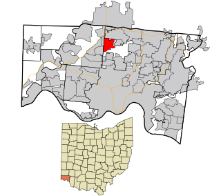
<span class="mw-page-title-main">New Burlington, Hamilton County, Ohio</span> Census-designated place in Ohio, United States

New Burlington is a census-designated place (CDP) in Springfield Township, Hamilton County, Ohio, United States. The population was 5,049 at the 2020 census.
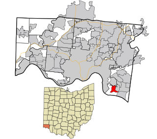
<span class="mw-page-title-main">Salem Heights, Hamilton County, Ohio</span> Census-designated place in Ohio, United States

Salem Heights is a census-designated place (CDP) in Anderson Township, Hamilton County, Ohio, United States, adjacent to the city of Cincinnati. The population of Salem Heights was 3,862 at the 2020 census.

References

  1. 1 2 "Have you heard of CUF? Neighborhood mulls name change". Local 12. Retrieved 20 June 2018.
  2. 1 2 3 4 "CUF 2020 Statistical Neighborhood Approximation" (PDF). City of Cincinnati. Retrieved 13 December 2023.
  3. "Uptown Cincinnati :: Parks". Archived from the original on 2008-05-09. Retrieved 2008-12-01.
  4. "Brack's Personal WebPage". Archived from the original on 2006-08-11. Retrieved 2008-12-01.
  5. ":Fairview German Language School || Cincinnati, Ohio:". Archived from the original on 2008-12-01. Retrieved 2008-12-01.

39°8′0″N84°31′30″W / 39.13333°N 84.52500°W / 39.13333; -84.52500