Clarkson, Mississauga

Last updated
Clarkson
Neighbourhood
Aerial Panorama of Clarkson 2022.jpg
Aerial view of Clarkson, Mississauga, 2022
Clarkson Village Welcome.jpg
Clarkson Village welcome sign, at Lakeshore Road West and Inverhouse Drive.
Clarkson, Mississauga
Coordinates: 43°31′9″N79°38′2″W / 43.51917°N 79.63389°W / 43.51917; -79.63389
Country Canada
Province Ontario
Regional municipality Peel
City Mississauga
Established1808
Time zone UTC-5 (Eastern)
  Summer (DST) UTC-4 (Eastern)
Forward sortation area
L5J
Area code(s) 905 and 289
NTS Map 30M12 Brampton
GNBC CodeFAREC

Clarkson, also called Clarkson Village, is a neighbourhood in the city of Mississauga, Ontario, Canada, situated in the southwest corner of the city, along the shore of Lake Ontario. It is bordered by Lake Ontario to the south, Oakville to the west, Erindale and Erin Mills to the north, and Lorne Park to the east.

Contents

History

In 1808, fifteen-year-old Warren Clarkson and his brother Joshua left their home in Albany, New York to seek their fortune in Canada. They had been invited to come work for a friend of the family who had bought land near Lake Ontario. Warren liked the area very much and decided to stay. He worked hard so that someday he would be able to own property. When he was twenty-six he had saved enough money to buy land and build a home. Warren married and began to raise a family. As the years went by Warren bought more land. He built the community's first store along the stagecoach trail. Fifteen years later the town council named this trail Clarkson Road.

A post office was opened in the family store and William Clarkson, Warren's son became the postmaster. For the next forty five years a member of the Clarkson family would run the post office. Clarkson community never grew very large. It had a few houses and shops along Clarkson Road, a railway station, a school, and a church. Less than one hundred people lived in the quiet community.

In 1856, Captain Edward Sutherland (1794-1885) moved to Clarkson with his seven children. A widower, he purchased "Bush's Inn," a former inn and coach house that was the halfway point between Hamilton, Ontario and Toronto (this building, a private residence, still stands on Clarkson Road South). Here, he is said to have introduced both strawberry and raspberry cultivation to the area. Clarkson eventually became the "Strawberry Capital of Ontario," and commercial fruit farming expanded in the area through the rest of the 19th and into the early 20th century. In 1915, a sign was erected at the Clarkson railway station declaring "Through this station passes more strawberries than any other station in Ontario." The Sutherlands later became connected by marriage to the Harrises of Benares (see "Sites of Interest" below).

The Party Line newspaper published out of Clarkson/Lorne Park, starting in 1951.[ citation needed ]

Park Royal, the second subdivision to be built in Clarkson, was developed by the Leonard W. Finch, President of the United Lands Corporation, on 900 acres of land west of Fifth Line West (present Southdown Road) to East Townline Road (present Winston Churchill Boulevard) [1] and south of the QEW. This development is of note because it was designed with all the electrical cables and wires underground and the office buildings were designed to be shorter than the trees. It was designed as a community with accommodations for schools, parks, a recreation centre and a library. On August 8, 1958 Park Royal was opened by the Lord Mayor of London, Sir Denis H. Truscott. On February 28, 1971, the Clarkson Community Centre and Arena was opened. [2]

Today

Clarkson Village, looking eastward at Lakeshore Road West Clarkson Village at Lakeshore Rd W 2022.jpg
Clarkson Village, looking eastward at Lakeshore Road West

Although the community and the surrounding area consists mostly of a mix of upper- and middle-class homes, some of the last major industrial sites in Mississauga outline the community, including:

Sites of interest

The historic Bradley Museum Clarkson Bradley Museum.jpg
The historic Bradley Museum
Rattray Marsh Conservation Area Rattray Marsh Conservation Area 2022.jpg
Rattray Marsh Conservation Area

Clarkson is home to both of the City of Mississauga's historic museums: Bradley Museum and Benares House.

The Bradley Museum provides a window into the everyday life of early settlers in Ontario, and hosts Sunday teas, rotating exhibits, and special events. The museum grounds include the original farmhouse built in 1830 by Lewis and Elizabeth Bradley, a United Loyalist couple who lived in the house with their seven children. The Anchorage, a Regency-style cottage built in 1837, was moved from its original location on the shores of Lake Ontario to the Bradley grounds in 1978. The Anchorage was the retirement home of Royal Navy Officer John Skynner (1762-1846), and remained derelict after being moved to the museum grounds until sufficient funds for its rehabilitation were raised in 1991. In December 2007, the Log Cabin was opened at Bradley after extensive fundraising efforts which saw the cabin moved from its location in Port Credit and repaired to its former glory. The Log Cabin is a popular choice for meetings and provides a popular overnight program for Girl Guides and Boy Scouts.

Benares House, located on the border between Clarkson and the neighbouring community of Lorne Park, was inhabited by four generations of the Harris and Sayers families. Rumored to be the inspiration for Canadian author Mazo de la Roche's famous "Whiteoak Chronicles" (or "Jalna series") novels, the Benares estate and most of its contents were donated to the Ontario Heritage Foundation by the great-grandchildren of Captain Harris. The site was fully restored and opened to the public in 1995. Benares now houses an interpretive gallery and hosts special events. Within the Clarkson/Lorne Park community, there are numerous streets dedicated to Roche, namely "Jalna Ave." and "Mazo Cres.", located in Lorne Park, and Clarkson, respectively.

Bell Gairdner Estate, is located at 2700 Lakeshore Road West is part of the Holcim Waterfront Estate. Built in 1937 for Charles Powell Bell, it was named for his wife Kathleen Harding as Harding House. [5] Bell died and his wife remarried James Arthur Gairdner, for whom shares the current name of the home with Bell. [6] It was later sold to Ontario Hydro in 1961 and finally acquired by the city in 1991 and there after the home was restored for used for banquets and events. [7]

The Modern Classical designed home faces Lake Ontario and located at the mouth of Joshua Creek (likely named for early settler Joshua Clarkson).

In addition to discovering these historic sites, visitors may also explore Rattray Marsh. This ecologically sensitive wetland is the last remaining lakefront marsh between Burlington, Ontario and Toronto, and provides opportunities for bird watching while strolling along boardwalks and well-maintained trails. Abundant displays of white trilliums, the floral emblem and provincial flower of Ontario, may be seen in late April and early May.

Transportation

Clarkson is home to the Clarkson GO Station, the transportation hub of the community, located on the Lakeshore West line. Local transit service is provided by Mississauga Transit routes 13, 14, 14A, 23, 45, 45A, 43, 110, and 29, all of which feed into the GO station. Clarkson is also near the Erin Mills Parkway / Southdown Road interchange of the QEW. The main roads in the area are Lakeshore Road West, Southdown Road, and Royal Windsor Drive.

Related Research Articles

<span class="mw-page-title-main">Mississauga</span> City in Ontario, Canada

Mississauga, historically known as Toronto Township, is a city in the Canadian province of Ontario. It is situated on the shores of Lake Ontario in the Regional Municipality of Peel, adjoining the western border of Toronto. With a population of 717,961 as of 2021, Mississauga is the seventh-most populous municipality in Canada, third-most in Ontario, and second-most in the Greater Toronto Area (GTA) after Toronto itself. However, for the first time in its history, the city's population declined according to the 2021 census, from a 2016 population of 721,599 to 717,961, a 0.5 percent decrease.

<span class="mw-page-title-main">Etobicoke</span> District of Toronto, Ontario, Canada

Etobicoke is an administrative district and former city within Toronto, Ontario, Canada. Comprising the city's west-end, Etobicoke is bordered on the south by Lake Ontario, on the east by the Humber River, on the west by Etobicoke Creek, the cities of Brampton, and Mississauga, the Toronto Pearson International Airport, and on the north by the city of Vaughan at Steeles Avenue West.

<span class="mw-page-title-main">Queen Elizabeth Way</span> Controlled-access highway in Ontario

The Queen Elizabeth Way (QEW) is a 400-series highway in the Canadian province of Ontario linking Toronto with the Niagara Peninsula and Buffalo, New York. The freeway begins at the Peace Bridge in Fort Erie and travels 139.1 kilometres (86.4 mi) around the western end of Lake Ontario, ending at Highway 427 in Toronto. The physical highway, however, continues as the Gardiner Expressway into downtown Toronto. The QEW is one of Ontario's busiest highways, with an average of close to 200,000 vehicles per day on some sections. Major highway junctions are at Highway 420 in Niagara Falls, Highway 405 in Niagara-on-the-Lake, Highway 406 in St. Catharines, the Red Hill Valley Parkway in Hamilton, Highway 403 and Highway 407 in Burlington, Highway 403 at the Oakville–Mississauga boundary, and Highway 427 in Etobicoke. Within the Regional Municipality of Halton the QEW is signed concurrently with Highway 403. The speed limit is 100 km/h (62 mph) throughout most of its length, with the exceptions being between Hamilton and St. Catharines where the posted limit is 110 km/h (68 mph).

<span class="mw-page-title-main">CFRB</span> Radio station in Toronto

CFRB is a commercial AM radio station in Toronto, Ontario, Canada. It is owned by Bell Media and carries a News/Talk radio format. Its studios and offices are in the Entertainment District at 250 Richmond Street West.
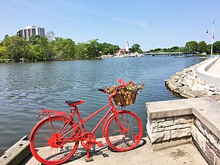
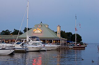
<span class="mw-page-title-main">Port Credit</span> Neighbourhood in Peel, Ontario, Canada

Port Credit is a neighbourhood in the south-central part of the City of Mississauga, Ontario, Canada, located at the mouth of the Credit River on the north shore of Lake Ontario. Its main intersection is Hurontario Street and Lakeshore Road, about 0.6 kilometres (0.37 mi) east of the river. Until 1974, Port Credit was an incorporated town. Its approximate boundaries are the Canadian National Railway to the north, Seneca Avenue to the east and Shawnmarr Road to the west. It had a population of 10,260 at the 2001 census.
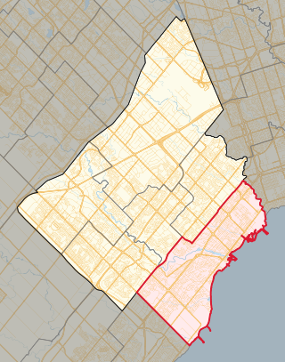
<span class="mw-page-title-main">Mississauga—Lakeshore</span> Federal electoral district in Ontario, Canada

Mississauga—Lakeshore is a federal electoral district in Peel Region, Ontario, Canada. It has been represented in the House of Commons of Canada since 1979.

<span class="mw-page-title-main">Bronte, Ontario</span> Unincorporated community in Ontario, Canada

Bronte is the community that makes up much of the west end of Oakville, in Ontario, Canada. Twelve Mile Creek flows through the middle of town and empties into Lake Ontario. Main roads include Bronte Road (north-south), Lakeshore Road West and Rebecca Street (east-west). Streets in the business section include Lakeshore, Jones, Marine, and Ontario Street. Bronte is also accessed via a superhighway located to the north of the former village. Other main roads include Third Line, Speers Road and Burloak Drive to the west

<span class="mw-page-title-main">Port Credit GO Station</span> Railway station in Mississauga, Ontario, Canada

Port Credit GO Station is a GO Transit train and bus station in Mississauga, Ontario Canada. Located in the Port Credit neighbourhood, it is a stop on the Lakeshore West line train service. Port Credit GO has been identified by Metrolinx as a transportation mobility hub, where different forms of transportation come together, serving as the origin, destination or transfer point for a significant amount of trips. It also is a concentrated point of employment, housing, and recreation, making them places of significant economic development and activity where office buildings, hospitals, educational institutions, government service and information centres, shopping malls and restaurants can be located. The under-construction Hurontario LRT will serve the station.
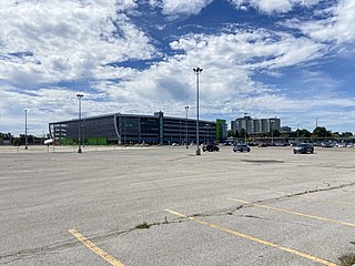
<span class="mw-page-title-main">Clarkson GO Station</span> Railway station in Mississauga, Ontario, Canada

Clarkson GO Station is a GO Transit railway station and bus station in Mississauga, Ontario, Canada. It is a stop on the Lakeshore West line train service, serving the Clarkson neighbourhood.

<span class="mw-page-title-main">Mazo de la Roche</span> Canadian writer (1879–1961)

Mazo de la Roche was a Canadian writer who was the author of the Jalna novels, one of the most popular series of books of her time.

<span class="mw-page-title-main">Sunnyside, Toronto</span> Lakefront district

Sunnyside is a lakefront district in Toronto, Ontario, Canada. It includes a beach and park area along Lake Ontario's Humber Bay, from west of Exhibition Place to the mouth of the Humber River. The area has several recreation uses, including rowing clubs, sports clubs, picnic areas, playgrounds, a nightclub, a bathing pavilion and public pool. The area is a 3 kilometres (1.9 mi) long strip along the lakeshore, bounded by the Gardiner Expressway and rail lines, which separate it from the Parkdale, Roncesvalles and Swansea neighbourhoods to the north. The name originates in a local farm owned by John Howard, which was situated just to the north, on the location of the current St. Joseph's Health Centre hospital.

<span class="mw-page-title-main">Lorne Park</span> Neighbourhood in Peel, Ontario, Canada

Lorne Park is a suburban residential neighbourhood located in southwestern Mississauga, Ontario, Canada, that was first established as a resort.
<span class="mw-page-title-main">Lakeview, Mississauga</span> Neighbourhood in Peel, Ontario, Canada

Lakeview is a neighbourhood in Mississauga in the Region of Peel, just east of Port Credit, which amalgamated into the Town of Mississauga in 1968. It is located in the extreme southeastern corner of the city, along the northern shores of Lake Ontario.

<span class="mw-page-title-main">Long Branch, Toronto</span> Neighbourhood in Toronto, Ontario, Canada

Long Branch is a neighbourhood and former municipality in the south-west of Toronto, Ontario, Canada. It is located in the south-western corner of the former Township of Etobicoke on the shore of Lake Ontario. The Village of Long Branch was a partially independent municipality from 1930 to 1967. Long Branch is located within a land grant from the government to Colonel Samuel Smith in the late 18th century. After Smith's death, a small portion of it was developed as a summer resort in the late 1800s.

<span class="mw-page-title-main">Jameson Avenue</span> Thoroughfare in Toronto, Ontario

Jameson Avenue is a multi-lane arterial road in the Parkdale neighbourhood in Toronto, Ontario, Canada. It is a north-south roadway from Lake Shore Boulevard to Queen Street. Originally laid out in the 19th century as a two-lane residential street, its traffic and land use has changed considerably from a suburban/semi-rural street to a main arterial connecting to an expressway.
<span class="mw-page-title-main">Marie Curtis Park</span> Public park in Toronto, Canada

Marie Curtis Park is a public park in Toronto, Ontario, Canada. It is located at the mouth of the Etobicoke Creek on Lake Ontario in the Long Branch neighbourhood. Marie Curtis Park was built after the devastating floods of Hurricane Hazel in 1954 destroyed 56 homes and cottages on the site, leaving 1,868 persons homeless and 81 dead. It is named after Marie Curtis, the reeve of Long Branch at the time of its construction. Long Branch at the time was a separate village; it's now amalgamated into the City of Toronto government.

<span class="mw-page-title-main">Lakeshore Road</span>

Lakeshore Road is a historic roadway in the Canadian province of Ontario, running through the city of Burlington and the town of Oakville in Halton Region, as well as the city of Mississauga in Peel Region. As its name implies, the road closely follows the shoreline of Lake Ontario, although the lake itself is not visible from the road in most areas. Lakeshore Road was once a key section of the historic Highway 2, which traversed the province, but has since been downloaded to local municipalities. Despite this historical role as a major route, however, most of the road is a lower-capacity picturesque residential and historic commercial street with only two through lanes until it becomes a four-lane, higher-volume artery after it enters Mississauga and jogs to the north.

<span class="mw-page-title-main">Mississauga—Lakeshore (provincial electoral district)</span> Provincial electoral district in Ontario, Canada

Mississauga—Lakeshore is a provincial electoral district in Ontario, Canada. It elects one member to the Legislative Assembly of Ontario. This riding was formerly known as Mississauga South prior to 2015.

<span class="mw-page-title-main">2022 Mississauga—Lakeshore federal by-election</span>

A by-election was held in the federal riding of Mississauga—Lakeshore in Ontario on December 12, 2022, following the resignation of incumbent Liberal MP Sven Spengemann. After 6 years in Parliament, Spengemann resigned on May 27, 2022, to accept a role with the United Nations. The election was won by former Ontario finance minister Charles Sousa.

References

  1. "Town of Oakville Notice (Road name changes (for Winston Churchill Blvd))". Canadian Champion. December 7, 1966.
  2. 1 2 Part Four 1951–2002
  3. "National Pollutant Release Inventory data search - Canada.ca".
  4. "CFRB-AM | History of Canadian Broadcasting".
  5. "City of Mississauga". 11 July 2018.
  6. "City of Mississauga". 11 July 2018.
  7. "Holcim Waterfront Estate gears up for spring opening".

Coordinates: 43°31′9″N79°38′2″W / 43.51917°N 79.63389°W / 43.51917; -79.63389