Clifton, Massachusetts

Last updated

Clifton Avenue Looking southeast on Clifton Ave, Clifton MA.jpg
Clifton Avenue
Clifton Station in a 1910 postcard Clifton station 1910 postcard.jpg
Clifton Station in a 1910 postcard

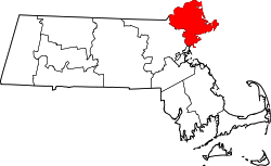
Clifton was a street car stop within the towns of Swampscott and Marblehead in Essex County, Massachusetts, United States. It includes Clifton Avenue.

Contents

The area was named by Benjamin Ware, a hotelier who developed Clifton with the intention of creating a resort area. His hotel, "Clifton House", was regaled as one of the finest lodgings in the county. In 1884, Ware attempted to subjugate all of Marblehead Neck, and the southeastern coastline of the town, along with his resort community, and form the Town of Clifton Village. The Committee on Towns eventually denied his proposal. Attractions in the area included the Clifton House. There has been no mention as Clifton as a place, and it is not known as a village, formally or informally, by any of the residents in the area.

The book An Era of Progress and Promise, 1863-1910 published following the Clifton Conference An era of progress and promise, 1863-1910 - the religious, moral, and educational development of the American Negro since his emancipation (IA eraofprogresspro00hart 0).pdf
The book An Era of Progress and Promise, 1863-1910 published following the Clifton Conference

In 1908 the Clifton Conference, addressing the education of African Americans, was held in Clifton at the home of William N. Hartshorn. [1] A branch of the Portland division of the Boston & Maine Railroad had a station in Clifton in the 1920s. The site of the station can be seen from Clifton Avenue and the track bed is now a bike path that extends from neighboring Swampscott station in the south to Salem in the north.

Theoretically but incorrectly, Clifton feigns to encompass the whole of the southeastern ocean front of Marblehead and incorporates the areas known as Greystone, Clifton Heights (Peabody Camp), Clifton and Rockaway. However, there is no place known as Clifton. There are a number of associations that serve to preserve and improve these neighborhoods: Clifton Improvement Association and Clifton Heights Improvement Association are of particular note for the work they have done. [2]

Notable person


Related Research Articles

<span class="mw-page-title-main">Essex County, Massachusetts</span> County in Massachusetts, United States

Essex County is a county in the northeastern part of the U.S. state of Massachusetts. At the 2020 census, the total population was 809,829, making it the third-most populous county in the state, and the seventy-eighth-most populous in the country. It is part of the Greater Boston area. The largest city in Essex County is Lynn. The county was named after the English county of Essex. It has two traditional county seats: Salem and Lawrence. Prior to the dissolution of the county government in 1999, Salem had jurisdiction over the Southern Essex District, and Lawrence had jurisdiction over the Northern Essex District, but currently these cities do not function as seats of government. However, the county and the districts remain as administrative regions recognized by various governmental agencies, which gathered vital statistics or disposed of judicial case loads under these geographic subdivisions, and are required to keep the records based on them. The county has been designated the Essex National Heritage Area by the National Park Service.

<span class="mw-page-title-main">Nahant, Massachusetts</span> Town in Massachusetts, United States

Nahant is a town in Essex County, Massachusetts, United States. The population was 3,334 at the 2020 census, which makes it the smallest municipality by population in Essex County. With just 1.0 square mile (2.7 km2) of land area, it is also the smallest municipality by area in the state. It is primarily a residential community. The town is situated on peninsula consisting of two near-islands connected to the mainland by a narrow sandy isthmus traversed by a single causeway known as "Nahant Road". Numerous tourist beaches line the shores, with the most popular being the so-called "Long Beach" and "Short Beach" along the eastern side of the causeway.

<span class="mw-page-title-main">Swampscott, Massachusetts</span> Town in Massachusetts, United States

Swampscott is a town in Essex County, Massachusetts, United States, located 15 miles (24 km) up the coast from Boston in an area known as the North Shore. The population was 15,111 as of the 2020 United States Census. A former summer resort on Massachusetts Bay, Swampscott is today a fairly affluent residential community and includes the village of Beach Bluff, as well as part of the neighborhood of Clifton.

<span class="mw-page-title-main">Marblehead, Massachusetts</span> Town in Massachusetts, United States

Marblehead is a coastal New England town in Essex County, Massachusetts, along the North Shore. Its population was 20,441 at the 2020 census. The town lies on a small peninsula that extends into the northern part of Massachusetts Bay. Attached to the town is a near island, known as Marblehead Neck, connected to the mainland by a narrow isthmus. Marblehead Harbor, protected by shallow shoals and rocks from the open sea, lies between the mainland and the Neck. Beside the Marblehead town center, two other villages lie within the town: the Old Town, which was the original town center, and Clifton, which lies along the border with the neighboring town of Swampscott.

<span class="mw-page-title-main">North Shore (Massachusetts)</span> Region of Massachusetts in the United States

The North Shore is a region in the U.S. state of Massachusetts, loosely defined as the sea coast between Boston and New Hampshire. Its counterpart is the South Shore region extending south and east of Boston.

<span class="mw-page-title-main">Massachusetts's 6th congressional district</span> U.S. House district for Massachusetts

Massachusetts's 6th congressional district is located in northeastern Massachusetts. It contains most of Essex County, including the North Shore and Cape Ann, as well as part of Middlesex County. It is represented by Seth Moulton, who has represented the district since January 2015. The shape of the district went through minor changes effective from the elections of 2012 after Massachusetts congressional redistricting to reflect the 2010 census. The towns of Tewksbury and Billerica were added, along with a small portion of the town of Andover.

<span class="mw-page-title-main">Newburyport/Rockport Line</span> Commuter rail service in Massachusetts, US

The Newburyport/Rockport Line is a branch of the MBTA Commuter Rail system, running northeast from downtown Boston, Massachusetts towards Cape Ann and the Merrimack Valley, serving the North Shore. The first leg, operating via the Eastern Route of the former Boston and Maine Railroad, serves Chelsea, Lynn, Swampscott, Salem, and Beverly. From there, a northern branch continues via the Eastern Route to serve Hamilton, Ipswich, Rowley, and Newburyport, while other trains operate east from Beverly via the Gloucester Branch, serving Manchester, Gloucester, and Rockport. A bicycle coach is offered on the Rockport branch during the summer. With over 11,000 daily riders in October 2022, the line is the second-busiest on the system.

<span class="mw-page-title-main">Massachusetts Route 129</span> Highway in Massachusetts

Route 129 is a 34.08-mile-long (54.85 km) east–west Massachusetts state route that runs from Route 4 and Route 110 in Chelmsford to Route 114 in Marblehead. Along the way it intersects several major highways including U.S. Route 3 in Chelmsford, Interstate 93 (I-93) in Wilmington, I-95 and Route 128 in Wakefield, and US 1 in Saugus and Lynnfield.

<span class="mw-page-title-main">Massachusetts Route 114</span> State highway in Essex County, Massachusetts, US

Route 114 is a 22.42-mile-long (36.08 km) Massachusetts state route that, while essentially a northwest–southeast route, is signed west–east. It runs from Route 28 in Lawrence to its terminus at Route 129 in Marblehead. The route is entirely located in Essex County.

<span class="mw-page-title-main">John Glover (general)</span> American general (1732–1797)

John Glover was an American fisherman, merchant, politician, and military leader from Marblehead, Massachusetts, who served as a brigadier general in the Continental Army during the American Revolutionary War. He is most famous in American history for his role in helping found what would become the United States Navy, along with his regiment rowing Washington across the Delaware, the Battle of Long Island, and leading one of the first integrated regiments in the American Revolution.

<span class="mw-page-title-main">North Shore Technical High School</span> Public school in Middleton, Massachusetts, United States

North Shore Technical High School was a public application-type high school located in the town of Middleton in the U.S. state of Massachusetts under the North Shore Regional Vocational School District. It served ninth through twelfth grade students from 16 communities all on the North Shore. They included Beverly, Boxford, Danvers, Essex, Gloucester, Hamilton, Lynnfield, Manchester-by-the-Sea, Marblehead, Middleton, Nahant, Rockport, Salem, Swampscott, Topsfield, and Wenham. NST was the home to their logo and mascot, the bulldog.

<span class="mw-page-title-main">Lynn station</span> MBTA rail station in Lynn, Massachusetts, US

Lynn station is an intermodal transit station in downtown Lynn, Massachusetts. It is a station on the MBTA Commuter Rail Newburyport/Rockport Line and a hub for the MBTA bus system. The rail station and parking garage temporarily closed on October 1, 2022, pending a reconstruction project, while the busway remained open. Interim platforms nearby opened in December 2023.

<span class="mw-page-title-main">Swampscott station</span> Rail station in Swampscott, Massachusetts, US

Swampscott station is a historic railroad station in Swampscott, Massachusetts. Located in the southwest portion of Swampscott near the Lynn border, it serves the MBTA Commuter Rail Newburyport/Rockport Line. The historic Stick/Eastlake-style depot building, was originally built in 1868 for the Eastern Railroad, but is no longer in use. The location still serves as an accessible MBTA Commuter Rail stop and park-and-ride location for Swampscott and adjoining Marblehead. The building was added to the National Register of Historic Places in 1998 as Swampscott Railroad Depot.

<span class="mw-page-title-main">Marblehead Little Theatre</span>

The Marblehead Little Theatre is a community theatre in Marblehead, Massachusetts. Founded in 1956, it is one of the oldest continually operating community theatres in New England.

<span class="mw-page-title-main">Children's Island</span> Island in the United States of America

Children's Island, formerly known as "Cat Island" is an island off Marblehead, Massachusetts, and is part of the City of Salem, Massachusetts. The YMCA of the North Shore has owned and operated a children's day camp on it since 1955. The first written record of the island was in 1655 when it was granted to Governor John Endecott. It was then bought and sold several times until around the Revolutionary War when the Essex hospital was built as a smallpox inoculation site. The hospital was burned down by townspeople of Marblehead. By the end of the 19th century, the Lowell island house was established as a summer resort. This was run for about 30 years before being converted into a sanitarium for sick and crippled children until 1946. The island then lay unused until bought by the YMCA and converted into a day camp.

<span class="mw-page-title-main">Cormorant Rock (Essex County, Massachusetts)</span>

Cormorant Rock is a small island about 300 feet off the southeastern tip of Children's Island just outside Marblehead Harbor, at latitude 42.510ºN, longitude 70.812ºW. Formerly known as Cat Island Rock and Eastern Rock of Cat Island, it is considered to be a part of Children's Island and was the location of a navigational spar erected in 1808 by the Marblehead Marine Society. Both islands are part of the city of Salem, even though they are closer to mainland Marblehead and are enclaved by its (water) territory.

<span class="mw-page-title-main">Marblehead Colonial Raised House</span>

The Marblehead Summer House is a house in Marblehead, Massachusetts, in the United States. There is evidence of it having been constructed as a one-storey building in 1717, and it was later converted to become an early three-storey building.

The Essex Hospital was a privately built smallpox inoculation hospital on Cat Island where many people were effectively inoculated against smallpox in 1773–1774. About a year after it opened, it was burned to the ground by paranoid and angry townspeople of Marblehead, Massachusetts.

<span class="mw-page-title-main">Holman K. Wheeler</span> Architect of historic structures in Essex County

Holman K. Wheeler was a prolific Massachusetts architect. Wheeler is responsible for designing more than 400 structures in the city of Lynn alone, including the iconic High Rock Tower which is featured prominently on the Lynn city seal. While practicing in Lynn and Boston over a career spanning at least 35 years Wheeler designed structures throughout the Essex County area, including Haverhill, Marblehead, Newburyport, Salem, Swampscott, and Lynn. Wheeler is responsible for a total of five Lynn structures listed on the National Register of Historic Places, more than any other person or firm.

<span class="mw-page-title-main">General Glover House</span> Building in Swampscott, Massachusetts

The General Glover House, also known as the Glover Farmhouse, is a 1700s colonial house, and the final home to Revolutionary War hero General John Glover, located on the Marblehead - Swampscott - Salem border. The house sits on the historic 2.4 acre property, formerly known as the Glover Farm, that also contains a collection of other historic buildings representing different eras of the farms history. This is includes an old barn, inn building, and former store.

References

  1. "Era of Progress and Promise: Book overview | NCpedia". www.ncpedia.org.
  2. "Swampscott Reconnaissance Report: Essex County Landscape Inventory" (PDF). Massachusetts Department of Conservation and Recreation, Essex National Heritage Commission. Archived from the original (PDF) on June 14, 2006. Retrieved December 1, 2013.

42°29′00″N70°52′48″W / 42.48333°N 70.88000°W / 42.48333; -70.88000