Cockwells

Last updated

A cluster of stop valve chambers beside the A30 near Cockwells A cluster of stop valve chambers beside the A30 near Cockwells - geograph.org.uk - 1575810.jpg
A cluster of stop valve chambers beside the A30 near Cockwells

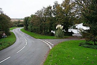
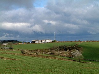
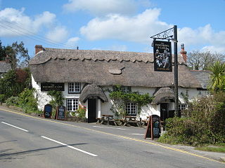
Cockwells is a hamlet in the civil parish of Ludgvan in Cornwall, England and situated on the A30 road north-east of the village of Crowlas. [1]

Hamlet (place) Small human settlement in a rural area

A hamlet is a small human settlement. In different jurisdictions and geographies, hamlets may be the size of a town, village or parish, be considered a smaller settlement or subdivision or satellite entity to a larger settlement. The word and concept of a hamlet have roots in the Anglo-Norman settlement of England, where the old French hamlet came to apply to small human settlements. In British geography, a hamlet is considered smaller than a village and distinctly without a church or other place of worship.

Civil parish Territorial designation and lowest tier of local government in England

In England, a civil parish is a type of administrative parish used for local government, they are a territorial designation which is the lowest tier of local government below districts and counties, or their combined form, the unitary authority. Civil parishes can trace their origin to the ancient system of ecclesiastical parishes which historically played a role in both civil and ecclesiastical administration; civil and religious parishes were formally split into two types in the 19th century and are now entirely separate. The unit was devised and rolled out across England in the 1860s.

Ludgvan civil parish and village in Cornwall, England

Ludgvan is a civil parish and village in Cornwall, England, UK, 2 12 miles (4.0 km) northeast of Penzance. Ludgvan village is split between Churchtown, on the hill, and Lower Quarter to the east, adjoining Crowlas. For the purposes of local government, Ludgvan elects a parish council every four years; the local authority is Cornwall Council.

Related Research Articles

St Clether is a civil parish and village in Cornwall, England, United Kingdom. The village is situated on the east flank of Bodmin Moor approximately eight miles (13 km) west of Launceston in the valley of the River Inny. The population of the civil parish at the 2011 census was 156.

Blowinghouse village in United Kingdom

Blowinghouse is the name of two settlements in Cornwall, England, United Kingdom.

River Allen, Cornwall river in Cornwall, United Kingdom and a tributary of the River Camel

The River Allen in north Cornwall is one of two rivers of the same name in Cornwall which share this name. In this case the name is the result of a mistake made in 1888 by Ordnance Survey, replacing the name Layne with Allen which is the old name for the lower reaches of the Camel. The other River Allen runs through Truro.

De Lank River river in the United Kingdom

The De Lank River is a small river in north Cornwall, England. It is a tributary of the River Camel and is approximately nine miles (14.5 km) long from its source on Bodmin Moor to its confluence with the Camel two miles (3 km) south of St Breward.

Calloose village in United Kingdom

Calloose is a hamlet near Leedstown in west Cornwall, England, UK.

Cambrose human settlement in United Kingdom

Cambrose is a hamlet east of Portreath in west Cornwall, England, UK.

Gillan, Cornwall human settlement in United Kingdom

Gillan is a hamlet in the parish of St Anthony-in-Meneage, Cornwall, England. Gillan Creek is one of the creeks of the Helford River.

Gwenter human settlement in United Kingdom

Gwenter is a hamlet in the parish of St Keverne, Cornwall, England.

Herniss village in United Kingdom

Herniss is a hamlet in the civil parish of Mabe in west Cornwall, England. Herniss is on the A394 main road. It is in the civil parish of Stithians

Higher Menadew human settlement in United Kingdom

Higher Menadew is a farm west of Luxulyan in Cornwall, England.

Lanjew

Lanjew is a farm in the parish of Withiel in Cornwall, England.

Lower Boscaswell village in the United Kingdom

Lower Boscaswell is a hamlet near Pendeen in Cornwall, England.

Nanceddan human settlement in United Kingdom

Nanceddan is a farm north of Ludgvan in west Cornwall, England.

Newtown is a hamlet in the parish of Germoe, Cornwall, England.

Penelewey human settlement in United Kingdom

Penelewey is a hamlet southeast of Playing Place in Cornwall, England, UK. Penelewey is on the B3289 road.

Penmayne is a hamlet next to Splatt in the civil parish of St Minver Lowlands in north Cornwall, England, UK.

Penpillick is a hamlet in Cornwall, England, UK. It is about two miles north of St Blazey on the A390 road.

Penwartha Coombe is a hamlet south of Perranporth, Cornwall, England.

Rumford is a hamlet in Cornwall, England. Rumford is in the civil parish of St Ervan. The telephone area code for Rumford is 01841.

Loggans Moor is a nature reserve and Site of Special Scientific Interest, noted for its biological characteristics, in west Cornwall, England, UK. It is located 1 mile north-east of the town of Hayle, off the A30 road.

References

  1. Ordnance Survey: Landranger map sheet 203 Land's End & Isles of Scilly (Map). Ordnance Survey. 2009. ISBN   978-0-319-23289-7.

Coordinates: 50°09′22″N5°28′19″W / 50.156°N 5.472°W / 50.156; -5.472

Geographic coordinate system Coordinate system

A geographic coordinate system is a coordinate system that enables every location on Earth to be specified by a set of numbers, letters or symbols. The coordinates are often chosen such that one of the numbers represents a vertical position and two or three of the numbers represent a horizontal position; alternatively, a geographic position may be expressed in a combined three-dimensional Cartesian vector. A common choice of coordinates is latitude, longitude and elevation. To specify a location on a plane requires a map projection.