List of rivers in Cornwall

Last updated

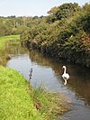
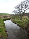
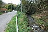
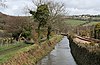
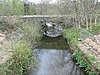
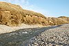
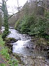
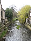
The county of Cornwall, located in southwest England in the United Kingdom, contains numerous small rivers and streams. The border between Cornwall and the neighbouring county of Devon is mostly the River Tamar.

Sketchmap of rivers of southeast Cornwall FoweyLooeRiversMapCornwallUK.gif
Sketchmap of rivers of southeast Cornwall
NameLengthSourceMouthPhoto
River Allen   OOjs UI icon edit-ltr-progressive.svg St Allen River Truro River Allen just before it joins the Truro River - geograph.org.uk - 1375161.jpg
River Allen   OOjs UI icon edit-ltr-progressive.svg Camelford River Camel River Allen - geograph.org.uk - 379778.jpg
River Camel   OOjs UI icon edit-ltr-progressive.svg 74 km (46 mi) Bodmin Moor ( 50°39′33″N 4°38′29″W )Padstow Bay River camel Feb2008.JPG
River Caerhays  OOjs UI icon edit-ltr-progressive.svg 13 km (8.1 mi) [1] English Channel ( 50°14′12″N 4°50′29″W ) Toward the Sea - geograph.org.uk - 1372662.jpg
Carnon River   OOjs UI icon edit-ltr-progressive.svg Chacewater ( 50°15′45″N 5°9′30″W ) English Channel Carnon River near Point Mills - geograph.org.uk - 1234714.jpg
River Cober   OOjs UI icon edit-ltr-progressive.svg Nine Maidens Downs The Loe River Cober in Loe Valley - geograph.org.uk - 984703.jpg
De Lank River   OOjs UI icon edit-ltr-progressive.svg 9 mi (14 km) Bodmin Moor River Camel DeLankRiverCornwallUK.jpg
River Fal   OOjs UI icon edit-ltr-progressive.svg 29 km (18 mi) Goss Moor English Channel DSCN2008FlushingRainbow.jpg
River Fowey   OOjs UI icon edit-ltr-progressive.svg 40 km (25 mi) Bodmin Moor English Channel Golant, River Fowey - geograph.org.uk - 495276.jpg
River Gannel   OOjs UI icon edit-ltr-progressive.svg 13 km (8.1 mi) Carland Cross ( 50°20′57″N 5°1′32″W ) Atlantic Ocean The River Gannel below Trevemper Bridge - geograph.org.uk - 1775540.jpg
Gover Stream   OOjs UI icon edit-ltr-progressive.svg 3 km (1.9 mi) St Austell River Stream in the Gover Valley - geograph.org.uk - 431992.jpg
Hamoaze   OOjs UI icon edit-ltr-progressive.svg Plymouth Sound Plymouth , The Hamoaze - geograph.org.uk - 1151458.jpg
River Hayle   OOjs UI icon edit-ltr-progressive.svg 12 mi (19 km) Crowan ( 50°9′25″N 5°16′59″W ) Atlantic Ocean Hayle River near St Erth - geograph.org.uk - 182864.jpg
Helford River   OOjs UI icon edit-ltr-progressive.svg 50 km (31 mi) [2] English Channel ( 50°5′48″N 5°6′7″W ) A summer morning in Helford - geograph.org.uk - 384012.jpg
River Inny   OOjs UI icon edit-ltr-progressive.svg 20 mi (32 km) Davidstow River Tamar The River Inny from Bealsmill Bridge - geograph.org.uk - 418914.jpg
River Kensey   OOjs UI icon edit-ltr-progressive.svg Treneglos River Tamar Prior's Bridge and the River Kensey - geograph.org.uk - 323493.jpg
Lerryn River   OOjs UI icon edit-ltr-progressive.svg Bodmin Moor River Fowey ( 50°22′19″N 4°38′12″W ) River Lerryn at Tallowater - geograph.org.uk - 492660.jpg
River Looe   OOjs UI icon edit-ltr-progressive.svg 40.1 km (24.9 mi) [3] [4] English Channel River Looe.jpg
River Lynher   OOjs UI icon edit-ltr-progressive.svg 34 km (21 mi) [5] Bodmin Moor Hamoaze River Lynher towards Saltash - geograph.org.uk - 356419.jpg
Marsland Water   OOjs UI icon edit-ltr-progressive.svg Atlantic Ocean Ford in Marsland Wood (geograph 1910478).jpg
River Menalhyl   OOjs UI icon edit-ltr-progressive.svg 12 mi (19 km) Nine Maidens stone row ( 50°28′15″N 4°54′36″W ) Atlantic Ocean ( 50°28′0″N 5°2′0″W ) The River Menalhyl - geograph.org.uk - 105315.jpg
Mylor Creek   OOjs UI icon edit-ltr-progressive.svg Looking down Mylor Creek at high tide - geograph.org.uk - 1042546.jpg
River Ottery   OOjs UI icon edit-ltr-progressive.svg 33 km (21 mi) Otterham River Tamar River Ottery - geograph.org.uk - 212774.jpg
Par River   OOjs UI icon edit-ltr-progressive.svg St Austell Bay Atlantic Coast Line 1.jpg
Penpol Creek   OOjs UI icon edit-ltr-progressive.svg River Fowey ( 50°21′32″N 4°38′7″W ) Penpoll Mill and Penpol Creek.jpg
Penpont Water   OOjs UI icon edit-ltr-progressive.svg River Inny Old bridge at Two Bridges - geograph.org.uk - 163310.jpg
Percuil River   OOjs UI icon edit-ltr-progressive.svg 11 km (6.8 mi) Treworlas ( 50°12′28″N 4°57′23″W ) Falmouth Bay ( 50°9′7″N 5°1′16″W ) Percuil River - geograph.org.uk - 476588.jpg
River Pol   OOjs UI icon edit-ltr-progressive.svg 6.4 km (4.0 mi) Pelynt Atlantic Ocean Polperro, harbour at low tide - geograph.org.uk - 571559.jpg
Pont Pill   OOjs UI icon edit-ltr-progressive.svg River Fowey Penleath Point and Fowey Harbour - geograph.org.uk - 254027.jpg
Port Navas Creek   OOjs UI icon edit-ltr-progressive.svg 1 km (0.62 mi) Helford River Porth Navas - geograph.org.uk - 739949.jpg
Red River   OOjs UI icon edit-ltr-progressive.svg Towednack English Channel The Red River, Marazion - geograph.org.uk - 923354.jpg
Red River   OOjs UI icon edit-ltr-progressive.svg 8 mi (13 km) Bolenowe Atlantic Ocean RedRiverCornwallAtGodrevyBeach.jpg
Restronguet Creek   OOjs UI icon edit-ltr-progressive.svg 2 mi (3.2 km) River Fal Restronguet Creek - geograph.org.uk - 13935.jpg
St Austell River   OOjs UI icon edit-ltr-progressive.svg 20.8 km (12.9 mi) English Channel St Austell River and Cycle Path - geograph.org.uk - 43637.jpg
River Seaton   OOjs UI icon edit-ltr-progressive.svg 11 mi (18 km) Caradon Hill English Channel River Seaton, Hessenford - geograph.org.uk - 1767126.jpg
River Strat   OOjs UI icon edit-ltr-progressive.svg 12.7 mi (20.4 km) Kilkhampton Atlantic Ocean ( 50°49′50″N 4°33′16″W ) The River Strat in Stratton - geograph.org.uk - 1801257.jpg
River Tamar   OOjs UI icon edit-ltr-progressive.svg 98 km (61 mi) Hamoaze Calstock Viaduct.jpg
River Tiddy   OOjs UI icon edit-ltr-progressive.svg Pensilva ( 50°30′4″N 4°25′24″W ) River Lynher ( 50°23′17″N 4°17′38″W ) River Tiddy (25902178096).jpg
Trevillet River   OOjs UI icon edit-ltr-progressive.svg Atlantic Ocean ( 50°40′27″N 4°43′48″W ) Old building near river at Rocky Valley - geograph.org.uk - 1444422.jpg
River Truro   OOjs UI icon edit-ltr-progressive.svg River Fal Truro Cathedral and the River Truro (Taken by Flickr user 2nd January 2015).jpg
River Valency   OOjs UI icon edit-ltr-progressive.svg 8.3 km (5.2 mi) Otterham ( 50°40′12″N 4°37′4″W ) Atlantic Ocean ( 50°41′32″N 4°41′57″W ) River Valency at Newmills - geograph.org.uk - 437373.jpg
River Warleggan  OOjs UI icon edit-ltr-progressive.svg River Fowey Warleggan River - geograph.org.uk - 276921.jpg

Notes

Related Research Articles

<span class="mw-page-title-main">Bodmin Moor</span> Granite moorland in northeast Cornwall, England

<span class="mw-page-title-main">The Lizard</span> Peninsula in southern Cornwall, England

<span class="mw-page-title-main">River Tamar</span> River in southwest England

The Tamar is a river in south west England that forms most of the border between Devon and Cornwall. A part of the Tamar Valley is a World Heritage Site due to its historic mining activities.

<span class="mw-page-title-main">River Camel</span> River in Cornwall, England

The River Camel is a river in Cornwall, England. It rises on the edge of Bodmin Moor and with its tributaries its catchment area covers much of North Cornwall. The river flows into the eastern Celtic Sea between Stepper Point and Pentire Point having covered about 30 miles, making it the second longest river wholly in Cornwall. The river is tidal upstream to Egloshayle and is popular for sailing, birdwatching and fishing. The name Camel comes from the Cornish language for 'the crooked one', a reference to its winding course. Historically the river was divided into three named stretches. Heyl was the name for the estuary up to Egloshayle, the River Allen was the stretch between Egloshayle and Trecarne, whilst the Camel was reserved for the stretch of river between its source and Trecarne.

<span class="mw-page-title-main">River Fal</span> River in Cornwall, England

The River Fal flows through Cornwall, England, rising at Pentevale on Goss Moor and reaching the English Channel at Falmouth. On or near the banks of the Fal are the castles of Pendennis and St Mawes as well as Trelissick Garden. The River Fal separates the Roseland peninsula from the rest of Cornwall. Like most of its kind on the south coast of Cornwall and Devon, the Fal estuary is a classic ria, or drowned river valley. The Fal estuary from Tregony to the Truro River was originally called Hafaraell.

<span class="mw-page-title-main">River Allen, Dorset</span> River in Dorset, England

The River Allen is a river in the county of Dorset in South West England. It flows for 14 miles (23 km) to its confluence with the River Stour immediately south of Wimborne Minster, between that town and the village of Oakley. It has two main tributaries, the Gussage Stream and the Crichel Stream.

<span class="mw-page-title-main">River Alt</span> River in Merseyside, England

The River Alt is an urban river that flows across Merseyside in England. The river has suffered from heavy pollution from industry and sewage upstream and run-off from farmland in its lower reaches. It empties into the River Mersey, near to where the Mersey itself flows into the Irish Sea. The river has benefited from clean-up schemes and a de-culverting process to improve its water quality and provide a better environment for wildlife.

<span class="mw-page-title-main">River Looe</span> River in south-east Cornwall, England

The River Looe is a river in south-east Cornwall, which flows into the English Channel at Looe. It has two main branches, the East Looe River and the West Looe River. The eastern branch has its source near St Cleer only 0.31 miles (0.5 km) away from the Golitha Falls on the River Fowey, and flows south, passing close to the western outskirts of Liskeard. The western branch has its source near Dobwalls.

<span class="mw-page-title-main">River Vyrnwy</span> River in Powys, Wales and Shropshire, England

The River Vyrnwy is a river which flows through northern Powys, Wales, and Shropshire, England. The name derives from Severn, the river of which it is a tributary.

<span class="mw-page-title-main">Helford River</span> Ria in Cornwall, England

The Helford River is a ria in Cornwall, England, fed by small streams into its many creeks. There are seven creeks on the Helford; from west to east these are Ponsontuel Creek, Mawgan Creek, Polpenwith Creek, Polwheveral Creek, Frenchman's Creek, Port Navas Creek, and Gillan Creek. The best known of these is Frenchman's Creek, made famous by Daphne du Maurier in her novel of the same name. A little further up river is Tremayne Quay, built for a visit by Queen Victoria in the 1840s which she then declined to make, allegedly because it was raining.

<span class="mw-page-title-main">London Apprentice</span> Human settlement in England

London Apprentice is a village in south Cornwall, England, UK, on the banks of St Austell River in the Pentewan Valley approximately two miles (3 km) south of St Austell.

<span class="mw-page-title-main">River Kyle</span> River in North Yorkshire, England

The River Kyle is a small river in North Yorkshire, England. At just under 6 miles (9.7 km) long, it is one of the shortest classified main rivers in the country.

<span class="mw-page-title-main">Sabden Brook</span> River in Lancashire, England

Sabden Brook is a small river running through Lancashire in England. It is 7.59 miles (12.21 km) long and has a catchment area of 6.84 square miles (17.723 km2). Rising just to the west of Newchurch-in-Pendle, Sabden Brook moves westward through its well-defined valley past Sabden Hall to the village of Sabden east of the town of Whalley.

<span class="mw-page-title-main">River Gannel</span> River in Cornwall, England

The River Gannel rises in the village of Indian Queens in mid Cornwall, England, United Kingdom. It flows north under Trevemper Bridge and becomes a tidal estuary, the Gannel, that divides the town of Newquay from the village of Crantock and joins the Celtic Sea. The Newlyn Downs form part of the catchment area of the river. The principle tributary of the Gannel is the Benny Stream. Since January 2016 the Gannel estuary, as far as the tidal limit, has been part of the Newquay and the Gannel Marine Conservation Zone.

<span class="mw-page-title-main">Red River (Koner)</span> River in north-west Cornwall, England

The Red River is a small river in north-west Cornwall, United Kingdom which issues into St Ives Bay at Godrevy on Cornwall's Atlantic coast. The Red River is about 8 miles (13 km) long and was given its name from the mineral deposits associated with tin mining, particularly oxides of Iron, which formerly coloured its water red. The river's gradient is relatively steep; the stream falls 170 metres (560 ft) from source to sea.

<span class="mw-page-title-main">The Loe</span> Freshwater lake in Cornwall, England

The Loe, also known as Loe Pool, is the largest natural freshwater lake in Cornwall, United Kingdom. The earliest recorded appearance of this simple name form was in 1337, when it was called "La Loo", but is mentioned as 'the lake' in 1302; Situated between Porthleven and Gunwalloe and downstream of Helston, it is separated from Mount's Bay by the shingle bank of Loe Bar. Both the Loe and Loe Bar are situated within the Penrose Estate, which is administered by the National Trust, and are designated as a Site of Special Scientific Interest by Natural England. It is within the Cornwall Area of Outstanding Natural Beauty and is considered a classic Geological Conservation Review Site. The South West Coast Path, which follows the coast of south-west England from Somerset to Dorset passes over Loe Bar.

<span class="mw-page-title-main">2013–14 United Kingdom winter floods</span> Series of 2013–2014 winter storms in the UK

The 2013–2014 United Kingdom winter floods saw areas of Ireland and the United Kingdom inundated following severe storms. The south of England saw heavy rainfalls associated with these storms which caused widespread flooding, power cuts and major disruptions to transport. Economically, the worst affected areas were Somerset, Devon, Dorset and Cornwall in the south west and the Thames Valley in the south east.

<span class="mw-page-title-main">River Seaton</span> River in east Cornwall, England

The River Seaton is a river in east Cornwall, England, UK which flows southwards for 11 miles (17 km) into the English Channel.

<span class="mw-page-title-main">Outline of Cornwall</span> Overview of and topical guide to Cornwall

The following outline is provided as an overview of and topical guide to Cornwall: Cornwall – ceremonial county and unitary authority area of England within the United Kingdom. Cornwall is a peninsula bordered to the north and west by the Celtic Sea, to the south by the English Channel, and to the east by the county of Devon, over the River Tamar. Cornwall is also a royal duchy of the United Kingdom. It has an estimated population of half a million and it has its own distinctive history and culture.

<span class="mw-page-title-main">Falmouth Bay</span>

Falmouth Bay is a body of water off the south coast of Cornwall, England, United Kingdom, with Rosemullion Head and Pendennis Point as its extremities. It separates the estuaries of Helford River (Helford) and River Fal.

References