Collinsville, Queensland

Last updated

Map all coordinates using: OpenStreetMap  
Download coordinates as: KML
Collinsville
Queensland
Collinsville in May 2018.jpg
Collinsville, May 2018
Australia Queensland location map.svg
Red pog.svg
Collinsville
Coordinates 20°33′09″S147°50′43″E / 20.5526°S 147.8452°E / -20.5526; 147.8452 (Collinsville (town centre)) Coordinates: 20°33′09″S147°50′43″E / 20.5526°S 147.8452°E / -20.5526; 147.8452 (Collinsville (town centre))
Population1,496 (2021 census) [1]
 • Density53.62/km2 (138.88/sq mi)
Postcode(s) 4804
Elevation187 m (614 ft) [2]
Area27.9 km2 (10.8 sq mi)
Time zone AEST (UTC+10:00)
Location
LGA(s) Whitsunday Region
State electorate(s) Burdekin
Federal division(s) Capricornia
Mean max tempMean min tempAnnual rainfall
30.2 °C
86 °F
16.4 °C
62 °F
704.7 mm
27.7 in
Localities around Collinsville:
Springlands Springlands Springlands
Springlands Collinsville Springlands
Springlands Scottville Springlands

Collinsville is a rural town and locality in the Whitsunday Region, Queensland, Australia. [3] [4] In the 2021 census, Collinsville had a population of 1,496 people. [1]

Contents

Geography

Collinsville is in the coal-rich Bowen Basin region of Central Queensland, 1,245 kilometres (774 mi) north of Brisbane and 87 kilometres (54 mi) south-west of the coastal town of Bowen. The Bowen Developmental Road passes through the town connecting with Bowen to the north-east and the Gregory Highway at Belyando Crossing to the south-west.

The Newlands railway system passes through Collinsville serving local mines. The line passes through the town itself but the Collinsville railway station is only a siding near the junction of Station Street and Railway Road ( 20°33′26″S147°51′06″E / 20.5571°S 147.8516°E / -20.5571; 147.8516 (Collinsville railway station) ). [5]

History

Biri (Birri) is an Aboriginal language of Central Queensland and North Queensland. Biri refers to a language chain extending from Central Queensland towards Townsville and is often used as a universal name for other languages and/or dialects across the region. The language area includes the towns of Bowen, Ayr, Collinsville and Nebo. [6]

European settlement of the region began in 1861 with the opening of the lands to pastoralists, with some cattle stations still in operation.

Coal was discovered in 1866 but it was not until 1912 that large-scale mining operations commenced.

The town was originally known as Moongunya, an aboriginal word that roughly translates to place of coal. [3] On 20 September 1921 it was officially renamed Collinsville after Charles Collins who was the Labor Member of the Queensland Legislative Assembly for Bowen from 1915 to 1936. [3]

Collinsville State School opened on 27 June 1921. [7]

Collinsville Post Office opened on 21 May 1923 (a receiving office had been open from 1922). [8]

The foundation stone of Our Lady of Lourdes Catholic Church was laid on Sunday 3 April 1927 by Reverend Father Eveney. [9] On Sunday 17 July 1927 Bishop Joseph Shiel officially opened the church in the presence of many people, including almost 500 people who had travelled from Bowen on a special train arranged for the occasion accompanied by the Bowen Brass Band. [10]

Methodist services were being held in Collinsville by the Methodist minister based in Bowen since at least 1935. [11] In December 1946 tenders were called to erect a Methodist church in Sonoma Street. [12] In 1947 the foundation stone for the Collinsville Methodist Church was laid. On 7 February 1948 the church was officially opened. When the Methodist Church amalgamated into the Uniting Church in Australia in 1977, it became the Collinsville Uniting Church. [13]

The St John Bosco Catholic School was established in 1936 under the Sisters of Mercy. The school is named after Saint John Bosco, a Roman Catholic priest who devoted himself to the betterment of children through love and education. [14]

On 13 October 1954, seven men were killed in the deepest part of the Collinsville State Coal Mine about 1.5 kilometres from the entrance of the No. 1 tunnel, when an outburst dislodged 900 tonnes of earth. [15] The Collinsville mine disaster was the largest loss of life in a Queensland mine since the Mount Mulligan mine disaster in 1921. [16]

Collinsville State High School opened on 28 January 1986. [7]

In the 2011 census, Collinsville had a population of 1,501 people, [17] which declined to 1,248 in the 2016 census, [18] before rebounding to 1,496 in the 2021 census. [1]

Heritage listings

Collinsville has a number of heritage-listed sites, including:

Economy

The town is home to a number of coal mines. This includes the Collinsville coal mine and the Sonoma Mine. These provide significant employment to the town and surrounding areas.

The town is expected to grow further with the development of more mining related projects, and green energy such as solar power is shaping up to be an important job creating industry for Collinsville.[ citation needed ]

It is also hoped that a new connecting road, leading to Proserpine, will be built. This will enable faster travel between the town and the coastal plain, and will also open up new opportunities for land development and export. [21]

Facilities

Facilities in Collinsville include a district hospital, a pharmacy, a newsagent, a bakery, two fuel stations, two medium size grocery stores, two places to buy clothing and a hardware shop.[ citation needed ]

Amenities

The Whitsunday Regional Council operates the Collinsville Library, located on 37 Conway Street, Collinsville. [22] It was opened in 1982. [23]

The Collinsville branch of the Queensland Country Women's Association meets at 33 Conway Street. [24]

There are four churches: Catholic, Anglican, Uniting, and Assembly of God. Our Lady of Lourdes Catholic Church is at 28 Stanley Street ( 20°33′15″S147°50′43″E / 20.5542°S 147.8452°E / -20.5542; 147.8452 (Our Lady of Lourdes Catholic Church) ). [25] Collinsville Uniting Church is at 33 Sonoma Street (corner of Conway Street, 20°33′10″S147°50′34″E / 20.5529°S 147.8428°E / -20.5529; 147.8428 (Collinsville Uniting Church) ). [26] [27] [28]

Sporting facilities include a golf course, rugby league grounds, tennis courts, a public swimming pool, squash courts, and lawn bowls.

Education

Collinsville has two primary schools, Collinsville State School and St John Bosco's Catholic Primary School, and a State High School. [29] In 2014, the Collinsville State School had an enrolment of 42 students with 4 teachers. [30] In 2014, the Collinsville State High School had an enrolment of 77 students with 12 teachers (11 full-time equivalent). [31] In 2016, St John Bosco's Catholic Primary School had an enrolment of 50 students. [32]

Attractions

A recreational vehicle park has been built offering 72-hour free stays for recreational vehicles and campervans. [33]

Related Research Articles

<span class="mw-page-title-main">Bowen, Queensland</span> Town in Queensland, Australia

Bowen is a coastal town and locality in the Whitsunday Region, Queensland, Australia. In the 2016 census, the locality of Bowen had a population of 10,377 people.

<span class="mw-page-title-main">Dalby, Queensland</span> Town in Queensland, Australia

Dalby is a rural town and locality in the Western Downs Region, Queensland, Australia. In the 2016 census, the locality of Dalby had a population of 12,719 people.

<span class="mw-page-title-main">Ayr, Queensland</span> Town in Queensland, Australia

Ayr is a rural town and locality in the Shire of Burdekin, Queensland, Australia. It is the centre of a sugarcane-growing region and the administrative centre for the Burdekin Shire Council. In the 2016 census, the locality of Ayr had a population of 8,738 people.

<span class="mw-page-title-main">Clermont, Queensland</span> Town in Queensland, Australia

Clermont is a rural town and locality in the Isaac Region, Queensland, Australia. At the 2021 census, the locality of Clermont had a population of 2952 people.

<span class="mw-page-title-main">Alpha, Queensland</span> Town in Queensland, Australia

Alpha is a rural town and a locality in the Barcaldine Region, Queensland, Australia. At the 2021 census, the locality had a population of 559 people.

<span class="mw-page-title-main">Proserpine, Queensland</span> Town in Queensland, Australia

Proserpine is a rural town and locality in the Whitsunday Region, Queensland, Australia. In the 2016 census, the locality of Proserpine had a population of 3,562 people.

<span class="mw-page-title-main">Home Hill, Queensland</span> Town in Queensland, Australia

Home Hill is a rural town and locality in the Shire of Burdekin, Queensland, Australia. In the 2016 census, the locality of Home Hill had a population of 2,954 people.

<span class="mw-page-title-main">Baralaba, Queensland</span> Town in Queensland, Australia

Baralaba is a rural town and locality in the Shire of Banana in central Queensland, Australia. In the 2016 census, Baralaba had a population of 314 people.

Scottville is a rural town and locality in the Whitsunday Region, Queensland, Australia. In the 2016 census the locality of Scottville had a population of 259 people.

<span class="mw-page-title-main">Shire of Bowen</span> Local government area in Queensland, Australia

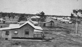
The Shire of Bowen was a local government area in the North Queensland region of Queensland, Australia. The shire, administered from the town of Bowen, covered an area of 21,184.4 square kilometres (8,179.3 sq mi), and existed as a local government entity from 1879 until 2008, when it amalgamated with the Shire of Whitsunday to form the Whitsunday Region.

<span class="mw-page-title-main">Gumlu, Queensland</span> Town in Queensland, Australia

Gumlu is a town and coastal locality in the Whitsunday Region, Queensland, Australia. In the 2016 census, the locality of Gumlu had a population of 181 people.

<span class="mw-page-title-main">Whitsunday Region</span> Local government area in Queensland, Australia

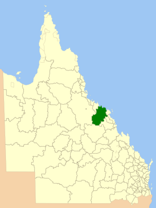
The Whitsunday Region is a local government area located in North Queensland, Australia. Established in 2008, it was preceded by two previous local government areas with a history extending back to the establishment of regional local government in Queensland in 1879.

The Collinsville Coal Mine is a coal mine located in Springlands and Collinsville in the Whitsunday Region, Queensland, Australia. The open-cut mine lies in the northern Bowen Basin. Collinsville produces coking and steaming coal for both domestic use and export. Exports leave the country via Abbot Point.

<span class="mw-page-title-main">Mount Coolon, Queensland</span> Suburb of Whitsunday Region, Queensland, Australia

Mount Coolon is a rural town and locality in the Whitsunday Region, Queensland, Australia. In the 2016 census, the locality of Mount Coolon had a population of 64 people.

<span class="mw-page-title-main">Springlands, Queensland</span> Suburb of Whitsunday Region, Queensland, Australia

Springlands is a rural locality in the Whitsunday Region, Queensland, Australia.

<span class="mw-page-title-main">Cannonvale, Queensland</span> Suburb of Whitsunday Region, Queensland, Australia

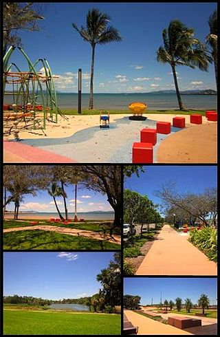
Cannonvale is a coastal locality in the Whitsunday Region, Queensland, Australia. In the 2016 census Cannonvale had a population of 5,716 people.

<span class="mw-page-title-main">Bowen River (Queensland)</span> River in Queensland, Australia

The Bowen River is a river located in North Queensland, Australia.

<span class="mw-page-title-main">Collinsville Cemetery, Queensland</span> Heritage-listed cemetery in Australia

Collinsville Cemetery is a heritage-listed cemetery at Collinsville-Scottville Road, Collinsville, Whitsunday Region, Queensland, Australia. It was built from 1927 onwards. It is also known as Collinsville-Scottville Cemetery. It was added to the Queensland Heritage Register on 18 September 2009.

The Collinsville mine disaster on 13 October 1954 resulted in the death of seven men at the Collinsville coal mine in Collinsville, Queensland, Australia.

Bogie is a rural locality in the Whitsunday Region, Queensland, Australia. In the 2016 census, Bogie had a population of 161 people.

References

  1. 1 2 3 Australian Bureau of Statistics (28 June 2022). "Collinsville (SAL)". 2021 Census QuickStats. Retrieved 8 February 2023. OOjs UI icon edit-ltr-progressive.svg
  2. Bureau of Meteorology Archived 12 February 2008 at the Wayback Machine - Retrieved on 27 January 2008
  3. 1 2 3 "Collinsville – town in Whitsunday Region (entry 7762)". Queensland Place Names. Queensland Government . Retrieved 17 May 2020.
  4. "Collinsville – locality in Whitsunday Region (entry 46859)". Queensland Place Names. Queensland Government . Retrieved 17 May 2020.
  5. "Queensland Globe". State of Queensland . Retrieved 5 June 2020.
  6. "Indigenous languages map of Queensland". State Library of Queensland. 2020. Retrieved 21 January 2020.
  7. 1 2 "Opening and closing dates of Queensland Schools". Queensland Government . Retrieved 18 July 2020.
  8. Premier Postal History. "Post Office List". Premier Postal Auctions. Archived from the original on 15 May 2014. Retrieved 10 May 2014.
  9. "COLLINSVILLE'S NEW CHURCH". The Catholic Advocate . Vol. XV, no. 827. Queensland, Australia. 14 April 1927. p. 36. Archived from the original on 12 September 2021. Retrieved 12 September 2021 via National Library of Australia.
  10. "COLLINSVILLE NOTES AND COMMENTS". Bowen Independent . Vol. 23, no. 1887. Queensland, Australia. 23 July 1927. p. 3. Archived from the original on 12 September 2021. Retrieved 12 September 2021 via National Library of Australia.
  11. "PERSONAL". Bowen Independent . Vol. 31, no. 2724. Queensland, Australia. 27 March 1935. p. 2. Archived from the original on 12 September 2021. Retrieved 12 September 2021 via National Library of Australia.
  12. "COLLINSVILLE AREA". Townsville Daily Bulletin . Vol. LXVII. Queensland, Australia. 30 December 1946. p. 6. Archived from the original on 12 September 2021. Retrieved 12 September 2021 via National Library of Australia.
  13. "Collinsville Memoirs Online". www.memoirs-online.com.au. Archived from the original on 7 April 2021. Retrieved 12 September 2021.
  14. "Overview". St John Bosco School. Archived from the original on 4 March 2016. Retrieved 11 January 2016.
  15. "Collinsville State Coal Mine 1954- Mining Accident Database". www.mineaccidents.com.au. Archived from the original on 28 February 2016. Retrieved 12 January 2016.
  16. "Collinsville disaster remembered". Australian Mining. 16 October 2007. Archived from the original on 7 May 2018. Retrieved 12 January 2016.
  17. Australian Bureau of Statistics (31 October 2012). "Collinsville". 2011 Census QuickStats. Retrieved 11 January 2016. OOjs UI icon edit-ltr-progressive.svg
  18. Australian Bureau of Statistics (27 June 2017). "Collinsville (SSC)". 2016 Census QuickStats. Retrieved 20 October 2018. OOjs UI icon edit-ltr-progressive.svg
  19. "Collinsville Cemetery (entry 602730)". Queensland Heritage Register . Queensland Heritage Council. Retrieved 16 July 2013.
  20. "Bowen River Hotel (entry 600042)". Queensland Heritage Register . Queensland Heritage Council. Retrieved 16 July 2013.
  21. "Road from Proserpine to Collinsville is back on track". Archived from the original on 6 July 2020. Retrieved 6 July 2020.
  22. "Collinsville Library". Public Libraries Connect. Archived from the original on 31 January 2018. Retrieved 31 January 2018.
  23. "Queensland Public Libraries Statistical Bulletin 2016-2017" (PDF). Public Libraries Connect. Archived (PDF) from the original on 30 January 2018. Retrieved 31 January 2018.
  24. "Branch Locations". Queensland Country Women's Association. Archived from the original on 26 December 2018. Retrieved 26 December 2018.
  25. "Our Lady of Lourdes Parish - Collinsville". Roman Catholic Diocese of Townsville . Archived from the original on 16 April 2020. Retrieved 12 September 2021.
  26. "Find a Church". Uniting Church in Australia, Queensland Synod. Archived from the original on 24 October 2020. Retrieved 22 November 2020.
  27. "Collinsville Uniting Church". Collinsville Connect. Archived from the original on 3 March 2021. Retrieved 12 September 2021.
  28. "Collinsville UCA". Bowen Uniting Church. Archived from the original on 5 March 2021. Retrieved 12 September 2021.
  29. "Queensland State and Non-State Schools". Queensland Government. 24 February 2014. Archived from the original on 8 May 2014. Retrieved 2 January 2016.
  30. "2014 School Annual Report" (PDF). Collinsville State School. Archived from the original (PDF) on 4 March 2016. Retrieved 11 January 2015.
  31. "2014 Annual School Report" (PDF). Collinsville State High School. Archived from the original (PDF) on 4 March 2016. Retrieved 12 January 2015.
  32. "St John Bosco Catholic School". St John Bosco Catholic School. Archived from the original on 4 March 2016. Retrieved 12 January 2016.
  33. "Collinsville Showground FC". Free Range Camping Pty Ltd. Archived from the original on 1 May 2018. Retrieved 1 May 2018.