Collinsville, Virginia

Last updated
Collinsville, Virginia
CDP
VAMap-doton-Collinsville.PNG
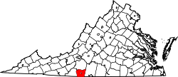
Location of Collinsville, Virginia
Coordinates: 36°43′19″N79°54′55″W / 36.72194°N 79.91528°W / 36.72194; -79.91528
CountryUnited States
State Virginia
County Henry
Area
  Total7.9 sq mi (20.4 km2)
  Land7.9 sq mi (20.4 km2)
  Water0.0 sq mi (0.1 km2)
Elevation
814 ft (248 m)
Population
 (2010)
  Total7,335
  Density930/sq mi (360/km2)
Time zone UTC−5 (Eastern (EST))
  Summer (DST) UTC−4 (EDT)
ZIP code
24078
Area code 276
FIPS code 51-18352 [1]
GNIS feature ID1495414 [2]

Collinsville is a census-designated place (CDP) in Henry County, Virginia, United States. The population was 7,335 at the 2010 census, which was down from the 7,777 reported in 2000. It is part of the Martinsville Micropolitan Statistical Area. Collinsville is also where the administration building and county courthouse of Henry County are located (though nearby Martinsville - an independent city which is not technically part of the county - is usually identified as the county seat).

Contents

Geography

Collinsville is located at 36°43′19″N79°54′55″W / 36.72194°N 79.91528°W / 36.72194; -79.91528 . [3]

According to the United States Census Bureau, the CDP has a total area of 7.9 sq mi (20 km2), of which, 7.9 sq mi (20 km2) of it is land and 0.04 sq mi (0.10 km2) of it (0.25%) is water.

Demographics

As of the census [1] of 2000, there were 7,777 people, 3,466 households, and 2,197 families residing in the CDP. The population density was 988.1 inhabitants per square mile (381.5/km2). There were 3,758 housing units at an average density of 477.5/sq mi (184.4/km2). The racial makeup of the CDP was 84.84% White, 11.28% African American, 0.14% Native American, 0.63% Asian, 0.18% Pacific Islander, 1.98% from other races, and 0.95% from two or more races. Hispanic or Latino of any race were 3.77% of the population.

There were 3,466 households, out of which 27.2% had children under the age of 18 living with them, 47.1% were married couples living together, 12.2% had a female householder with no husband present, and 36.6% were non-families. 32.1% of all households were made up of individuals, and 12.4% had someone living alone who was 65 years of age or older. The average household size was 2.23 and the average family size was 2.77.

In the CDP, the population was spread out, with 21.6% under the age of 18, 8.3% from 18 to 24, 29.7% from 25 to 44, 23.2% from 45 to 64, and 17.2% who were 65 years of age or older. The median age was 38 years. For every 100 females, there were 90.3 males. For every 100 females age 18 and over, there were 87.2 males.

The median income for a household in the CDP was $30,380, and the median income for a family was $39,417. Males had a median income of $28,137 versus $20,955 for females. The per capita income for the CDP was $17,145. About 6.9% of families and 8.8% of the population were below the poverty line, including 10.0% of those under age 18 and 6.8% of those age 65 or over.

Climate

The climate in this area is characterized by hot, humid summers and generally mild to cool winters. According to the Köppen Climate Classification system, Collinsville has a humid subtropical climate, abbreviated "Cfa" on climate maps. [4]

Related Research Articles

<span class="mw-page-title-main">Sunnyside–Tahoe City, California</span> Census-designated place in California, United States

Sunnyside–Tahoe City is a census-designated place (CDP) in Placer County, California, located on the northwest shore of Lake Tahoe. The population was 1,557 at the 2010 census, down from 1,761 at the 2000 census, and a total area of 3.4 sq mi (8.8 km2), all of it land. It comprises two communities, Sunnyside, and Tahoe City.

<span class="mw-page-title-main">Ocean Grove, Massachusetts</span> CDP in Massachusetts, United States

Ocean Grove is a census-designated place (CDP) in the town of Swansea in Bristol County, Massachusetts, United States, on the north shore of Mount Hope Bay near the Cole River. The population was 2,811 at the 2010 census, and 2,904 as of the 2020 census.

<span class="mw-page-title-main">Stonewall, Texas</span> Census-designated place in Texas, United States

Stonewall is an unincorporated community and census-designated place (CDP) in Gillespie County, Texas, United States. The population was 525 at the 2010 census. It was named for Confederate General Thomas J. (Stonewall) Jackson, by Israel P. Nunez who established a stage station near the site in 1870.

<span class="mw-page-title-main">Lipscomb, Texas</span> Census-designated place in Texas, United States

Lipscomb is an unincorporated community and census-designated place (CDP) in Lipscomb County, Texas, United States. It is the Lipscomb county seat. The population was 37 at the 2010 census.

<span class="mw-page-title-main">Timberlake, Virginia</span> CDP in Virginia, United States

Timberlake is a census-designated place (CDP) in Campbell County, Virginia, United States. The population was 13,267 at the 2020 census. It is part of the Lynchburg Metropolitan Statistical Area.

<span class="mw-page-title-main">Bassett, Virginia</span> CDP in Virginia, United States

Bassett is a census-designated place (CDP) in Henry County, Virginia, United States. The population was 1,100 at the 2010 census. It is part of the Martinsville Micropolitan Statistical Area. The town was founded along a rail line by the same family that later started Bassett Furniture. Bassett Furniture's headquarters have remained in Bassett since it began in 1902.

<span class="mw-page-title-main">Chatmoss, Virginia</span> CDP in Virginia, United States

Chatmoss is a census-designated place (CDP) in Henry County, Virginia, United States. The population was 1,698 at the 2010 census, down slightly from the 1,742 reported in 2000. It is part of the Martinsville Micropolitan Statistical Area.

<span class="mw-page-title-main">Fieldale, Virginia</span> CDP in Virginia, United States

Fieldale is a census-designated place (CDP) in Henry County, Virginia, United States. The population was 879 at the 2010 census. It is part of the Martinsville Micropolitan Statistical Area.

<span class="mw-page-title-main">Horsepasture, Virginia</span> CDP in Virginia, United States

Horsepasture is a census-designated place (CDP) in Henry County, Virginia, United States. The population was 2,227 at the 2010 census. It is part of the Martinsville Micropolitan Statistical Area.

<span class="mw-page-title-main">Laurel Park, Virginia</span> CDP in Virginia, United States

Laurel Park is a census-designated place (CDP) in Henry County, Virginia, United States. The population was 675 at the 2010 census. It is part of the Martinsville Micropolitan Statistical Area.

<span class="mw-page-title-main">Oak Level, Virginia</span> CDP in Virginia, United States

Oak Level is a census-designated place (CDP) in Henry County, Virginia, United States. The population was 857 at the 2010 census. It is part of the Martinsville Micropolitan Statistical Area.

Sandy Level is a census-designated place (CDP) in Henry County, Virginia, United States. The population was 484 at the 2010 census, which was a significant decrease from the 689 reported in 2000. It is part of the Martinsville Micropolitan Statistical Area.

<span class="mw-page-title-main">Stanleytown, Virginia</span> CDP in Virginia, United States

Stanleytown is a census-designated place (CDP) in Henry County, Virginia, United States. The population was 1,422 at the 2010 census. It is part of the Martinsville Micropolitan Statistical Area.

Villa Heights is a census-designated place (CDP) in Henry County, Virginia, United States. The population was 717 at the 2010 census. It is part of the Martinsville Micropolitan Statistical Area.

<span class="mw-page-title-main">Rushmere, Virginia</span> Census-designated place in Virginia, United States

Rushmere is a census-designated place (CDP) in Isle of Wight County, Virginia, United States. The population was 1,018 at the 2010 census.

<span class="mw-page-title-main">Lake Marcel-Stillwater, Washington</span> Census-designated place in Washington, United States

Lake Marcel-Stillwater is a census-designated place (CDP) in King County, Washington, United States. The population was 1,277 at the 2010 census.

<span class="mw-page-title-main">Roosevelt, Washington</span> Census-designated place in Washington, United States

Roosevelt is an unincorporated community and census-designated place (CDP) in Klickitat County, Washington, United States. The population was 156 at the 2010 census, up from 79 at the 2000 census. The Roosevelt Regional Landfill, one of the largest landfills in the United States, is located at Roosevelt.

<span class="mw-page-title-main">Greenwater, Washington</span> CDP in Washington, United States

Greenwater is a census-designated place (CDP) in the northwest United States in Pierce County, Washington. Southeast of Seattle, the population was 67 at the 2010 census, down from 91 in 2000.

<span class="mw-page-title-main">Switzer, West Virginia</span> Census-designated place in West Virginia, United States

Switzer is an unincorporated community and census-designated place (CDP) in Logan County, West Virginia, United States. The CDP includes the neighboring unincorporated community of Micco. The total CDP population was 595 at the 2010 census.

Hollins is a census-designated place (CDP) in Botetourt and Roanoke counties in the U.S. state of Virginia. Hollins covers much of the area known locally as "North County". The population was 15,574 at the 2020 census. It is part of the Roanoke Metropolitan Statistical Area. The area is also the home of Hollins University in addition to four properties listed on the National Register of Historic Places: the Black Horse Tavern-Bellvue Hotel and Office, Harshbarger House, the Hollins College Quadrangle, and Old Tombstone.

References

  1. 1 2 "U.S. Census website". United States Census Bureau . Retrieved 2008-01-31.
  2. "US Board on Geographic Names". United States Geological Survey. 2007-10-25. Retrieved 2008-01-31.
  3. "US Gazetteer files: 2010, 2000, and 1990". United States Census Bureau. 2011-02-12. Retrieved 2011-04-23.
  4. Climate Summary for Collinsville, Virginia