Columbia Valley's geography covers approximately 23,000 square miles (14,720,000 acres) extending 185 miles (298km) from the east to west and 200 miles (322km) from north to south. ATF included the entire valley within the viticultural area except the portion between Banks Lake and the Snake River. Therefore, the Columbia Valley appellation encompasses 18,000 square miles (11,520,000 acres).[1]
Columbia Valley viticultural area is the largest wine region in Washington containing about 99% of the state's viticulture acreage of over 59,000 acres (23,876ha) and seventeen appellations currently within its boundary.[2][6] Grapes grown here include Cabernet Sauvignon, Merlot, Chardonnay, Riesling, Syrah, Pinot Gris, and Sauvignon blanc. Concord grapes and other Vitis labrusca grapes are grown in the region as well. The unique climates of the area allow the Columbia Valley to produce wines that are very fruit-forward, like California wine, but which also retain some of the balance and structure of European wine.[6]
Name
The name “Columbia Valley" was derived from the river that flows through and defines the region. In 1792, the river was named after the American-built 212-ton fully-rigged ship "Columbia Rediviva" commanded by Captain Robert Gray when he discovered the river mouth on the Pacific coast and navigated into it. In 1804-1806, the Lewis and Clark Pacific Expedition explored and mapped the area, as their maps detail both the Columbia River and the Columbia Valley. Later, other explorers and pioneers referred to the treeless basin in Washington, Oregon, and Idaho as the “Columbia Valley”, “Columbia Plain”, “Great Columbia Plain”, “ Columbia Plateau”, “Columbia Basin” and “Inland Empire.” The term “Columbia Valley” is widely used today to refer to the viticultural area, and appears in literature, magazines, newspapers, and illustrated in maps.[1]
History
Grapes are not indigenous to the Columbia Valley viticultural area, but both Vinifera and Labruscavines are grown. The oldest planted Vinifera vines still in existence were planted by German immigrants in the Tampico vicinity, west of Union Gap, in 1871. Others were planted in the Kennewick area in 1895, and in the Walla Walla area by 1899. Planting of premium Vinifera grapes began in the Columbia Valley in the mid 1960’s. By 1981 there were over 6,610 acres (2,675ha) of Vinifera grapes including 2,700 acres (1,093ha) of bearing vineyards. Predominant varieties include White Riesling, Chenin Blanc, Chardonnay, Cabernet Sauvignon, Gewurztraminer, Merlot, Semilion, Sauvignon Blanc, Muscat, Pinot Noir, and Grenache. Nearly 20,000 acres (8,094ha) of Concord grapes also grow within the appellation, but are not used for wine production.[1]
The Columbia Valley is a large, treeless basin surrounding the Yakima, Snake and Columbia Rivers in Washington and Oregon while all surrounding areas are forested. The area is distinguished by its broadly undulating or rolling surface, cut by rivers and broken by long sloping basaltic uplifts extending generally in an east-west direction. The area is dominated by its major rivers. The Cascade Range forms its western boundary with the Palouse regions bordering the area to the east.[6] To the north, the Okanogan Highlands form the boundary while on the east, the Greater Spokane area and the eastern portion of the high rolling Palouse Prairie constitute the boundary of the valley. The southern boundary is defined by the Blue Mountains, the 2,000ft (610m) contour line and the foothills of the Cascade Mountains southwest of the Columbia River. Elevation in surrounding areas exceeds 2,000ft (610m) while the elevation in the Columbia Valley generally does not exceed 2,000ft (610m).[1][7] It encompasses the valleys formed by the Columbia River and its tributaries, including the Walla Walla, the Snake, and Yakima Rivers. Columbia Valley stretches between the 46th parallel and 47th parallel which puts it in line with the well-known French wine growing regions of Bordeaux and Burgundy. The northern latitude gives the areas two more hours of additional daylight during the summer growing season than California wine regions receive.[1][6] Columbia Valley’s soils were formed by the Missoula Floods, a series of cataclysmic events over 15,000 years ago. Most vineyards lie below the floodwaters, with soils of windblown deposits of sand and silt loess, overlying gravel and slackwater sediment with a basaltic bedrock. The volcanic and sandyloam soil of the valley offers good drainage and is poor in nutrients, ideal in forcing the vine to concentrate its resources into the grape clusters.[7]
Seventeen appellations currently designate separate viticultural areas with their unique properties within the vast Columbia Valley area but share common characteristics. They are Ancient Lakes of the Columbia Valley, Candy Mountain, Goose Gap, Horse Heaven Hills, Rattlesnake Hills, Lake Chelan, Naches Heights, Red Mountain, The Rocks District of Milton-Freewater, Rocky Reach, Rocky Slope, Snipes Mountain, The Burn of Columbia Valley, Walla Walla Valley, Wahluke Slope and Yakima Valley. North of the Rattlesnake Hills is a region commonly known as Columbia Cascade, but it is not a recognized American viticultural area.[3] Other distinctive wine growing regions that have not yet partitioned for AVA status include the Othello region located in Adams County and the Tri-Cities area around the towns of Kennewick, Pasco and Richland.[6]
Climate
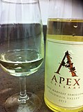
Columbia Valley Chardonnay
Climate differentiates the Columbia Valley viticultural area from surrounding areas. In general, the Columbia Valley viticultural area is characterized as experiencing a growing season of over 150 days, a total degree day average of over 2,000, and annual rainfall of 15 inches (381mm) or less.[1] Most of the land in the Oregon portion of the Columbia Valley is located on north facing slopes. This differs from Washington State where nearly all vineyards are located on south facing slopes. This difference makes the Oregon portion of the valley physically and climatologically distinct from Washington.
The vast size of the appellation allows for an array of diverse microclimates among the various sub-appellations, but the entire region shares the common climate traits of cold winters and long dry growing seasons with low humidity. The warm days and cool nights of the area help retain the balance of acid and sugar levels in the grape which give Washington wines their characteristic balance in flavors. The peak ripening of the grapes occurs during the last four to six weeks of the growing season, with the grapes hanging on the vines a little longer than in California. This allows the grape more time to develop maturity in tannins as well as other aroma and profile characteristics that will be brought out in the resulting wines. The longer growing season also allows the grapes to be harvested at a cooler temperature than in other more southerly wine regions.[6] Deep winter freezes are the main climate threat to the grape growing industry of the Columbia Valley. Temperatures can drop from 40°F (4°C) to less than 0°F (−18°C) in a matter of hours. Many vineyards incorporate wind turbines to maintain air circulation around the grapes and stay warm enough to prevent frost. In most years, the vines enter into a long winter dormancy rather than freeze, which helps the vines come out of the winter and into the growing season healthier.[7]
Total degree days as measured by the scale developed by Winkler and Amerine of the University of California, Davis range between 2,000 and 3.000 for areas within the Columbia Valley although some locations experience readings well in excess of 3.000 degree days. Typical readings are 2,636 degree days at Kennewick, Wash.; 2,666 at Sunnyside, Wash.; 2,274 at Yakima; 2,818 at Wenatchee, Wash.; 2,512 at Grand Coulee Dam, Wash.; ,605 at Clarkston Heights, Wash.; 2,881 at Walla Walla (FAA); 3,230 at Richland, Wash.; 3,014 at The Dalles; 2,073 at Moro, Oreg.; 2,040 at Heppner, Oreg.; 3,006 at Milton-Freewater, Oreg.; and 2,711 degree days at Pendleton, Oreg. Surrounding areas experience less than 2,000 degree days with 1,820 at Goldendale, Wash.; 1,678 at Cle Elum, Wash.; and 1,901 degree days at Colville, Washington.[1]
Rainfall
In Columbia Valley, rainfall is less than 15 inches (381mm) annually, ranging from 6to 9.9 inches (152.4–251.5mm) throughout Benton County, Wash., to 10 inches (254mm) in Wenatchee, Wash.; 15 inches (381mm) in Walla Walla; 13 inches (330mm) in Clarkston Heights, Wash.; 14 inches (356mm) at The Dalles; 12 inches (305mm) at Moro, Oreg.; 13.5 inches (343mm) at Milton-Freewater, Oreg.; and 13 inches (330mm) at Pendleton. Rainfall in surrounding areas is higher, with an annual average of 17 inches (432mm) at Goldendale, Wash.; 22 inches (559mm) at Cle Elum, Wash.; 17 inches (432mm) at Colville, Wash.; and 39 inches (991mm) at Mill Creek, Washington.[1]
Vineyards use drip irrigation systems to better regulate water vines receive.
The rain shadow of the Cascade Range leaves the Columbia Valley with some areas receiving less than 6 inches (15cm) of annual rainfall. The development of intricate irrigation systems has allowed this area to become a premium grape growing region. Using water from the nearby Columbia, Snake, Yakima and Walla Walla Rivers growers are able to precisely control the timing and amount of water that the vines receive. This control over the vines' potential vigor has a large influence on better yields and fruit quality.[6]
This page is based on this Wikipedia article Text is available under the CC BY-SA 4.0 license; additional terms may apply. Images, videos and audio are available under their respective licenses.