Tampico, Washington | |
|---|---|
 Tampico, Washington Location of Tampico, Washington | |
| Coordinates: 46°32′01″N120°52′45″W / 46.53361°N 120.87917°W [1] | |
| Country | United States |
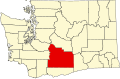
| State | Washington |
| County | Yakima |
| Elevation | 2,136 ft (651 m) |
| Population | |
• Total | 312 |
| Time zone | UTC-8 (Pacific (PST)) |
| • Summer (DST) | UTC-7 (PDT) |
| ZIP code | 98903 |
| Area code | 509 |
| FIPS code | 53-70245 [2] |
| GNIS feature ID | 2585046 [1] |
Tampico is a census-designated place and unincorporated community in Yakima County, Washington, United States, located approximately eighteen miles west of Yakima on Ahtanum Creek. The population was 312 at the 2010 United States census. [2]