Cowiche, Washington | |
|---|---|
 Cowiche, Washington Location of Cowiche, Washington  Cowiche, Washington Cowiche, Washington (Washington (state)) | |
| Coordinates: 46°40′19″N120°42′43″W / 46.67194°N 120.71194°W [1] | |
| Country | United States |
| State | Washington |
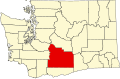
| County | Yakima |
| Elevation | 1,749 ft (533 m) |
| Population (2020) | |
• Total | 535 |
| Time zone | UTC-8 (Pacific (PST)) |
| • Summer (DST) | UTC-7 (PDT) |
| ZIP code | 98923 |
| Area code | 509 |
| GNIS feature ID | 2584963 [1] |
Cowiche (pronounced Cow-witch-ee) is a census-designated place and unincorporated community northwest of Yakima, Washington, near the eastern foothills of the Cascade Mountain range, in central Washington State (US). Cowiche, sometimes spelled Cowychee, is said to mean "footbridge between the valley and the mountains." According to the 2020 census, [2] the town had a population of 535, which is an increase from 428 at 2010. [3]