Gleed, Washington

Last updated
Gleed, Washington
CDP
Yakima County Washington Incorporated and Unincorporated areas Gleed Highlighted.svg
Location of Gleed, Washington
Coordinates: 46°39′21″N120°36′14″W / 46.65583°N 120.60389°W / 46.65583; -120.60389 Coordinates: 46°39′21″N120°36′14″W / 46.65583°N 120.60389°W / 46.65583; -120.60389
CountryUnited States
State Washington
County Yakima
Area
  Total5.4 sq mi (13.9 km2)
  Land5.4 sq mi (13.9 km2)
  Water0.0 sq mi (0.0 km2)
Elevation
1,253 ft (382 m)
Population
 (2010)
  Total2,906
  Density550.1/sq mi (212.4/km2)
Time zone UTC-8 (Pacific (PST))
  Summer (DST) UTC-7 (PDT)
ZIP code
98904
Area code 509
FIPS code 53-26945 [1]
GNIS feature ID1512241 [2]

Gleed is a census-designated place (CDP) in Yakima County, Washington, United States. The population was 2,906 at the 2010 census.

Contents

Geography

Gleed is located at 46°39′21″N120°36′14″W / 46.65583°N 120.60389°W / 46.65583; -120.60389 (46.655778, -120.603859). [3]

According to the United States Census Bureau, the CDP has a total area of 5.4 square miles (13.9 km2), all of it land.

Recreation Opportunities

Lower Naches Community Park, a 7.5 acre county park open daily 9:00 a.m. to dusk, has an open grass area for family picnicking and field sports. Children's play equipment is also available. [4]

Educational facilities

The Lower Naches primary school in Gleed closed at the end of the 2015–16 school year and was replaced by a new school in Naches starting the 2016–17 school year. [5]

Demographics

As of the census [1] of 2000, there were 2,947 people, 1,098 households, and 847 families residing in the CDP. The population density was 550.1 people per square mile (212.3/km2). There were 1,137 housing units at an average density of 212.2/sq mi (81.9/km2). The racial makeup of the CDP was 91.55% White, 0.41% African American, 0.48% Native American, 0.20% Asian, 0.10% Pacific Islander, 5.06% from other races, and 2.21% from two or more races. Hispanic or Latino of any race were 8.35% of the population.

There were 1,098 households, out of which 34.8% had children under the age of 18 living with them, 65.8% were married couples living together, 7.7% had a female householder with no husband present, and 22.8% were non-families. 18.8% of all households were made up of individuals, and 9.1% had someone living alone who was 65 years of age or older. The average household size was 2.67 and the average family size was 3.02.

In the CDP, the age distribution of the population shows 26.4% under the age of 18, 6.0% from 18 to 24, 28.2% from 25 to 44, 25.9% from 45 to 64, and 13.5% who were 65 years of age or older. The median age was 39 years. For every 100 females, there were 98.2 males. For every 100 females age 18 and over, there were 93.4 males.

The median income for a household in the CDP was $44,161, and the median income for a family was $48,950. Males had a median income of $33,511 versus $24,408 for females. The per capita income for the CDP was $20,185. About 2.6% of families and 5.4% of the population were below the poverty line, including 7.0% of those under age 18 and 5.3% of those age 65 or over.

Related Research Articles

Yakima County, Washington U.S. county in Washington

Yakima County is a county in the U.S. state of Washington. As of the 2010 census, its population was 243,231. The county seat and largest city is Yakima. The county was formed out of Ferguson County in January 1865 and is named for the Yakama tribe of Native Americans.

Johnsville, California census-designated place in California, United States

Johnsville is a census-designated place (CDP) in Plumas County, California, United States. The population was 20 at the 2010 census, down from 21 at the 2000 census.

Denair, California Census-designated place in California, United States

Denair is a census-designated place (CDP) in Stanislaus County, California, United States. The population was 4,404 at the 2010 census, up from 3,446 at the 2000 census. It is part of the Modesto Metropolitan Statistical Area.

Pemberton Heights, New Jersey Census-designated place in New Jersey, United States

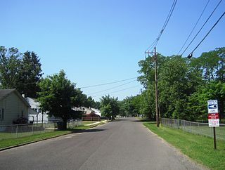
Pemberton Heights is an unincorporated community and census-designated place (CDP) located within Pemberton Township, in Burlington County, New Jersey, United States. As of the 2010 United States Census, the CDP's population was 2,423.

Old Orchard, Pennsylvania Place in Pennsylvania, United States

Old Orchard is a census-designated place (CDP) in Palmer Township, Northampton County, Pennsylvania, United States. It is located in the Lehigh Valley region of the state.

Homeland Park, South Carolina Census-designated place in South Carolina, United States

Homeland Park is a census-designated place (CDP) in Anderson County, South Carolina, United States. The population was 6,296 at the 2010 census.

West Wenatchee, Washington Unincorporated community in Washington, United States

West Wenatchee is a former census-designated place (CDP) and now an unincorporated community in Chelan County, Washington, United States. The United States Census Bureau removed the community at the 2010 census, with most of its former area being merged into Wenatchee city limits, raising the population significantly. The area that was West Wenatchee is part of the Wenatchee–East Wenatchee Metropolitan Statistical Area.

Frederickson, Washington CDP in Washington, United States

Frederickson is a census-designated place (CDP) in Pierce County, Washington, United States. The population was 5,758 at the 2000 census and has grown to 18,719 at the 2010 census.

Ahtanum, Washington CDP in Washington, United States

Ahtanum is a census-designated place (CDP) in Yakima County, Washington, United States. The population was 3,601 at the 2010 census.

Eschbach, Washington CDP in Washington, United States

Eschbach is a census-designated place (CDP) in Yakima County, Washington, United States. The population was 415 at the 2010 census.

Harrah, Washington Town in Washington, United States

Harrah is a town in Yakima County, Washington, United States. The population was 625 at the 2010 census. It is on the Yakama Indian Reservation. The mayor is Barbara Harrer.

Naches, Washington Town in Washington, United States

Naches is a town in Yakima County, Washington, United States. The population was 795 individuals at the 2010 census.

Satus, Washington CDP in Washington, United States

Satus is a census-designated place (CDP) in Yakima County, Washington, United States. The population was 746 at the 2000 census. It is southwest from the Toppenish National Wildlife Refuge. The community was not recognized in the 2010 census. The area was first settled and established as a post office location in 1890.
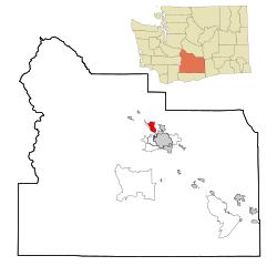
Summitview, Washington CDP in Washington, United States

Summitview is a census-designated place (CDP) in Yakima County, Washington, United States. The population was 967 at the 2010 census.

Terrace Heights, Washington CDP in Washington, United States

Terrace Heights is a census-designated place (CDP) in Yakima County, Washington, United States. The population was 6,937 at the 2010 census. It is essentially a suburb of the city of Yakima.

Tieton, Washington City in Washington, United States

Tieton is a city in Yakima County, Washington, United States. The population was 1,191 at the 2010 census.

Union Gap, Washington City in Washington, United States

Union Gap is a city in Yakima County, Washington, United States. As of the 2010 census, the city population was 6,047. Union Gap has become the retail hub for the entire Yakima Valley as a result of Valley Mall and other thriving businesses being located here. Part of the city is part of the Yakama Nation.

West Valley, Washington CDP in Washington, United States

West Valley is a former census-designated place (CDP) in Yakima County, Washington, United States. The area has been annexed by the city of Yakima. The population was 10,433 at the 2000 census.

White Swan, Washington CDP in Washington, United States

White Swan is a census-designated place (CDP) in Yakima County, Washington, United States. The population was 3,033 at the 2000 census.

Barre (CDP), Massachusetts CDP in Massachusetts, United States

Barre is a census-designated place (CDP) in the town of Barre in Worcester County, Massachusetts, United States. The population was 1,009 at the 2010 census.

References

  1. 1 2 "U.S. Census website". United States Census Bureau . Retrieved 2008-01-31.
  2. "US Board on Geographic Names". United States Geological Survey. 2007-10-25. Retrieved 2008-01-31.
  3. "US Gazetteer files: 2010, 2000, and 1990". United States Census Bureau. 2011-02-12. Retrieved 2011-04-23.
  4. "Yakima County Public Services". Archived from the original on 2012-05-30. Retrieved 2011-10-12.
  5. Naches Valley School District looks for site for new elementary Archived 2012-09-18 at archive.today Yakima Herald-Republic Oct. 22, 2011