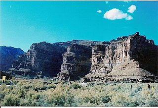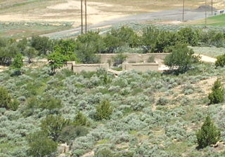
Royal is a ghost town that existed in the early 1900s as a small coal mining town in Carbon County, Utah, United States. Originally called Bear Canyon, the town was renamed Cameron, Rolapp, and finally Royal when the Royal Coal Company purchased it, changing names each time a new owner took over. All that remains of Royal today are some stone walls, a couple of the mines, and a miner's dwelling. These remnants can be seen in Price Canyon.
The Castle Gate mine disaster occurred on March 8, 1924, in a coal mine near the town of Castle Gate, Utah, located approximately 90 miles southeast of Salt Lake City. All of the 171 men working in the mine were killed in the series of three violent explosions. One worker, the leader of the rescue crew, died from carbon monoxide inhalation while attempting to reach the victims shortly after the explosion.

Ninemile Canyon is a canyon, approximately 40 miles (64 km) long, located in Carbon and Duchesne counties in eastern Utah, United States. Promoted as "the world's longest art gallery", the canyon is known for its extensive rock art, most of it created by the Fremont culture and the Ute people. The rock art, shelters, and granaries left behind by the Fremont make Ninemile Canyon a destination for archaeologists and tourists alike.
Kimberly is a ghost town in the northwest corner of Piute County, Utah, United States. Located high in Mill Canyon on the side of Gold Mountain in the Tushar Mountains, Kimberly was formerly a gold mining town. Originally settled in the 1890s, it lasted until 1910. Kimberly had a minor rebirth in the 1930s, but has been uninhabited since approximately 1938. The town is perhaps best known as the birthplace of Ivy Baker Priest, a former United States Treasurer.

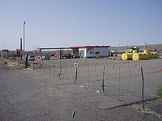
Woodside is a ghost town located on the west bank of the shallow Price River in the nearly uninhabited eastern part of Emery County, Utah, United States. Its fenced-in filling station is one of the only signs of human activity along the lonely stretch of U.S. Route 6/191 between Wellington and Green River.
Scranton is a ghost town in Tooele County, Utah, United States. Located in Barlow Canyon near the Juab County line, it was a short-lived mining town. Scranton has been uninhabited for over a century, but some of its structures have survived relatively intact.
Mohrland is a ghost town located in Emery County, Utah, United States. Lying in Cedar Creek Canyon near the Carbon County line, Mohrland was Emery County's largest coal mining town, with a history more typical of Carbon County's coal camps than of most Emery County communities.
La Plata is a ghost town on the southern end of Cache County, Utah, United States. Located in the Bear River Mountains on a small tributary of the east fork of the Little Bear River, La Plata was a short-lived silver mining boomtown in the 1890s.
Alunite is a ghost town located some 5 miles (8.0 km) south of Marysvale, near the mouth of Cottonwood Canyon in Piute County, Utah, United States. A small but important mining town during World War I, Alunite was inhabited from approximately 1915–1930.

Forest City is a ghost town in Utah County, Utah, United States. It is located in the valley of Dutchman Flat in the upper part of American Fork Canyon, in the Uinta National Forest. A silver mining town just over the mountain from Alta, Forest City was inhabited about 1871–1880. The town grew up around the smelter that was built to process ore from the canyon's mines. The American Fork Railroad, which was intended to serve Forest City and the smelter, stopped short of its destination due to engineering difficulties. Transportation costs rose too high for the mines to continue operating profitably. As the smelter, mines, and railroad closed down, Forest City was abandoned.
Castleton is a ghost town in the Castle Valley in southeastern Grand County, Utah, United States.

Sego is a ghost town in Grand County, Utah, United States. It lies in the narrow, winding Sego Canyon, in the Book Cliffs some 5 miles (8.0 km) north of Thompson Springs. Formerly an important eastern Utah coal mining town, Sego was inhabited about 1910–1955. The town is accessed via the grade of the Ballard & Thompson Railroad, a spur from the Denver and Rio Grande Western built by the founders of the town to transport the coal.

Newhouse is a ghost town located on the eastern edge of the Wah Wah Valley in Beaver County, Utah, United States. A silver mining town based on the Cactus Mine on the western slopes of the San Francisco Mountains, Newhouse was smaller and quieter than Frisco, 5 miles (8.0 km) to the southeast.
Grass Creek is a ghost town in Summit County, Utah, United States. Lying some 8 miles (13 km) northeast of Coalville, it was once an important coal mining town. Grass Creek was inhabited circa 1860–1940.

Silver City is a ghost town located at the mouth of Dragon Canyon on the west flank of the East Tintic Mountains in northeast Juab County in central Utah, United States. It was a silver mining town approximately 90 miles (140 km) south-southwest of Salt Lake City. This area was considered part of the Tintic Mining District and also produced bismuth, copper, gold, and lead. Settlement began with the first mining strikes here in 1869. Silver City was inhabited until 1930, after the mines played out. Jesse Knight, known as the "Mormon Wizard" for his ability to find ore easily, decided to build a smelter in Silver City because it had the flattest ground in all of the Tintic Mining District. Silver City had several mines in 1890, but the mines hit water and were abandoned. Now there is little left other than a few holes where mines were, and a number of tailings piles. The Silver City Cemetery, however, survives and is listed on the National Register of Historic Places.

Knightsville is a ghost town located in the East Tintic Mountains on the northern slope of Godiva Mountain, approximately 2 miles (3.2 km) east of Eureka, in the northeastern corner of Juab County in central Utah, United States. A silver mining camp, Knightsville was established and operated as a company town by local mining entrepreneur Jesse Knight. The town was inhabited from 1896 until approximately 1940.

Standardville is a ghost town in Carbon County, Utah, United States. Standardville was established after coal was discovered in the area in 1912. The layout of the town was so well-planned, it became the "standard" for all mining towns to follow, which resulted in the town name of Standardville. In 1922, a group of striking miners killed a mine guard and wounded two miners before escaping. In 1930, 20 miners were killed in a mine explosion caused by carbon monoxide gas. In 1950, the mine shut down and people began to relocate elsewhere. A couple families remained until the 1970s, after which Standardville was abandoned.
Winter Quarters is a ghost town in Carbon County, Utah, United States. Coal was discovered in the area in 1875, and later that year, the Pleasant Valley Coal Company began coal mining operations. A group of coal miners were delayed during an early winter storm in 1877, which led to the town's name of Winter Quarters. On May 1, 1900, an explosion in the Winter Quarters Number Four mine killed 200 miners. Despite the mine explosion, the coal mining operations remained active until 1922, when the opening of a new mine in Castle Gate caused many people to relocate there. By 1930, Winter Quarters was abandoned.
Dragon is a ghost town in Uintah County, at the extreme eastern edge of Utah, United States. Founded in about 1888 as a Gilsonite mining camp, Dragon boomed in the first decade of the 20th century as the end-of-line town for the Uintah Railway. Although it declined when the terminus moved farther north in 1911, Dragon survived as the largest of the Gilsonite towns. It was abandoned after its mining operations stopped in 1938 and the Uintah Railway went out of business in 1939.
Desert Lake is a ghost town in Castle Valley in northern Emery County, Utah, United States. It was inhabited from 1885 to about 1910.


