Cooper City, Florida | |
|---|---|
| City of Cooper City | |
 Cooper City's City Hall | |
 Flag | |
| Motto: "Someplace Special" | |
 | |
| Coordinates: 26°2′41″N80°17′22″W / 26.04472°N 80.28944°W | |
| Country | |
| State | |
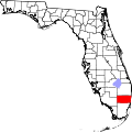
| County | Broward |
| Incorporated | June 20, 1959 [1] |
| Government | |
| • Type | Commission-Manager |
| • Mayor | James Curran |
| • Commissioners | Lisa Mallozzi, Jeff Green, Jeremy Katzman, and Ryan C. Shrouder |
| • City Manager | Alejandro “Alex” Rey |
| • City Clerk | Tedra Allen |
| Area | |
| 8.34 sq mi (21.60 km2) | |
| • Land | 8.04 sq mi (20.82 km2) |
| • Water | 0.30 sq mi (0.78 km2) 3.63% |
| Elevation | 6.6 ft (2 m) |
| Population (2020) | |
| 34,401 | |
| • Density | 4,279.7/sq mi (1,652.42/km2) |
| • Metro | 6,166,488 |
| Time zone | UTC-5 (Eastern (EST)) |
| • Summer (DST) | UTC-4 (EDT) |
| ZIP code | 33328-33330, 33026 |
| Area codes | 954, 754 |
| FIPS code | 12-14125 [3] |
| GNIS feature ID | 0280777 [4] |
| Website | www |
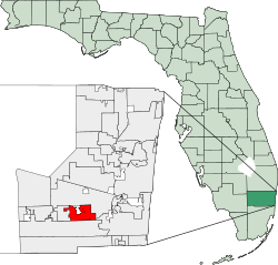
Cooper City is a city in Broward County, Florida, United States. The city is named for Morris Cooper, who founded the community in 1959. It's part of the Miami metropolitan area of South Florida. The city's population was 34,401 at the 2020 census. [5]
Contents
- Geography
- Climate
- Demographics
- 2010 and 2020 census
- 2000 census
- Education
- Public schools
- Private schools
- Sports
- Notable people
- Sister city
- References
- External links
In 2006, Cooper City expanded with the annexation of the Waldrep Dairy Farm.