Morgan County is a county in northern Utah, United States. As of the 2020 census, the population was 12,295. Its county seat and largest city is Morgan. Morgan County is part of the Ogden-Clearfield, UT Metropolitan Statistical Area as well as the Salt Lake City-Provo-Orem, UT Combined Statistical Area.
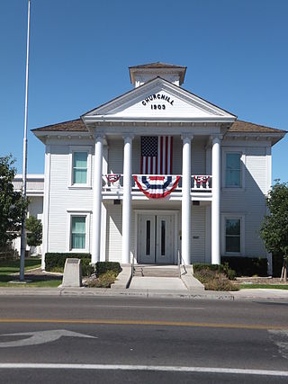
Churchill County is a county in the western U.S. state of Nevada. As of the 2020 census, the population was 25,516. Its county seat is Fallon. Named for Mexican–American War hero brevet Brigadier General Sylvester Churchill, the county was formed in 1861. Churchill County comprises the Fallon, NV Micropolitan Statistical Area. It is in northwestern Nevada. Churchill County is noteworthy in that it owns and operates the local telephone carrier, Churchill County Communications.

Washington Township is a township in Armstrong County, Pennsylvania, United States. The population was 898 at the 2020 census, a decrease from 923 at the 2010 census.

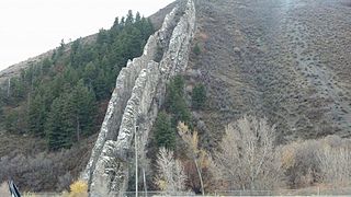
The Santa Monica Mountains are a coastal mountain range in Southern California, next to the Pacific Ocean. It is part of the Transverse Ranges. The Santa Monica Mountains National Recreation Area encompasses this mountain range. Because of its proximity to densely populated regions, it is one of the most visited natural areas in California.

Skidoo was an unincorporated community in Inyo County, California. The geographical location of the old town site lies at an elevation of 5,689 feet. Skidoo is a ghost town located in Death Valley National Park. It is on the National Register of Historic Places.
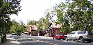
Coloma is a census-designated place in El Dorado County, California, US. It is approximately 36 miles (58 km) northeast of Sacramento, California. Coloma is most noted for being the site where James W. Marshall found gold in the Sierra Nevada foothills, at Sutter's Mill on January 24, 1848, leading to the California Gold Rush. Coloma's population is 529.

Cherokee is an unincorporated community and census-designated place in Butte County, California. It is an area inhabited by Maidu Indians prior to the gold rush, but that takes its name from a band of Cherokee prospectors who perfected a mining claim on the site. The population was 69 at the 2010 census. It lies at an elevation of 1306 feet.

Hamilton is an abandoned mining town located in the White Pine Range, in western White Pine County, Nevada, United States.

Panamint City is a ghost town in the Panamint Range, near Death Valley, in Inyo County, California, US. It is also known by the official Board of Geographic Names as Panamint. Panamint was a boom town founded after silver and copper were found there in 1872. By 1874, the town had a population of about 2,000. Its main street was one mile (1.6 km) long. Panamint had its own newspaper, the Panamint News. Silver was the principal product mined in the area. The town is located about three miles northwest of Sentinel Peak. According to the National Geographic Names Database, NAD27 latitude and longitude for the locale are 36°07′06″N117°05′43″W, and the feature ID number is 1661185. The elevation of this location is identified as being 6,280 feet AMSL. The similar-sounding Panamint Springs, California, is located about 25.8 miles at 306.4 degrees off true north near Panamint Junction.

Ruby is a ghost town in Santa Cruz County, Arizona, United States. It was founded as a mining town in Bear Valley, originally named Montana Camp, so named because the miners were mining at the foot of Montana Peak.
Greenwater was an unincorporated community near Death Valley located in the eastern side of the Inyo County, California. It is now a deserted ghost town.

Midland is a ghost town in Riverside County in the southeastern part of the U.S. state of California. It is adjacent to the Little Maria Mountains and located about 20 mi (32 km) northwest of Blythe. It is accessible from Blythe in the south via Lovekin Boulevard and Midland Road, and from Rice in the north via Midland Road.
Wauconda is a small unincorporated community in Okanogan County, Washington, United States. Once a boom town, it has dwindled almost to nothing; it is now under single ownership.

Corte Madera Creek is a short stream which flows southeast for 4.5 miles (7.2 km) in Marin County, California. Corte Madera Creek is formed by the confluence of San Anselmo Creek and Ross Creek in Ross and entering a tidal marsh at Kentfield before connecting to San Francisco Bay near Corte Madera.

Fairview is a ghost town in Churchill County, Nevada, in the United States of America.

Hobbs is an unincorporated community in west Fisher County, Texas, United States. It is located at the intersection of Farm to Market Roads 611 and 1614, about 20 mi (32 km) east of Snyder. It lies within the physiographic region known as the Rolling Plains in the valley of the Clear Fork Brazos River.
Thoeny is a ghost town in the northern part of Valley County, Montana, United States, near the Canadian province of Saskatchewan. Thoeny is located north of Hinsdale and west of Opheim. The school house still stands. There is also a cemetery located on the hill.
Lucky Valley is a ghost town in Woodbury County, in the U.S. state of Iowa.
Diamond is a ghost town in eastern Juab County, Utah, United States. The Diamond Cemetery is listed on the National Register of Historic Places.

