Banks Lake South, Washington

Last updated

Banks Lake South, Washington
Grant County Washington Incorporated and Unincorporated areas Banks Lake South Highlighted.svg
Location of Banks Lake South in Washington
Coordinates: 47°37′49″N119°16′30″W / 47.63028°N 119.27500°W / 47.63028; -119.27500
CountryUnited States
State Washington
County Grant
Area
  Total2.9 sq mi (7.5 km2)
  Land2.4 sq mi (6.3 km2)
  Water0.5 sq mi (1.2 km2)
Elevation
1,634 ft (498 m)
Population
 (2020)
  Total234
  Density81/sq mi (31/km2)
Time zone UTC-8 (Pacific (PST))
  Summer (DST) UTC-7 (PDT)
ZIP code
99115 [1]
Area code 509
FIPS code 53-04125 [2]
GNIS feature ID1852937 [3]

Banks Lake South is a census-designated place (CDP) in Grant County, Washington, United States. The population was 234 at the 2020 census. [4]

Contents

Geography

Banks Lake South is located in northern Grant County at 47°37′49″N119°16′30″W / 47.63028°N 119.27500°W / 47.63028; -119.27500 (47.630298, -119.274900), [5] adjacent to the eastern border of Coulee City. It is on the east side of Banks Lake near its southern end, part of the Upper Grand Coulee valley.

U.S. Route 2 passes through the CDP, leading east 30 miles (48 km) to Wilbur and west 68 miles (109 km) to Wenatchee. Spokane is 94 miles (151 km) to the east via US 2. Washington State Route 155 leads northeast from Banks Lake 25 miles (40 km) to the city of Grand Coulee near the Grand Coulee Dam.

According to the United States Census Bureau, the Banks Lake South CDP has a total area of 2.9 square miles (7.5 km2), of which 2.4 square miles (6.3 km2) are land and 0.46 square miles (1.2 km2), or 16.06%, are water. [6]

Demographics

As of the census [2] of 2000, there were 160 people, 75 households, and 53 families residing in the CDP. The population density was 65.7 people per square mile (25.3/km2). There were 86 housing units at an average density of 35.3/sq mi (13.6/km2). The racial makeup of the CDP was 99.38% White, and 0.62% from two or more races.

There were 75 households, out of which 21.3% had children under the age of 18 living with them, 65.3% were married couples living together, 4.0% had a female householder with no husband present, and 29.3% were non-families. 26.7% of all households were made up of individuals, and 6.7% had someone living alone who was 65 years of age or older. The average household size was 2.13 and the average family size was 2.57.

In the CDP, the age distribution of the population shows 16.3% under the age of 18, 4.4% from 18 to 24, 18.8% from 25 to 44, 41.9% from 45 to 64, and 18.8% who were 65 years of age or older. The median age was 53 years. For every 100 females, there were 105.1 males. For every 100 females age 18 and over, there were 103.0 males.

The median income for a household in the CDP was $37,500, and the median income for a family was $38,750. Males had a median income of $34,375 versus $28,750 for females. The per capita income for the CDP was $18,588. About 4.3% of families and 8.7% of the population were below the poverty line, including 14.3% of those under the age of eighteen and 8.8% of those 65 or over.

Related Research Articles

<span class="mw-page-title-main">Grant County, Washington</span> County in Washington, United States

Grant County is a county located in the U.S. state of Washington. As of the 2020 census, the population was 99,123. The county seat is Ephrata, and the largest city is Moses Lake. The county was formed out of Douglas County in February 1909 and is named for U.S. President Ulysses S. Grant.

<span class="mw-page-title-main">Funny River, Alaska</span> Census-designated place in Alaska, United States

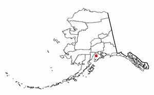
Funny River is a census-designated place (CDP) in Kenai Peninsula Borough, Alaska, United States. At the 2010 census the population was 877, up from 636 in 2000.

<span class="mw-page-title-main">Matlacha, Florida</span> Census-designated place in Florida, United States

Matlacha is a census-designated place (CDP) in Lee County, Florida, United States. The CDP had a population of 598 at the 2020 census, down from 677 at the 2010 census. It is part of the Cape Coral-Fort Myers, Florida Metropolitan Statistical Area.

<span class="mw-page-title-main">Kicking Horse, Montana</span> Census-designated place in Montana, United States

Kicking Horse is a census-designated place (CDP) in Lake County, Montana, United States. The population was 286 at the 2010 census, up from 80 in 2000.

<span class="mw-page-title-main">Sutcliffe, Nevada</span> CDP in Nevada, United States

Sutcliffe is a census-designated place (CDP) in Washoe County, Nevada, United States. The population was 253 at the 2010 census. It is part of the Reno–Sparks Metropolitan Statistical Area.

<span class="mw-page-title-main">Jette, Montana</span> Census-designated place in Montana, United States

Jette is a census-designated place (CDP) in Lake County, Montana, United States. The population was 253 at the 2010 census.

<span class="mw-page-title-main">Oliver, Pennsylvania</span> Census-designated place in Pennsylvania, United States

Oliver is a census-designated place (CDP) in Fayette County, Pennsylvania, United States. The population was 2,535 at the 2010 census, down from 2,925 at the 2000 census. Oliver is located in North Union Township.

<span class="mw-page-title-main">Red Bank, South Carolina</span> Census-designated place in South Carolina, United States

Red Bank is an unincorporated community and census-designated place (CDP) in Lexington County, South Carolina, United States. The population was 9,617 at the 2010 census, up from 8,811 at the 2000 census. It is part of the Columbia, South Carolina Metropolitan Statistical Area.

<span class="mw-page-title-main">Cascade Valley, Washington</span> Census-designated place in Washington, United States

Cascade Valley is a census-designated place (CDP) in Grant County, Washington, United States. The population was 2,246 at the 2010 census, up from 1,811 at the 2000 census.

<span class="mw-page-title-main">Coulee City, Washington</span> Town in Washington, United States

Coulee City is a town in Grant County, Washington. The population was 549 at the 2020 census.

<span class="mw-page-title-main">Grand Coulee, Washington</span> City in Washington, United States

Grand Coulee is a city in Grant County, Washington, United States. The population was 972 at the 2020 census.

<span class="mw-page-title-main">Lakeview, Washington</span> Census-designated place in Washington, United States

Lakeview is a census-designated place (CDP) in Grant County, Washington, United States. The population was 915 at the 2010 census, up from 797 at the 2000 census. The community is referred to as Lakeview Park on topographic maps and by locals.

<span class="mw-page-title-main">Moses Lake North, Washington</span> Census-designated place in Washington, United States

Moses Lake North is a census-designated place (CDP) in Grant County, Washington, United States. It is also included in the Moses Lake micropolitan area. The population was 4,050 at the 2020 census.

<span class="mw-page-title-main">Ames Lake, Washington</span> Census-designated place in Washington, United States

Ames Lake is an unincorporated community and census-designated place (CDP) in King County, Washington, United States. The population was 1,524 at the 2020 census, up from 1,486 at the 2010 census.

<span class="mw-page-title-main">Cottage Lake, Washington</span> Census-designated place in Washington, United States

Cottage Lake is a census-designated place (CDP) in King County, Washington, United States. The population was 22,494 at the 2010 census. The lake itself falls within the 98072 ZIP code, while the developments east of the lake fall under the 98077 ZIP code.

<span class="mw-page-title-main">Lake Marcel-Stillwater, Washington</span> Census-designated place in Washington, United States

Lake Marcel-Stillwater is a census-designated place (CDP) in King County, Washington, United States. The population was 1,334 at the 2020 census.

<span class="mw-page-title-main">Lake Morton-Berrydale, Washington</span> Census-designated place in Washington, United States

Lake Morton-Berrydale is a census-designated place (CDP) in King County, Washington, United States. The population was 10,474 at the 2020 census.

<span class="mw-page-title-main">Lakeland North, Washington</span> Census-designated place in Washington, United States

Lakeland North is a census-designated place (CDP) in King County, Washington, United States. The population was 13,663 at the 2020 census. Part of the community was annexed into neighboring Auburn in 2008.

<span class="mw-page-title-main">Lakeland South, Washington</span> Census-designated place in Washington, United States

Lakeland South is a census-designated place (CDP) in King County, Washington, United States. The population was 13,169 at the 2020 census.

<span class="mw-page-title-main">Maple Heights-Lake Desire, Washington</span> Census-designated place in Washington, United States

Maple Heights-Lake Desire is a census-designated place (CDP) in King County, Washington, United States. At the 2020 census, the population was 3,873.

References

  1. "Banks Lake South WA ZIP Code". zipdatamaps.com. 2023. Retrieved June 16, 2023.
  2. 1 2 "U.S. Census website". United States Census Bureau . Retrieved January 31, 2008.
  3. "Banks Lake South Census Designated Place". Geographic Names Information System . United States Geological Survey, United States Department of the Interior.
  4. "Census Bureau profile: Banks Lake South, Washington". United States Census Bureau. May 2023. Retrieved May 9, 2024.
  5. "US Gazetteer files: 2010, 2000, and 1990". United States Census Bureau. February 12, 2011. Retrieved April 23, 2011.
  6. "Geographic Identifiers: 2010 Demographic Profile Data (G001): Banks Lake South CDP, Washington". American Factfinder. U.S. Census Bureau. Retrieved March 29, 2017.[ dead link ]