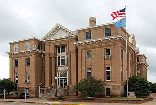
Payne County is located in the U.S. state of Oklahoma. As of the 2020 census, its population was 81,646. Its county seat is Stillwater. The county was created in 1890 as part of Oklahoma Territory and is named for Capt. David L. Payne, a leader of the "Boomers".

Logan County is a county located in the U.S. state of Oklahoma. As of the 2020 census, the population was 49,555. Its county seat is Guthrie.

Cimarron County is the westernmost county in the U.S. state of Oklahoma. Its county seat is Boise City. As of the 2020 census, its population was 2,296, making it the least-populous county in Oklahoma; and indeed, throughout most of its history, it has had both the smallest population and the lowest population density of any county in Oklahoma. Located in the Oklahoma Panhandle, Cimarron County contains the only community in the state (Kenton) that observes the Mountain Time Zone. Black Mesa, the highest point in the state, is in the northwest corner of the county. The Cimarron County community of Regnier has the distinction of being the driest spot in Oklahoma ranked by lowest annual average precipitation, at just 15.62 inches; at the same time, Boise City is the snowiest location in Oklahoma ranked by highest annual average snowfall, at 31.6 inches.

Cimarron Hills is an unincorporated community and a census-designated place (CDP) located in and governed by El Paso County, Colorado, United States. Cimarron Hills is an enclave of the City of Colorado Springs. The CDP is a part of the Colorado Springs, CO Metropolitan Statistical Area. The population of the Cimarron Hills CDP was 19,311 at the United States Census 2020. The Colorado Springs post office serves the area.

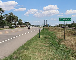
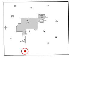
Atwood is an unincorporated town, a post office, and a census-designated place (CDP) located in and governed by Logan County, Colorado, United States. The CDP is a part of the Sterling, CO Micropolitan Statistical Area. The Atwood post office has the ZIP Code 80722. At the United States Census 2020, the population of the Atwood CDP was 138.

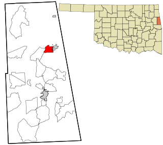
Eldon is an unincorporated community and census-designated place (CDP) in Cherokee County, Oklahoma, United States. The population was 368 at the 2010 census, a loss of 62.3 percent from 991 at the 2000 census, due largely to shrinkage of the CDP boundaries. It lies east of Tahlequah at the junction of U.S. Highway 62 and State Highway 51. The Eldon Post Office existed from March 20, 1911, until May 30, 1936. The community is said to have been named for Eldon, Illinois.

Cimarron City is a town in Logan County, Oklahoma, United States. The population was 150 at the 2010 census, a 39.4 percent gain over the figure of 110 in 2000. It is part of the Oklahoma City Metropolitan Statistical Area. Cimarron City is a combination bedroom and retirement community.

Coyle is a town in Logan County, Oklahoma, United States. The population was 325 at the 2010 census, compared to the figure of 337 in 2000. It is part of the Oklahoma City metropolitan area. The town was named for William Coyle, an influential Guthrie business man.

State Highway 74, usually abbreviated as SH-74 or OK-74 is the numbering of two different highways maintained by the U.S. state of Oklahoma. These highways were once a single major north–south route, connecting Oklahoma City to more rural parts of the state. The original road stretched from SH-7 near Tatums to SH-11 west of Deer Creek.

Felt is a small unincorporated community and census-designated place (CDP) in Cimarron County, Oklahoma, United States. As of the 2020 census, the town’s population was 77. It was named for C.F.W. Felt of the Santa Fe Railroad. Nearby is the Cedar Breaks Archeological District, included on the National Register of Historic Places listings in Cimarron County, Oklahoma. The community is served by a post office and a school. During the Great Depression in 1936 a farm in Felt was the site of the iconic Dust Bowl photograph known as Dust Bowl Cimarron County, Oklahoma.

Kenton is a town in Cimarron County, Oklahoma, United States. As of the 2020 census, the community had 31 residents.

State Highway 33 is a state highway in the U.S. state of Oklahoma. It is a major highway that traverses most of the state, and at one time traversed its entirety. Its general orientation is west to east.

Bison is an unincorporated community and census-designated place (CDP) located on US Highway 81 in Garfield County, Oklahoma, United States, consisting of a 30-acre (12 ha) town plat. As of the 2010 census, it had a population of 65.

U.S. Route 64 (US-64) is a U.S. highway running from the Four Corners area to the Outer Banks of North Carolina. Between these two points, the highway passes through the entire width of Oklahoma; a total of 591.17 miles (951.40 km) of US-64 lies in the state of Oklahoma. US-64 enters the state from New Mexico, crossing the line between the two states between Clayton, New Mexico, and Boise City in Cimarron County. The route runs the full length of the Oklahoma Panhandle, then serves the northernmost tier of counties in the main body of the state before dipping southeastward to Tulsa, the state's second-largest city. From Tulsa, the highway continues southeast, leaving Oklahoma just west of Fort Smith, Arkansas. In addition to Tulsa, US-64 serves fifteen Oklahoma counties and the cities of Guymon, Woodward, Enid, and Muskogee.

Old Green is a census-designated place (CDP) in Adair County, Oklahoma, United States. The population was 315 at the 2010 census.
Caney Ridge is an unincorporated community and census-designated place (CDP) in Cherokee County, Oklahoma, United States, within the Cherokee Nation. It was first listed as a CDP prior to the 2020 census.
Lovell is a census-designated place (CDP) in Logan County, Oklahoma, United States. It was first determined by the United States Census Bureau prior to the 2020 census. It is named after the village of Lovell, which is incorporated in its boundaries.
Twin Lakes is an unincorporated community and census-designated place (CDP) in Logan County, Oklahoma, United States. It was first listed as a CDP prior to the 2020 census.
Pershing is an unincorporated community and census-designated place (CDP) in Osage County, Oklahoma, United States. It was first listed as a CDP prior to the 2020 census.
Canadian Shores is an unincorporated community and census-designated place (CDP) in Pittsburg County, Oklahoma, United States. It was first listed as a CDP prior to the 2020 census.


