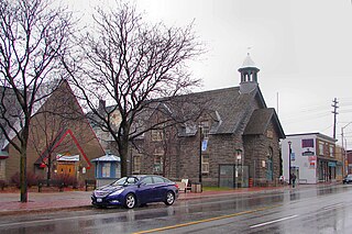
Westboro is an area in the west end of Ottawa, Ontario, Canada. Located along the Ottawa River, Island Park Drive defines Westboro's eastern border, while the Ottawa River defines its northern border. Under this definition, the population of the area is 22,725.

The Greenbelt is a 203.5-square-kilometre (78.6 sq mi) protected green belt traversing Ottawa, Ontario, Canada. It includes green space, forests, farms, and wetlands from Shirleys Bay in the west and to Green's Creek in the east. It is the largest publicly owned green belt in the world and the most ecologically diverse area in Eastern Ontario. The National Capital Commission (NCC) owns and manages 149.5 square kilometres (57.7 sq mi), and the rest is held by other federal government departments and private interests. Real estate development within the Greenbelt is strictly controlled.
Whitewater Region is a township on the Ottawa River in Renfrew County, located within the scenic Ottawa Valley in eastern Ontario, Canada. Whitewater Region is made up of the former municipalities of Beachburg, Cobden, Ross and Westmeath, which were amalgamated into the current township on January 1, 2001.

Orléans is a federal electoral district in Ottawa, Ontario, Canada, that has been represented in the House of Commons of Canada since 1988.

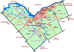
Carleton County is the name of a former county in Ontario, Canada. In 1969, it was superseded by the Regional Municipality of Ottawa–Carleton. In 2001, the Regional Municipality and its eleven local municipalities were replaced by the current city of Ottawa.

The Regional Municipality of Ottawa–Carleton was a Regional Municipality and Census Division in Ontario, Canada, that existed between January 1, 1969, and January 1, 2001, and was primarily centred on the City of Ottawa. It was created in 1969 by restructuring Carleton County and annexing Cumberland Township from the United Counties of Prescott and Russell into the newly created Region of Ottawa–Carleton.
Russell County is a historic county in the Canadian province of Ontario.

Orleans is a community in Ottawa, Ontario, Canada. It is located in the east end of the city along the Ottawa River, about 16 km (10 mi) from Downtown Ottawa. The Canada 2021 Census determined that Orléans' population was 125,937. Before being amalgamated into Ottawa in 2001, the community of Orléans was spread over two municipal jurisdictions, the eastern portion being in the pre-amalgamation City of Cumberland, the western portion in the City of Gloucester. According to the 2021 census, 75,453 people lived in the Cumberland portion of Orleans, while 50,484 lived in the Gloucester portion. Today, Orléans spans the municipal wards of Orléans East-Cumberland, Orléans West-Innes, and Orléans South-Navan. Orléans contains a significant francophone population.

Glengarry—Prescott—Russell is a federal electoral district in Ontario, Canada, that has been represented in the House of Commons of Canada since 1953.

Nepean—Carleton was a federal electoral district in Ontario, Canada that was represented in the House of Commons from 1979 to 1988, and again from 1997 to 2015.

Billings Bridge is a bridge over the Rideau River in Ottawa. Bank Street passes over the river by way of this bridge. The bridge was named after Braddish Billings, who settled in this area and established a farm nearby in 1812. The first bridge, originally called Farmers Bridge, was built over the river here in 1830. The current bridge was built in 1916.

Osgoode Township is a former township that is now a part of the city of Ottawa, Ontario, Canada. The township along the Rideau River was established in 1798 and incorporated in 1850. It was an independent township in Carleton County until its amalgamation with the city in 2001. It remains a largely rural area with only some 23,285 inhabitants as of the 2016 census. As of the Canada 2021 Census, this had increased to 24,199. On Ottawa city council it is represented by George Darouze.

Carleton is a federal electoral district in Ontario, Canada, represented in the House of Commons of Canada from 1867 to 1968 and since 2015. It was represented in the Legislative Assembly of Upper Canada from 1821 to 1840 and in the Legislative Assembly of the Province of Canada from 1841 until 1866. It has been represented by Pierre Poilievre the current Leader of the Opposition since it's creation in 2015.

This is a list of the extreme points of San Marino: the points that are farther north, south, east or west than any other location.

Windsor is a town of 5,300 people, part of the Le Val-Saint-François Regional County Municipality in the Estrie region of Quebec, Canada.
Kars is a village on the Rideau River within Rideau-Jock Ward in the city of Ottawa, Ontario. Prior to joining the city in 2000 it was part of Rideau Township.
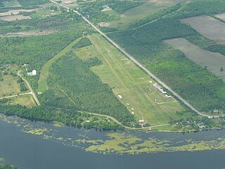
Fallingbrook is a neighbourhood in the community of Orleans, a suburb in the city of Ottawa, Ontario, Canada. It is located on the east edge of Orleans and is bounded by Tenth Line Road in the west, St. Joseph Boulevard to the north, Trim Road to the east and Innes Road to the south. Below the community of Fallingbrook flows the Ottawa River, and Petrie Island is the closest beach.
Sarsfield, Ontario is a village in Cumberland Ward in the east portion of the City of Ottawa in the former township of Cumberland.
Glengarry—Prescott—Russell is a provincial electoral district in eastern Ontario, Canada. It elects one member to the Legislative Assembly of Ontario.
Queenswood Heights is a neighbourhood located in Orleans, the suburb in the east end of Ottawa, Ontario, Canada. Prior to amalgamation in 2001, the neighbourhood was in the Township of Cumberland. Queenswood Heights is bounded by St. Joseph Boulevard to the north, Tenth Line Road to the east, Innes Road to the south, and the former Cumberland-Gloucester boundary to the west (the Queenswood Heights Community Association considers Duford St. to be the western boundary). According to the Canada 2016 Census, the population of the neighbourhood was 11,031. Queenswood Heights spans 3.71 square kilometres.