
This is a list of bridges, dams, and ferries on the Ottawa River, proceeding stream upwards from the Saint Lawrence River, with the year in which they were opened.
This is a list of bridges, dams, and ferries on the Ottawa River, proceeding stream upwards from the Saint Lawrence River, with the year in which they were opened.
| Span | Year built | North side: Montreal Island | Via | South side: Île Perrot | Carries | Coordinates and Comments |
|---|---|---|---|---|---|---|
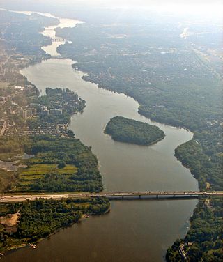
| Galipeault Bridge | 1924 | Sainte-Anne-de-Bellevue | Île Bellevue | Île Perrot | ||
| Canadian National Rail Bridge | Sainte-Anne-de-Bellevue | Île Bellevue | Île Perrot | CN Rail, Via Rail Canada (passenger trains to Ottawa/Toronto) | ||
| Canadian Pacific Rail Bridge | Sainte-Anne-de-Bellevue | Île Bellevue | Île Perrot | CP Rail | ||
| Span | Year built | North side: Île Perrot | Via | South side: Montérégie | Carries | Coordinates and Comments |
|---|---|---|---|---|---|---|
| Canadian National Rail Bridge | Île Perrot | Dorion | CN Rail, Via Rail Canada (passenger trains to Ottawa/Toronto) | |||
| Canadian Pacific Rail Bridge | Île Perrot | Dorion | CP Rail | |||
| Taschereau Bridge | Île Perrot | Dorion (Montérégie) | ||||
| Span | Year built | North side: Montreal Island | Via | South side: Île Perrot | Carries | Coordinates and Comments |
|---|---|---|---|---|---|---|
| Île aux Tourtes Bridge | Senneville | Île Girwood, Île aux Tortues | Vaudreuil-Dorion (Montérégie) | |||
| Span | Year built | North side: Montreal Island | Via | South side: Île Perrot | Carries | Coordinates and Comments |
|---|---|---|---|---|---|---|
| unnamed road bridge | Notre-Dame-du-Nord | Notre-Dame-du-Nord | ||||
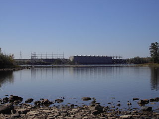
| Première-Chute Generating Station | Notre-Dame-du-Nord | Notre-Dame-du-Nord | (no road access across dam) | |||
| Rapides-des-Îles Generating Station | Notre-Dame-du-Nord | Notre-Dame-du-Nord | (local road access across dam) | |||
| Rapides-des-Quinze Generating Station | Quebec | Quebec | (no road access across dam) | |||
| Lac-des-Quinze Generating Station | Laverlochère-Angliers | Laverlochère-Angliers | (local road access across dam) | |||
| Grassy Narrow Bridge | Quebec | Quebec | (covered bridge) | |||
| Rapide-Deux Generating Station | Rapide-Deux | Rapide-Deux | (local road access across dam) | |||
| Rapide-Sept Generating Station | Rapide-Sept | Rapide-Sept | (local road access across dam) | |||
| unnamed road bridge | Rapides Twin | Rapides Twin | ||||
| unnamed road bridge | 47°40′08″N77°31′25″W / 47.66876°N 77.52361°W ? | |||||
| Bourque Generating Station | Ukunemakak | Ukunemakak | (local road access across dam) | |||
| unnamed road bridge |
The Rivière des Prairies, called the Back River in English, is a delta channel of the Ottawa River in southwestern Quebec, Canada. The Kanien'kehá:ka called it Skowanoti, meaning "River behind the island". The river separates the cities of Laval and Montreal.

The Hackensack River is a river, approximately 45 miles (72 km) long, in the U.S. states of New York and New Jersey, emptying into Newark Bay, a back chamber of New York Harbor. The watershed of the river includes part of the suburban area outside New York City just west of the lower Hudson River, which it roughly parallels, separated from it by the New Jersey Palisades. It also flows through and drains the New Jersey Meadowlands. The lower river, which is navigable as far as the city of Hackensack, is heavily industrialized and forms a commercial extension of Newark Bay.

Hudson is an off-island suburb of Montreal, with a population of 5,411. It is located on the south-west bank of the lower Ottawa River, in Vaudreuil-Soulanges Regional County Municipality. Situated about 60 kilometres (37 mi) west of downtown Montreal, many residents commute to work on the Island of Montreal.
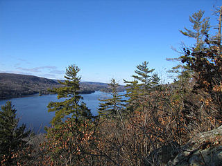
The Gatineau River is a river in western Quebec, Canada, which rises in lakes north of the Baskatong Reservoir and flows south to join the Ottawa River at the city of Gatineau, Quebec. The river is 386 kilometres (240 mi) long and drains an area of 23,700 square kilometres (9,200 sq mi).
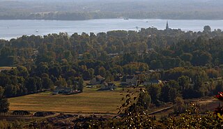
Oka is a small village on the northern bank of the Ottawa River, northwest of Montreal, Quebec, Canada. Located in the Laurentians valley on Lake of Two Mountains, where the Ottawa has its confluence with the St. Lawrence River, the town is connected via Quebec Route 344. It is located 50 km west of Montreal.
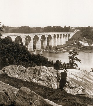
The Croton Aqueduct or Old Croton Aqueduct was a large and complex water distribution system constructed for New York City between 1837 and 1842. The great aqueducts, which were among the first in the United States, carried water by gravity 41 miles (66 km) from the Croton River in Westchester County to reservoirs in Manhattan. It was built because local water resources had become polluted and inadequate for the growing population of the city. Although the aqueduct was largely superseded by the New Croton Aqueduct, which was built in 1890, the Old Croton Aqueduct remained in service until 1955.

The Neosho River is a tributary of the Arkansas River in eastern Kansas and northeastern Oklahoma in the United States. Its tributaries also drain portions of Missouri and Arkansas. The river is about 463 miles (745 km) long. Via the Arkansas, it is part of the Mississippi River watershed. Its name is an Osage word meaning "clear water." The lower section is also known as the Grand River.
Chats Falls were a set of waterfalls on the Ottawa River, near Fitzroy Harbour, Ontario, and Quyon, Quebec, Canada. A hydroelectric generating station is now located here, owned and operated jointly by Hydro-Québec and Ontario Power Generation. It lies within the cities of Ottawa, Ontario and Pontiac, Quebec.

The Rivière des Prairies generating station is a run of river hydroelectric power station on the Rivière des Prairies between the islands of Jesus and Montreal, Quebec, Canada. Built in 1929, it is now managed and operated by Hydro-Québec. It has a generating capacity of 48 MW. There is no lock allowing boats to bypass the dam.

Palisade Avenue is the name given to a historic road which parallels the eastern crest of Hudson Palisades in northeastern New Jersey. It travels between Jersey City and Fort Lee, passing through Jersey City Heights, North Hudson, and Cliffside Park, with various parts carrying Hudson and Bergen county route designations. The avenue re-aligns itself at several places along its route as it crosses traditional municipal boundaries created in the 19th century. As a primary route running along the top of the Hudson Palisades, many segments offer scenic views of the Hudson River and the New York skyline. Since 2020 there is proposed state legislation to restrict building heights that would rise above the cliffs on the eastern side of Palisade Avenue along the entire corridor from Jersey City to Fort Lee.

Dock Bridge is a pair of vertical lift bridges crossing the Passaic River at Newark, Essex County and Harrison, Hudson County, New Jersey, United States, used exclusively for railroad traffic. It is the seventh crossing from the river's mouth at Newark Bay and is 5.0 miles (8.0 km) upstream from it. Also known as the Amtrak Dock Vertical Lift, it carries Amtrak, NJ Transit, and PATH trains. It is listed on the state and federal registers of historic places.

Port Imperial is a community centered around an intermodal transit hub on the Weehawken, New Jersey, waterfront of the Hudson River across from Midtown Manhattan, served by New York Waterway ferries and buses, Hudson–Bergen Light Rail, and NJT buses. The district lies under and at the foot of Pershing Road, a thoroughfare traveling along the face of the Hudson Palisades, which rise to its west. The Hudson River Waterfront Walkway runs along the shoreline and is abutted by recently constructed residential neighborhoods, Lincoln Harbor to the south and Bulls Ferry to the north.
Lake Hudson, also known as Markham Ferry Reservoir, is a man-made reservoir in Mayes County, Oklahoma, United States, about 2 miles (3.2 km) northwest of Locust Grove, Oklahoma and 8 miles (13 km) southeast of Pryor, Oklahoma. It was created by the completion of the Robert S. Kerr Dam on the Grand River in 1964. It is managed by the Grand River Dam Authority (GRDA).

Point-No-Point Bridge is a railroad bridge crossing the Passaic River between Newark and Kearny, New Jersey, United States, in the New Jersey Meadowlands. The swing bridge is the fourth from the river's mouth at Newark Bay and is 2.6 miles (4.2 km) upstream from it. A camelback through truss bridge, it is owned by Conrail as part of its North Jersey Shared Assets and carries the Passaic and Harsimus Line used by CSX Transportation and Norfolk Southern. River Subdivision accesses the line via Marion Junction. Conrail is replacing the bridge, which was opened in 1901. Work began in November 2022.