The town was featured in Life magazine for sending more men per capita to serve in World War II than any other town of its size; 38 percent of the men who lived in D'Lo served.[2]
In 2016 the town was featured on the UP reality TV series, Small Town, Big Mayor.[3]
History
The town of D'Lo was founded by R. W. May on March 1, 1900, when a town plat was registered with the Simpson County Board of Supervisors, March 1, 1900.[4] On August 16, 1901, a village by the name "D'Lo" was incorporated and boundaries identified by Governor of Mississippi.[5] The village of "D'Lo" was raised to the rank of "town" on October 27, 1905, by proclamation and signed by the Governor Mississippi.[6]
The name D'Lo is a modification of the name of the local U.S. Post Office, which was named "Dlo" from 1881 to January 1, 1950.[7] The Post Office was established and approved June 17, 1881, under the name "Dlo".[8] The first postmaster was May's wife, Mary Frances May, and the post office was run from May's home until it moved with the establishment of the town.[4] The name "Dlo" was chosen by the contract postal rider on the Brandon-Westville mail route after the initial choice, "Millhaven", was rejected by the Post Office Department. Just as the Strong River got its name from a translation of a Choctaw word describing the strong taste of the river water – which has a large amount of tannic acid dissolved in it – "Dlo" derives from a French phrase meaning "Bitter Undrinkable Water", which appears on an early map of the area. The phrase beginning "De l'eau non potable..." was shortened to "Dlo", and then "D'Lo."[9]
The town expanded in 1916 when the Finkbine Lumber Company chose it as the location for a $1,000,000 sawmill plant. Finkbine constructed many houses in the community for their workers, as well as a combination dry goods, hardware, grocery store, farm supply, feed and seed, and general store known as Kew Mercantile Company. During the peak of the Finkbine's sawmill plant operation, between 1916 and 1930, Millhaven was recognized as the largest town between Jackson and Hattiesburg. It had two large YMCA buildings, a movie theater, ten grocery stores, a furniture store, three appliance dealers, ten gas stations, seven butcher's markets, a dry cleaner, five cafes, three auto shops, a boat building and cabinet shop, a machine shop, three pharmacies, a bank, lighted basketball courts, professional basketball and baseball teams, and a newspaper called The D'Lo Herald.[citation needed]
The town also had Baptist and Methodist churches, and a three-story brick school with 550 students and 17 teachers. Its three-story Pine View Hospital was considered the best hospital between Jackson and the Mississippi Gulf Coast, as far as equipment and doctors were concerned. During this time the population of Millhaven was estimated to be around 5,000, which made it the second largest milling town in the United States. However, by the 1930s the Finkbine Mill had consumed almost all the timber in the surrounding counties, and the plant was shut down.[10]
With the Finkbine sawmill closed, D'Lo lost jobs and suffered a major decline in population. It took several years for the town's economy to begin to recover. With the construction of U.S. Route 49 through the town, Lumber companies could reach second-growth of timber in the surrounding areas. A new hardwood sawmill reportedly supplied timber to firms that built weapons and equipment for World War II. Although the mill was effective at keeping the town going for many years, it was never a large enough operation to recoup the huge loss of population. Once with a population of 5,000, during the 1940s, the town had around 400 residents. This is the estimated population in the 21st century.
Of the town's population of about 400, around 150 males served in the Armed Forces during World War II. About 46 volunteers also served prior to the bombing of Pearl Harbor. So many citizens served in the war that the town's story was featured in the July 6, 1942, edition of Life magazine. The story featured a picture of two young boys standing in the deserted streets of D'Lo with the headline, "D'Lo Men Have Gone Off to War", with a caption that stated, "There is a war and a country is in danger. When that happens the men drop what they are doing and go off from the deep southern hamlet of D'Lo, Miss." A monument located at the town's community center lists the D'Lo citizens who served during the war.[11]
The name was changed to D'Lo effective January 1, 1950.[12]
D'Lo Town Hall
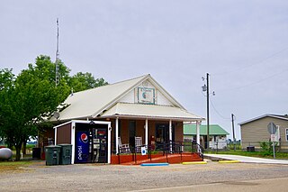
D'Lo, 2021
Simpson County Historical Society building in D'Lo
Finkbine Lumber Company Sawmill, D'Lo, circa 1920
Geography
According to the United States Census Bureau, the town has a total area of 0.7-square-mile (1.8km2), all land.
As of the census[14] of 2000, there were 394 people, 179 households, and 114 families residing in the town. The population density was 569.7 inhabitants per square mile (220.0/km2). There were 206 housing units at an average density of 297.8 per square mile (115.0/km2). The racial makeup of the town was 79.19% White, 19.54% African American, 0.51% Native American, 0.25% Pacific Islander, and 0.51% from two or more races.
There were 179 households, out of which 24.0% had children under the age of 18 living with them, 50.3% were married couples living together, 10.6% had a female householder with no husband present, and 35.8% were non-families. 34.1% of all households were made up of individuals, and 19.0% had someone living alone who was 65 years of age or older. The average household size was 2.20 and the average family size was 2.77.
In the town, the population was spread out, with 20.3% under the age of 18, 9.6% from 18 to 24, 22.6% from 25 to 44, 27.9% from 45 to 64, and 19.5% who were 65 years of age or older. The median age was 42 years. For every 100 females, there were 79.9 males. For every 100 females age 18 and over, there were 81.5 males.
The median income for a household in the town was $28,750, and the median income for a family was $33,125. Males had a median income of $27,500 versus $21,731 for females. The per capita income for the town was $15,469. About 11.7% of families and 13.7% of the population were below the poverty line, including 15.6% of those under age 18 and 17.6% of those age 65 or over.
Parks and recreation
The Strong River at the D'Lo Water Park
D'Lo has a water park on the Strong River, called D'Lo Water Park. A one-screen movie theatre, called the "Lux Theatre", closed in the 1950s. [citation needed]
A portion of the 2000 film O Brother, Where Art Thou?, known as the "Siren Scene", was filmed on the banks of the Strong River at the D'Lo Water Park.[citation needed]
The most controversial piece of D'Lo history is the origins of the name itself. Three different stories explain how the odd name originated. The oldest and probably the most common story claims that an early settler referred to this area along the Strong River, where it commonly floods, as being "too damn low". When it came time for the village to get a post office, he suggested that the village be named "too damn low", but the postal authorities would not approve of the name because of the profanity. Someone supposedly suggested the name "D-Low", which over the years was shortened to "D'Lo".
Another account said that Millhaven was rejected by the postal authorities as a town name.[why?] Purportedly the US Postal Service provided the village with a list of alternative four-letter names for the residents to choose from. Among these names was one spelled "Delo". After the citizens chose this name, a penman prepared a letter to be sent back to the authorities informing them of the name they had chosen. The letter was written in a script that may have put the lower case "e" in Delo above the "lo". The story concludes that the little "e" was probably misinterpreted as an apostrophe and therefore the post office documented the village name as being D'Lo.
The last version involves the adaptation of a French phrase: See §History.
Related Research Articles
Bradley County is a county located in the U.S. state of Arkansas. As of the 2020 census, the population was 10,545. The county seat is Warren. It is Arkansas's 43rd county, formed on December 18, 1840, and named for Captain Hugh Bradley, who fought in the War of 1812.
Washington Parish is a parish located in the interior southeast corner of the U.S. state of Louisiana, one of the Florida Parishes. As of the 2020 census, the population was 45,463. Its parish seat is Franklinton. Its largest city is Bogalusa. The parish was founded in 1819.
McGeheemə-GHEE is a city in Desha County, Arkansas, United States. The population was 4,219 at the 2010 census.
Burdette is a town in Mississippi County, Arkansas, United States. The population was 140 at the 2020 census, down from 191 in 2010.
Etowah is a town in Mississippi County, Arkansas, United States. The population was 254 at the 2020 census, down from 351 in 2010.
Caryville is a town in Washington County, Florida, United States located along the Choctawhatchee River. The Caryville is part of the Florida Panhandle in North Florida. The population was 301 at the 2020 census.
Zemple is a city in Itasca County, Minnesota, United States. The population was 93 at the 2010 census.
Willow River is a city in Pine County, Minnesota, United States, at the confluence of the Kettle and Willow Rivers. The population was 415 at the 2010 census.
McCool is a town in Attala County, Mississippi. The population was 135 at the 2010 census.
Bruce is a town situated along the Skuna River in Calhoun County, Mississippi, United States. As of the 2020 census, it had a population of 1,707.
Sumrall is a town in Lamar County, Mississippi. It is part of the Hattiesburg, Mississippi Metropolitan Statistical Area. The population was 1,421 at the 2010 census.
Glendora is a village in Tallahatchie County, Mississippi. The population was 285 at the 2000 census.
Bonner-West Riverside is a census-designated place (CDP) in Missoula County, Montana, United States, including the unincorporated communities of Bonner, Milltown, West Riverside, and Pinegrove. It is part of the Missoula, Montana Metropolitan Statistical Area. The population was 1,663 at the 2010 census, a decline from its population of 1,693 in 2000.
Red House is a town in Cattaraugus County, New York, United States. As of the 2020 census, the town population was 30, making it the least populous town in the state. The town is on the south edge of Cattaraugus County, south of the city of Salamanca.
Ohiopyle is a borough in Fayette County, Pennsylvania, United States. The population was 38 at the 2020 census. While Ohiopyle has a tiny year-round population, it is often filled with tourists on the weekend, who come for the outdoor recreation opportunities at the surrounding Ohiopyle State Park, as well as the Great Allegheny Passage bicycle trail which connects with the Chesapeake and Ohio Canal towpath trail to form a continuous 335-mile off-road trail from Pittsburgh, Pennsylvania to Washington, D.C. The borough of Ohiopyle is served by the Uniontown Area School District.
Townshend is a town in Windham County, Vermont, United States. The town was named for the Townshend family, powerful figures in British politics. The population was 1,291 at the 2020 census.
Dendron is a town in Surry County, Virginia, United States. The population was 251 at the 2020 census. Sculptor Leslie Garland Bolling was born in Dendron, as was mayor of Hopewell, Virginia, Curtis W. Harris.
Sartell is a city in Benton and Stearns Counties in the U.S. state of Minnesota that straddles the Mississippi River. It is part of the St. Cloud Metropolitan Statistical Area. The population was 19,351 at the 2020 census, making it St. Cloud's most populous suburb and the fourth-largest city in central Minnesota, after St. Cloud, Elk River, and Willmar.
Corinth is a town in Saratoga County, New York, United States. The population was 6,500 at the 2020 census. The town contains a village also named Corinth. The town is on the northeastern border of the county, north of Saratoga Springs. The town is noted as "the snowshoe capital of the world" and is home to Palmer Falls where the Hudson River passes through the Palmertown Range.
The Finkbine-Guild Lumber Company was established to harvest and market the virgin longleaf pine stands of southern Mississippi during the early 20th century. The main sawmills were located in Wiggins and D'Lo, Mississippi. When the local timber supply dwindled, the company tried to utilize redwood trees from California, but that operation failed because of high transportation costs. Other attempts were made at promoting a more diversified use of the cutover timberlands; some ventures were successful while others were not.
↑ Mississippi Official and Statistical Register, 2004, page 372
↑ Mississippi Department of Archives and History, Government Records, Secretary of State records, State Charters of Incorporation 1857-1991, B_Book_2 page_78
↑ Gallagher, John S. and Patera, Alan H. (1996) Mississippi Post Offices, p. 155. Lake Grove, Oregon: The Depot; ISBN0-943645-35-2 The change of designation is recorded in the U.S. Official Postal Guide, part I, July 1951, p. 746
↑ Gallagher, John S. and Patera, Alan H. (1996) Mississippi Post Offices, p. 155. Lake Grove, Oregon: The Depot; ISBN0-943645-35-2 The change of designation is recorded in the U.S. Official Postal Guide, part I, July 1951, p. 746.
This page is based on this Wikipedia article Text is available under the CC BY-SA 4.0 license; additional terms may apply. Images, videos and audio are available under their respective licenses.