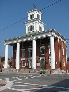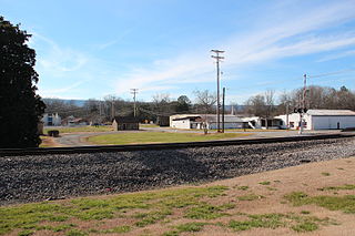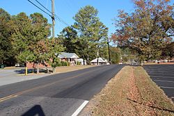
Washington County is a county located in the Commonwealth of Virginia. As of the 2010 census, the population was 54,876. Its county seat is Abingdon.

Gordon County is a county located in the northwestern part of the U.S. state of Georgia. As of the 2010 census, the population was 55,186. The county seat is Calhoun. Gordon County comprises the Calhoun, GA Micropolitan Statistical Area, which is included in the Atlanta-Athens-Clarke County-Sandy Springs, GA Combined Statistical Area.

Blountstown is a city in Calhoun County, Florida, United States. The population was 2,514 at the 2010 census, which represented an increase from 2,444 in 2000. It is the county seat of Calhoun County.

Arlington is a city in Calhoun and Early counties, Georgia, United States. As of the 2010 census, the city had a population of 1,479.

Calhoun is a city in Gordon County, Georgia, United States. As of the 2010 census, the city had a population of 15,650, up from 10,667 in 2000. Calhoun is the county seat of Gordon County.

Fairmount is a city in Gordon County, Georgia, United States. As of the 2010 census it had a population of 720. Gordon County is home to New Echota, which was once the Cherokee Nation's capital. It was the origin of the Cherokee written language and newspaper, the Cherokee Phoenix.

Sugar Valley is an unincorporated community in Gordon County, Georgia, United States, northwest of Calhoun and east of Horn Mountain Ridge. SR 136 runs through the center of the town.

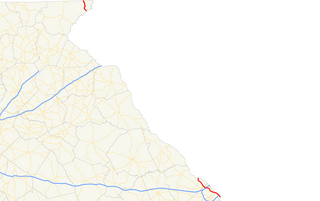
State Route 28 (SR 28) is a 25.7-mile-long (41.4 km) state highway in the U.S. state of Georgia. It exists in two distinct segments separated by the northern segment of South Carolina Highway 28 (SC 28), which connects the two segments. The southern segment is entirely within the Augusta metropolitan area. The northern segment is located in the northeastern corner of the Chattooga River District of the Chattahoochee–Oconee National Forest. SR 28 consists of Georgia's segments of a multi-state Route 28 that includes two segments of SC 28 and one segment of North Carolina Highway 28 (NC 28). The northern segment of SR 28 is unnamed, but the southern segment is known as Furys Ferry Road from its western terminus to the intersection with SR 104 Conn. in Augusta, Washington Road in the northern part of Augusta, John C. Calhoun Expressway, Greene Street, 5th Street, and Broad Street in downtown Augusta, and Sand Bar Ferry Road in the northeastern part of Augusta.

State Route 45 (SR 45) is a 88.1-mile-long (141.8 km) state highway that runs south-to-north through portions of Seminole, Miller, Early, Calhoun, Terrell, Webster, and Sumter counties in the southwestern part of the U.S. state of Georgia. The route connects Iron City and Plains, via Colquitt and Dawson.

State Route 53 (SR 53) is a 172.146-mile-long (277.042 km) west-to-east state highway located in the northern part of the U.S. state of Georgia. The highway travels from the Alabama state line west of Cave Spring northeast, then east, then southeast to US 129 Bus./US 441 Bus./SR 15/SR 24 Bus. in Watkinsville.

Sonoraville is an unincorporated community in Gordon County, Georgia, United States, located seven miles outside Calhoun.
State Route 77 (SR 77) is a 124-mile-long (200 km) north–south state highway in the eastern part of the U.S. state of Alabama. The southern terminus of the highway is at an intersection with U.S. Route 431 (US 431) near LaFayette. The northern terminus of the highway is at an intersection with US 431 just north of Attalla. North of Talladega, the highway passes the entrance to Talladega Superspeedway, home of the NASCAR Sprint Cup, Infinity Series, and Camping World Truck Series races that are held annually.

State Route 234 (SR 234) is a 28.3-mile-long (45.5 km) east–west state highway located in the southwestern part of the U.S. state of Georgia. It travels through portions of Calhoun and Dougherty counties.

State Route 136 (SR 136) is a 136.380-mile-long (219.482 km) state highway that travels west-to-east through portions of Dade, Walker, Gordon, Murray, Gilmer, Pickens, Dawson, and Hall counties in the northwestern and north-central parts of the U.S. state of Georgia. The highway travels from its western terminus at SR 71 at the Alabama state line, west of Trenton, to its eastern terminus at SR 60 north-northwest of Gainesville.

State Route 225 (SR 225) is a 36.1-mile-long (58.1 km) north–south state highway that traverses through the northwestern part of the U.S. state of Georgia. It travels through portions of Gordon and Murray counties. It is the most direct route for citizens of Murray County to reach Calhoun, Interstate 75 (I-75), and Cleveland, Tennessee.

State Route 156 (SR 156) is a 34.3-mile-long (55.2 km) state highway that runs west-to-east through portions of Floyd and Gordon counties in the northwestern part of the U.S. state of Georgia.

New Town(Cherokee: ᎤᏍᏔᎾᎵ, romanized: Ustanali) is an unincorporated community in Gordon County, Georgia, United States, located northeast of Calhoun. New Town is near the New Echota historic site, which was formerly part of the Cherokee Nation. Ashworth Middle School and Gordon Central High School are located in the New Town community.

Cash is an unincorporated community in Gordon County, Georgia, United States. Cash is located on County Road 373 east of Calhoun, and between Sonoraville and Red Bud.

State Route 62 (SR 62) is a 62.1-mile-long (99.9 km) state highway in the southwestern part of the U.S. state of Georgia. It connects Columbia, Alabama with Albany.
The Gordon County School District is a public school district in Gordon County, Georgia, United States, based in Calhoun. It serves the communities of Calhoun, Cash, Damascus, Fairmount, New Town, Plainville, Ranger, Red Bud, Resaca, Sonoraville, and Sugar Valley.


