Plainville, Georgia

Last updated
Plainville, Georgia
Plainville, Georgia stores Mar 2017.jpg
Historic buildings in Plainville
Gordon County Georgia Incorporated and Unincorporated areas Plainville Highlighted.svg
Location in Gordon County and the state of Georgia
Coordinates: 34°24′15″N85°2′15″W / 34.40417°N 85.03750°W / 34.40417; -85.03750 Coordinates: 34°24′15″N85°2′15″W / 34.40417°N 85.03750°W / 34.40417; -85.03750
Country United States
State Georgia
County Gordon
Incorporated (city)January 1, 1960
Government
  MayorGreg Martin
Area
[1]
  Total0.72 sq mi (1.87 km2)
  Land0.72 sq mi (1.87 km2)
  Water0.00 sq mi (0.00 km2)
Elevation
679 ft (207 m)
Population
 (2020)
  Total356
  Density493.07/sq mi (190.32/km2)
Time zone UTC-5 (Eastern (EST))
  Summer (DST) UTC-4 (EDT)
ZIP code
30733
Area code(s) 706/762
FIPS code 13-61684 [2]
GNIS feature ID0332706 [3]
Website plainvillega.com

Plainville is a city located in Gordon County, Georgia. The population of Plainville was 313 at the 2010 census, [4] up from 257 at the 2000 census.

Contents

History

Plainville was incorporated in 1903. [5] The name is a transfer from Plainville, Connecticut. [6]

Geography

Plainville is located in southwestern Gordon County at 34°24′15″N85°2′15″W / 34.40417°N 85.03750°W / 34.40417; -85.03750 (34.404212, -85.037404). [7] The southern border of the town is the Floyd County line. Georgia State Highway 53 passes 1.5 miles (2.4 km) east of the city, leading northeast 8 miles (13 km) to Calhoun, the Gordon County seat, and southwest 14 miles (23 km) to Rome.

Plainville has an area of 0.72 square miles (1.87 km2), all land. [4]

Plainville is situated in the Ridge-and-Valley region of northwest Georgia, about 3 miles (5 km) east of a bend in the Oostanaula River, an area known as "the Bend".

Demographics

Historical population
CensusPop.
1910 148
1920 91−38.5%
1930 12436.3%
1940 1326.5%
1950 1427.6%
1960 16113.4%
1970 19219.3%
1980 28146.4%
1990 231−17.8%
2000 25711.3%
2010 31321.8%
2020 35613.7%
U.S. Decennial Census [8]

As of the census [2] of 2000, there were 257 people, 98 households, and 68 families residing in the city. The population density was 435.5 inhabitants per square mile (168.1/km2). There were 102 housing units at an average density of 172.8 per square mile (66.7/km2). The racial makeup of the city was 97.67% White, 0.39% Native American, and 1.95% from two or more races. Hispanic or Latino of any race were 1.17% of the population.

There were 98 households, out of which 37.8% had children under the age of 18 living with them, 55.1% were married couples living together, 13.3% had a female householder with no husband present, and 29.6% were non-families. 21.4% of all households were made up of individuals, and 7.1% had someone living alone who was 65 years of age or older. The average household size was 2.62 and the average family size was 3.14.

In the city, the population was spread out, with 26.8% under the age of 18, 11.3% from 18 to 24, 30.7% from 25 to 44, 19.1% from 45 to 64, and 12.1% who were 65 years of age or older. The median age was 35 years. For every 100 females, there were 107.3 males. For every 100 females age 18 and over, there were 97.9 males.

The median income for a household in the city was $28,654, and the median income for a family was $30,000. Males had a median income of $25,625 versus $20,875 for females. The per capita income for the city was $14,046. About 16.3% of families and 18.1% of the population were below the poverty line, including 31.6% of those under the age of eighteen and 16.7% of those 65 or over.

Related Research Articles

<span class="mw-page-title-main">Cherokee County, Alabama</span> County in Alabama, United States

Cherokee County, Alabama is a county located in the northeastern part of the U.S. state of Alabama. As of the 2020 census, the population was 24,971. Its county seat is Centre. The county is named for the Cherokee tribe.

<span class="mw-page-title-main">Cleburne County, Alabama</span> County in Alabama, United States

Cleburne County is a county located in the east central portion of the U.S. state of Alabama. As of the 2020 census, the population was 15,056. Its county seat is Heflin. Its name is in honor of Patrick R. Cleburne of Arkansas who rose to the rank of major general in the Confederate States Army. The eastern side of the county borders the state of Georgia.

<span class="mw-page-title-main">Polk County, Georgia</span> County in Georgia, United States

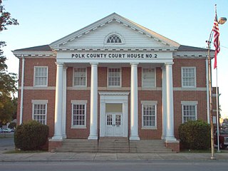
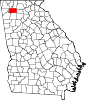
Polk County is a county located in the northwestern part of the U.S. state of Georgia. As of the 2010 census, the population was 41,475. The county seat is Cedartown. The county was created on December 20, 1851, by an act of the Georgia General Assembly and named after James K. Polk, the eleventh President of the United States.

<span class="mw-page-title-main">Gordon County, Georgia</span> County in Georgia, United States

Gordon County is a county located in the northwestern part of the U.S. state of Georgia. As of the 2010 census, the population was 55,186. The county seat is Calhoun. Gordon County comprises the Calhoun, GA Micropolitan Statistical Area, which is included in the Atlanta-Athens-Clarke County-Sandy Springs, GA Combined Statistical Area.

<span class="mw-page-title-main">Dougherty County, Georgia</span> County in Georgia, United States

Dougherty County is located in the southwestern portion of the U.S. state of Georgia. As of the 2010 census, the population was 94,565. The county seat and sole incorporated city is Albany.

<span class="mw-page-title-main">Arlington, Georgia</span> City in Georgia, United States

Arlington is a city in Calhoun and Early counties, Georgia, United States. Per the 2020 census, the population was 1,209.

<span class="mw-page-title-main">Edison, Georgia</span> City in Georgia, United States

Edison is a city in Calhoun County, Georgia, United States. Per the 2020 census, the population was 1,230. The Edison Commercial Historic District is listed on the National Register of Historic Places.

<span class="mw-page-title-main">Leary, Georgia</span> City in Georgia, United States

Leary is a city in Calhoun County, Georgia, United States. The population was 618 at the 2010 census. Jimmy Carter reported seeing an unidentified flying object while at Leary, Georgia in 1969.

<span class="mw-page-title-main">Morgan, Georgia</span> City in Georgia, United States

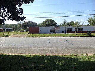
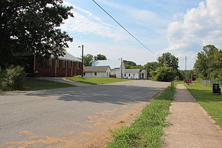
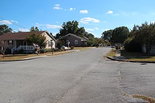
Morgan is a city in Calhoun County, Georgia, United States. The population was 1,861 at the 2010 census. The city is the county seat of Calhoun County.

<span class="mw-page-title-main">Fort Oglethorpe, Georgia</span> City in Georgia, United States

Fort Oglethorpe is a city predominantly in Catoosa County with some portions in Walker County in the U.S. state of Georgia. As of the 2020 census, the city had a population of 10,423. It is part of the Chattanooga, TN–GA Metropolitan Statistical Area. It is home to Lakeview – Fort Oglethorpe High School.

<span class="mw-page-title-main">Lyerly, Georgia</span> Town in Georgia, United States

Lyerly is a town in Chattooga County, Georgia, United States. As of the 2020 census, the town had a population of 454.

<span class="mw-page-title-main">Lindale, Georgia</span> Census-designated place in Georgia, United States

Lindale is an unincorporated community and census-designated place (CDP) in Floyd County, Georgia, United States. It is part of the Rome, Georgia Metropolitan Statistical Area. The population was 4,191 at the 2010 census.

<span class="mw-page-title-main">Calhoun, Georgia</span> City in Georgia, United States

Calhoun is a city in Gordon County, Georgia, United States. As of the 2020 census, the city had a population of 16,949. Calhoun is the county seat of Gordon County.

<span class="mw-page-title-main">Fairmount, Georgia</span> City in Georgia, United States

Fairmount is a city in Gordon County, Georgia, United States. As of the 2010 census it had a population of 720. Gordon County is home to New Echota, which was once the Cherokee Nation's capital. It was the origin of the Cherokee written language and newspaper, the Cherokee Phoenix.

<span class="mw-page-title-main">Ranger, Georgia</span> Town in Georgia, United States

Ranger is a town in Gordon County, Georgia, United States. The population was 131 at the 2010 census, up from 85 in 2000.

<span class="mw-page-title-main">Colbert, Georgia</span> City in Georgia, United States

Colbert is a city in Madison County, Georgia, United States. The population was 592 at the 2010 census.

<span class="mw-page-title-main">Aragon, Georgia</span> City in Georgia, United States

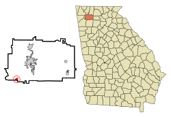
Aragon is a city in Polk County, Georgia, United States. As of the 2020 census, the city had a population of 1,440.

<span class="mw-page-title-main">Hiawassee, Georgia</span> Town in Georgia, United States

Hiawassee is the county seat of Towns County, Georgia, United States. The community's population was 880 at the 2010 census. Its name is derived from the Cherokee—or perhaps Creek—word Ayuhwasi, which means meadow, Hiawassee is also known in the novel "Restart" by Gordon Korman.

<span class="mw-page-title-main">LaFayette, Georgia</span> City in Georgia, United States

LaFayette is a city in, and the county seat of, Walker County, Georgia, United States. As of the 2020 census, the city population was 6,888. It was founded as Chattooga.

<span class="mw-page-title-main">Calhoun Falls, South Carolina</span> Town in South Carolina, United States

Calhoun Falls is a town in Abbeville County, South Carolina, United States. The population was 1,724 at the 2020 census, down from 2,004 at the 2010 census.

References

  1. "2020 U.S. Gazetteer Files". United States Census Bureau. Retrieved December 18, 2021.
  2. 1 2 "U.S. Census website". United States Census Bureau . Retrieved 2008-01-31.
  3. "US Board on Geographic Names". United States Geological Survey. 2007-10-25. Retrieved 2008-01-31.
  4. 1 2 "Geographic Identifiers: 2010 Demographic Profile Data (G001): Plainville city, Georgia". American Factfinder. U.S. Census Bureau. Retrieved November 23, 2016.[ dead link ]
  5. "Gordon County". Calhoun Times. 1 September 2004. p. 92. Retrieved 26 April 2015.
  6. Krakow, Kenneth K. (1975). Georgia Place-Names: Their History and Origins (PDF). Macon, GA: Winship Press. p. 178. ISBN   0-915430-00-2.
  7. "US Gazetteer files: 2010, 2000, and 1990". United States Census Bureau. 2011-02-12. Retrieved 2011-04-23.
  8. "Census of Population and Housing". Census.gov. Retrieved June 4, 2015.