Swanage is a coastal town and civil parish in the south east of Dorset, England. It is at the eastern end of the Isle of Purbeck and one of its two towns, approximately 6+1⁄4 miles (10 km) south of Poole and 25 miles (40 km) east of Dorchester. In the 2011 census the civil parish had a population of 9,601. Nearby are Ballard Down and Old Harry Rocks, with Studland Bay and Poole Harbour to the north. Within the parish are Durlston Bay and Durlston Country Park to the south of the town. The parish also includes the areas of Herston, just to the west of the town, and Durlston, just to the south.

The Isle of Purbeck is a peninsula in Dorset, England. It is bordered by water on three sides: the English Channel to the south and east, where steep cliffs fall to the sea; and by the marshy lands of the River Frome and Poole Harbour to the north. Its western boundary is less well defined, with some medieval sources placing it at Flower's Barrow above Worbarrow Bay. John Hutchins, author of The History and Antiquities of the County of Dorset, defined Purbeck's western boundary as the Luckford Lake steam, which runs south from the Frome. According to writer and broadcaster Ralph Wightman, Purbeck "is only an island if you accept the barren heaths between Arish Mell and Wareham as cutting off this corner of Dorset as effectively as the sea." The most southerly point is St Alban's Head.

Purbeck was a local government district in Dorset, England. The district was named after the Isle of Purbeck, a peninsula that forms a large proportion of the district's area. However, it extended significantly further north and west than the traditional boundary of the Isle of Purbeck which is the River Frome. The district council was based in the town of Wareham, which is itself north of the Frome.

Durlston Country Park is a 320-acre country park and nature reserve stretching along the coast of the Isle of Purbeck on the outskirts of Swanage in Dorset, England. The park is a popular destination for tourists to enjoy the walks, views, visitor centre, climbing, and wildlife, including Durlston Castle, the Great Globe, Tilly Whim Caves, and Anvil Point Lighthouse. It is a gateway to the Jurassic Coast World Heritage Site, forms part of the 630 mile South West Coast Path, and is owned by Dorset Council.

Langton Matravers is a village and civil parish on the Isle of Purbeck, in the county of Dorset in the south of England. It is situated about 2 miles (3.2 km) west of Swanage town centre and 5 miles (8 km) south-east of Corfe Castle. In the 2011 Census the civil parish had 381 households and a population of 853.

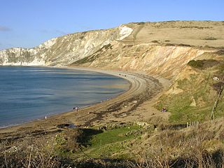
Worth Matravers is a village and civil parish in the English county of Dorset. The village is situated on the cliffs west of Swanage. It comprises limestone cottages and farm houses and is built around a pond, which is a regular feature on postcards of the Isle of Purbeck.
Purbeck Marble is a fossiliferous limestone found in the Isle of Purbeck, a peninsula in south-east Dorset, England. It is a variety of Purbeck stone that has been quarried since at least Roman times as a decorative building stone.

The Old Malthouse School was a preparatory school in the village of Langton Matravers near Swanage in the Isle of Purbeck, Dorset, United Kingdom.

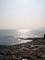
Chapman's Pool is a small cove to the west of Worth Matravers on the Isle of Purbeck, in Dorset, England.

Ailladie, is an 800-metre-long (2,600 ft) west-facing limestone sea cliff, that varies in height from 8 metres (26 ft) to 35 metres (115 ft), situated on the coast of The Burren in County Clare, Ireland. Ailladie is one of Ireland's most highly regarded rock-climbing locations, particularly for high technical grade single pitch traditional climbing routes and deep-water soloing routes. It is also a location for shore-angling competitions, and, with its cliffs and view of the Aran Islands, is a popular photography stop for tourists.

Tilly Whim Caves consists of three stone quarries in Durlston Country Park, 1 mile (1.6 km) south of Swanage, on the Isle of Purbeck, in Dorset, southern England. The Tilly Whim Caves are a part of the Jurassic Coast.
Purbeck stone refers to building stone taken from a series of limestone beds found in the Upper Jurassic to Lower Cretaceous Purbeck Group, found on the Isle of Purbeck, Dorset in southern England. The best known variety of this stone is Purbeck Marble. The stone has been quarried since at least Roman times up to the present day.
Durnford School was an English preparatory school for boys which opened in 1894 on the Isle of Purbeck in Dorset.

Kimmeridge Bay is a bay on the Isle of Purbeck, a peninsula on the English Channel coast in Dorset, England, close to and southeast of the village of Kimmeridge, on the Smedmore Estate. The area is renowned for its fossils, with The Etches Collection in the village of Kimmeridge displaying fossils found by Steve Etches in the area over a 30-year period. It is a popular place to access the coast for tourists. To the east are the Kimmeridge Ledges, where fossils can be found in the flat clay beds.

Anvil Point is part of the Jurassic Coast on the Isle of Purbeck in Dorset, England. It is within the grounds of Durlston Country Park and is about 3 kilometres (1.9 mi) from Swanage town centre. Anvil Point Lighthouse is located on the point.
Flower’s Barrow is an Iron Age hillfort, built over 2500 years ago, above Worbarrow Bay in Dorset on the south coast of England.

St Alban's Head is a headland located 5 kilometres (3.1 mi) southwest of Swanage, on the coast of Dorset, England. It is the most southerly part of the Purbeck peninsula, and comprises an outcrop of Portland Stone from the overlying Lower Purbeck Stone. It is part of the Jurassic Coast, a World Heritage Site. It is designated a Special Area of Conservation under the European Union's Habitats Directive.

Dorset is a county located in the middle of the south coast of England. It lies between the latitudes 50.512°N and 51.081°N and the longitudes 1.682°W and 2.958°W, and occupies an area of 2,653 km2. It spans 90 kilometres (56 mi) from east to west and 63 kilometres (39 mi) from north to south.

The Priest's Way is the historical route taken by clergy from St Nicholas's, Worth Matravers to St Mary's Church, Swanage in the Isle of Purbeck in Dorset. The track arose as a result of St Mary's being a chapel of ease to St Nicholas's, and followed the route priests took to say mass in Swanage. A modern footpath and bridleway follows much of the route.