
Breckland in Norfolk and Suffolk is a 39,433 hectare Special Protection Area (SPA) under the European Union Directive on the Conservation of Wild Birds. The SPA partly overlaps the 7,544 hectare Breckland Special Area of Conservation. As a landscape region it is an unusual natural habitat of England. It comprises the gorse-covered sandy heath that lies mostly in the south of the county of Norfolk but also in the north of Suffolk. An area of considerable interest for its unusual flora and fauna, it lies to the east of another unusual habitat, the Fens, and to the south west of the Broads. The typical tree of this area is the Scots pine. Breckland is one of the driest areas in England.

Deben Estuary is a 981.1-hectare (2,424-acre) biological Site of Special Scientific Interest (SSSI) covering the River Deben and its banks 12 kilometres from its mouth north of Felixstowe to Woodbridge in Suffolk. It is a Ramsar internationally important wetland site and a Special Protection Area under the European Union Directive on the Conservation of Wild Birds. It is also in the Suffolk Coast and Heaths Area of Outstanding Natural Beauty. It partly overlaps two geological SSSIs, Ferry Cliff, Sutton and Ramsholt Cliff.
Rex Graham Reserve is a 2.8-hectare (6.9-acre) biological Site of Special Scientific Interest east of Mildenhall in Suffolk. It is a Special Area of Conservation, and part of the Breckland Special Protection Area. It was formerly managed by the Suffolk Wildlife Trust.

Foxhole Heath is an 85.2-hectare (211-acre) biological Site of Special Scientific Interest east of Eriswell in Suffolk. It is a Nature Conservation Review site, Grade I, and part of Breckland Special Area of Conservation and Breckland Special Protection Area under the European Union Directive on the Conservation of Wild Birds.

Wangford Warren and Carr is a 67.8-hectare (168-acre) biological Site of Special Scientific Interest between Brandon and Lakenheath in Suffolk. It is a Nature Conservation Review site, Grade I, and part of the Breckland Special Area of Conservation, and Special Protection Area An area of 15 hectares is managed as a nature reserve by the Suffolk Wildlife Trust

Sutton and Hollesley Heaths is a 483.3-hectare (1,194-acre) biological Site of Special Scientific Interest south-east of Woodbridge in Suffolk. Most of the site is managed by the Suffolk Wildlife Trust as Sutton and Hollesley Commons. It is part of the Sandlings Special Protection Area under the European Union Directive on the Conservation of Wild Birds, and the Suffolk Coast and Heaths Area of Outstanding Natural Beauty.

Berner's Heath is a 236.9-hectare (585-acre) biological Site of Special Scientific Interest north-east of Icklingham in Suffolk. It is a Nature Conservation Review site, a Special Area of Conservation, and a Special Protection Area

Barnham Heath is a 78.6-hectare (194-acre) biological Site of Special Scientific Interest near Barnham, a village south of Thetford in Suffolk. It is a Nature Conservation Review site, Grade 2, and part of the Breckland Special Protection Area under the European Union Directive on the Conservation of Wild Birds

Breckland Farmland is a 13,392.4 hectare biological Site of Special Scientific Interest (SSSI) in many separate areas between Swaffham in Norfolk and Bury St Edmunds in Suffolk. It is part of the Breckland Special Protection Area under the European Union Directive on the Conservation of Wild Birds.
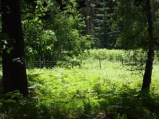
Breckland Forest is an 18,126 hectare biological and geological Site of Special Scientific Interest in many separate areas between Swaffham in Norfolk and Bury St Edmunds in Suffolk. It is part of the Breckland Special Protection Area under the European Union Directive on the Conservation of Wild Birds. It contains two Geological Conservation Review sites, Beeches Pit, Icklingham and High Lodge. Barton Mills Valley is a Local Nature Reserve in the south-west corner of the site.

Cavenham–Icklingham Heaths is a 419 hectare biological Site of Special Scientific Interest west of Icklingham in Suffolk. It is a Nature Conservation Review site, Grade I, and part of Breckland Special Area of Conservation and Breckland Special Protection Area under the European Union Directive on the Conservation of Wild Birds. Cavenham Heath is a 203.1 hectare National Nature Reserve.
Lakenheath Warren is a 588.3-hectare (1,454-acre) biological Site of Special Scientific Interest south-east of Lakenheath in Suffolk, England. It is a Nature Conservation Review site, Grade I, and part of Breckland Special Area of Conservation and Breckland Special Protection Area under the European Union Directive on the Conservation of Wild Birds. The RAF Lakenheath base is located nearby.

Little Heath, Barnham lies south-west of Barnham, Suffolk. Much of the area is now a Site of Special Scientific Interest, which almost surrounds the former chemical weapon store and filling station (FFD1)

Eriswell Low Warren is a 7.4-hectare (18-acre) biological Site of Special Scientific Interest north-east of Eriswell in Suffolk. It is a Nature Conservation Review site, Grade I, and part of the Breckland Special Protection Area under the European Union Directive on the Conservation of Wild Birds.

How Hill Track is a 3.1-hectare (7.7-acre) biological Site of Special Scientific Interest east of Mildenhall in Suffolk. It is in the Breckland Special Protection Area under the European Union Directive on the Conservation of Wild Birds.

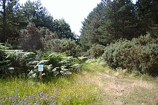
Thetford Heaths is a 270.6-hectare (669-acre) biological and geological Site of Special Scientific Interest in Suffolk. It is a Nature Conservation Review site, Grade I, and parts of it are a national nature reserve, and a Geological Conservation Review, It is part of the Breckland Special Area of Conservation, and Special Protection Area A large part of this dry heathland site is calcareous grassland, and some areas are grazed by sheep or rabbits. There are several nationally rare plants and an uncommon heathland bird, and many lichens and mosses.

Weather and Horn Heaths, Eriswell is a 133.3-hectare (329-acre) biological Site of Special Scientific Interest east of Eriswell in Suffolk. It is a Nature Conservation Review site, Grade I, and part of the Breckland Special Area of Conservation, and Special Protection Area

West Stow Heath is a 44.3-hectare (109-acre) biological Site of Special Scientific Interest west of West Stow in Suffolk. It is part of the Breckland Special Protection Area under the European Union Directive on the Conservation of Wild Birds.

Barnham Cross Common is a 69.1-hectare (171-acre) biological Site of Special Scientific Interest on the southern outskirts of Thetford in Norfolk. It is owned by Thetford Town Council and is registered common land. It is also a Local Nature Reserve and a Nature Conservation Review site, Grade 1. It is part of the Breckland Special Area of Conservation and Special Protection Area.
