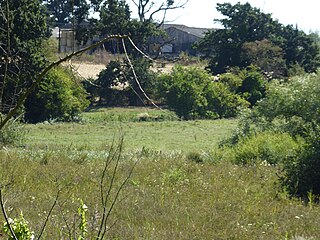
Ducan's Marsh is a 3.6-hectare (8.9-acre) biological Site of Special Scientific Interest north-east of Loddon in Norfolk. It is part of the Broadland Ramsar site and Special Protection Area, and The Broads Special Area of Conservation.

Fox Fritillary Meadow is a 2.4-hectare (5.9-acre) biological Site of Special Scientific Interest north of Framsden in Suffolk. It is owned and managed by the Suffolk Wildlife Trust.

Sutton and Hollesley Heaths is a 483.3-hectare (1,194-acre) biological Site of Special Scientific Interest south-east of Woodbridge in Suffolk. Most of the site is managed by the Suffolk Wildlife Trust as Sutton and Hollesley Commons. It is part of the Sandlings Special Protection Area under the European Union Directive on the Conservation of Wild Birds, and the Suffolk Coast and Heaths Area of Outstanding Natural Beauty.

Bixley Heath is a 5.1-hectare (13-acre) biological Site of Special Scientific Interest on the eastern outskirts of Ipswich in Suffolk. It is also a Local Nature Reserve owned and managed by Ipswich Borough Council.

Newney Green Pit is a 0.07 hectare geological Site of Special Scientific Interest west of Writtle in Essex. It is a Geological Conservation Review site.

Holton Pit is a 1.6-hectare (4.0-acre) geological Site of Special Scientific Interest east of Halesworth in Suffolk. It is a Geological Conservation Review site.

Valley Farm Pit, Sudbourne is a 0.5-hectare (1.2-acre) geological Site of Special Scientific Interest north of Orford in Suffolk. It is a Geological Conservation Review site, and in the Suffolk Coast and Heaths Area of Outstanding Natural Beauty.
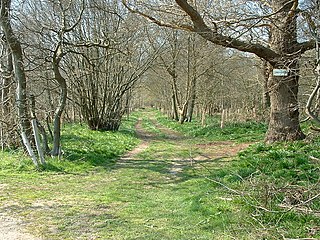
Freston and Cutler's Woods with Holbrook Park is a 142 hectare biological Site of Special Scientific Interest south of Ipswich in Suffolk. The site is in the Suffolk Coast and Heaths Area of Outstanding Natural Beauty

Weston Fen is a 49.7-hectare (123-acre) biological Site of Special Scientific Interest in Hopton in Suffolk. It is part of the Waveney and Little Ouse Valley Fens Special Areas of Conservation, and an area of 37 hectares is managed as a nature reserve called Market Weston Fen by the Suffolk Wildlife Trust.

Bobbitshole is a 1.7-hectare (4.2-acre) geological Site of Special Scientific Interest in Belstead, on the southern outskirts of Ipswich in Suffolk. It is a Geological Conservation Review site.

Waldringfield Pit is a 0.8-hectare (2.0-acre) geological Site of Special Scientific Interest between Martlesham Heath and Waldringfield in Suffolk. It is a Geological Conservation Review site.

Oakley Wood is a 48.1-hectare (119-acre) biological Site of Special Scientific Interest west of Hathern in Leicestershire.

Croft and Huncote Quarry is a 35.3 hectare geological Site of Special Scientific Interest north of Croft in Leicestershire. It is a Geological Conservation Review site.

Ant Broads and Marshes is a 745.3-hectare (1,842-acre) biological Site of Special Scientific Interest north-east of Norwich in Norfolk. Most of it is a Nature Conservation Review site, Grade 1, and it is part of the Broadland Ramsar and Special Protection Area, and The Broads Special Area of Conservation. Part of it is the Barton Broad nature reserve, which is managed by the Norfolk Wildlife Trust, and two areas are National Nature Reserves.

Booton Common'' is an 8.2-hectare (20-acre) biological Site of Special Scientific Interest north-west of Norwich in Norfolk. It is managed by the Norfolk Wildlife Trust and is a Special Area of Conservation

Stiffkey Valley is a 44.4-hectare (110-acre) biological Site of Special Scientific Interest east of Wells-next-the-Sea in Norfolk. It is in the Norfolk Coast Area of Outstanding Natural Beauty.
Shotesham Common is a 21.6-hectare (53-acre) biological Site of Special Scientific Interest south of Norwich in Norfolk.

Syderstone Common is a 43.7-hectare (108-acre) biological Site of Special Scientific Interest west of Fakenham in Norfolk. An area of 24-hectare (59-acre) is managed by the Norfolk Wildlife Trust

Limpenhoe Meadows is a 12-hectare (30-acre) biological Site of Special Scientific Interest west of Reedham in Norfolk. It is part of the Broadland Ramsar site and Special Protection Area, and The Broads Special Area of Conservation.
