
Bramerton Pits is a 0.7-hectare (1.7-acre) geological Site of Special Scientific Interest north of the village of Bramerton in Norfolk on the southern banks of the River Yare. It is a Geological Conservation Review site.

Swanscombe Skull Site or Swanscombe Heritage Park is a 3.9-hectare (9.6-acre) geological Site of Special Scientific Interest in Swanscombe, north-west Kent, England. It contains two Geological Conservation Review sites and a National Nature Reserve. The park lies in a former gravel quarry, Barnfield Pit, which is the most important site in the Swanscombe complex, alongside several other nearby pits.

Wansunt Pit is a 1.9-hectare (4.7-acre) geological Site of Special Scientific Interest in Dartford Heath between Crayford in the London Borough of Bexley and Dartford in Kent. It is also a Geological Conservation Review site. It is important geologically because it exposes the Dartford Heath Gravel, and the relationship of this exposure to the Swanscombe sequence and the Thames Terraces is a controversial issue in Thames Pleistocene studies. The site is part of Braeburn Park, a nature reserve managed by the London Wildlife Trust.

Downfield Pit is a 3.6-hectare (8.9-acre) geological Site of Special Scientific Interest near Ware in Hertfordshire. It is in the Geological Conservation Review in the Thames Pleistocene section, and the local planning authority is East Hertfordshire District Council.

Fern House Gravel Pit is a 1.3-hectare (3.2-acre) geological Site of Special Scientific Interest in Fern, near Bourne End in Buckinghamshire. It is also a Geological Conservation Review site.

Purfleet Chalk Pits is a 10.7-hectare (26-acre) geological Site of Special Scientific Interest in Purfleet in Essex. It is a Geological Conservation Review site.

Ardleigh Gravel Pit is a 1.2-hectare (3.0-acre) geological Site of Special Scientific Interest south of Ardleigh in Essex. It is a Geological Conservation Review site.
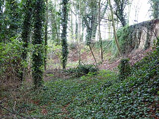
St Osyth Pit is a 0.1-hectare (0.25-acre) geological Site of Special Scientific Interest north of St Osyth in Essex. It is a Geological Conservation Review site.

Newney Green Pit is a 0.07-hectare (0.17-acre) geological Site of Special Scientific Interest west of Writtle in Essex. It is a Geological Conservation Review site.
Eye Gravel Pit is a 0.4-hectare (0.99-acre) geological Site of Special Scientific Interest in Eye Green in Cambridgeshire. It is a Geological Conservation Review site, and part of it overlaps Eye Green Local Nature Reserve.
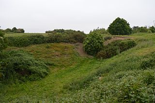
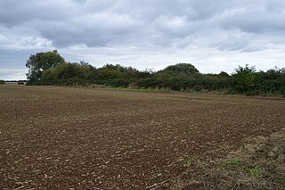
Flixton Quarry is a 0.7 hectares geological Site of Special Scientific Interest 3.75 miles (6.04 km) south-west of Bungay in the English county of Suffolk. It is a Geological Conservation Review site located in the parish of Homersfield.

Holton Pit is a 1.6-hectare (4.0-acre) geological Site of Special Scientific Interest east of Halesworth in Suffolk. It is a Geological Conservation Review site.

Chillesford Church Pit is a 1.1-hectare (2.7-acre) geological Site of Special Scientific Interest in Chillesford, south of Saxmundham in Suffolk. It is a Geological Conservation Review site, and it is in the Suffolk Coast and Heaths Area of Outstanding Natural Beauty.

Aldeburgh Brick Pit is a 0.9-hectare (2.2-acre) geological Site of Special Scientific Interest in Aldeburgh in Suffolk. It is a Geological Conservation Review site, and it is in the Suffolk Coast and Heaths Area of Outstanding Natural Beauty.

Sandy Lane Pit, Barham is an 11.1-hectare (27-acre) geological Site of Special Scientific Interest west of Barham in Suffolk, England. It is a Geological Conservation Review site.

Creeting St Mary Pits is a 5.4-hectare (13-acre) geological Site of Special Scientific Interest south Creeting St Mary in Suffolk, England. It is a Geological Conservation Review site.

Great Blakenham Pit is a 2.2-hectare (5.4-acre) geological Site of Special Scientific Interest south of Great Blakenham in Suffolk. It is a Geological Conservation Review site.
Hascot Hill Pit is a 0.3-hectare (0.74-acre) geological Site of Special Scientific Interest south-west of Needham Market in Suffolk. It is a Geological Conservation Review site. It is also a Local Wildlife Site.

Sturry Pit is a 0.7 hectares geological Site of Special Scientific Interest north-east of Canterbury in Kent. It is a Geological Conservation Review site.
Weybourne Town Pit is a 0.7-hectare (1.7-acre) geological Site of Special Scientific Interest west of Sheringham in Norfolk. It is a Geological Conservation Review site and it is in the Norfolk Coast Area of Outstanding Natural Beauty.
