
West Punjab was a province in the Dominion of Pakistan from 1947 to 1955. It was established from the western-half of British Punjab, following the independence of Pakistan. The province covered an area of 159,344 km sq, including much of the current Punjab province and the Islamabad Capital Territory, but excluding the former Princely state of Bahawalpur. Lahore, being the largest city and the cultural centre, served as the capital of the province. The province was composed of four divisions and was bordered by the state of Bahawalpur to the south-east, the province of Baluchistan to the south-west and Sind to the south, North-West Frontier Province to the north-west, and Azad Jammu and Kashmir to the north. It shared International border with Indian state of East Punjab to the east and Indian-administered Jammu & Kashmir to the north-east. It was dissolved and merged into West Pakistan upon creation of One Unit Scheme, in 1955.

Dera Ismail Khan, abbreviated as D.I. Khan, is a city and capital of Dera Ismail Khan District, located in Khyber Pakhtunkhwa, Pakistan. It is the 37th largest city of Pakistan and fifth largest in the province of Khyber Pakhtunkhwa by population. Dera Ismail Khan is situated on the west bank of the Indus River, at its junction with the Gomal River.
Muzaffargarh District is a district of the Punjab province of Pakistan. Its capital is Muzaffargarh city. It lies on the bank of the Chenab River.

Dera Ghazi Khan, abbreviated as D.G. Khan, is a city in the southwestern part of Punjab, Pakistan. It is the 19th most populous city of Pakistan. Lying west of the Indus River, it is the headquarters of Dera Ghazi Khan District and Dera Ghazi Khan Division.
Layyah District, is a district in the Punjab, Pakistan. It is located in the southern part of the province. Layyah is the district headquarter of Layyah District. Layyah has hot desert climate.

Rawalpindi Division, also locally known as Pothohar or North Punjab region, is an administrative division of Punjab Province, Pakistan. Rawalpindi city is the capital of the division. According to the 2017 Census of Pakistan, the total population of division was 10 million. Divisions are the third tier of government below the federal and provincial levels.
Sibi is a city situated in the Balochistan province of Pakistan. The city serves as the administrative headquarters of the district and tehsil of the same name.

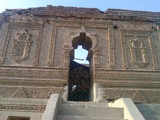
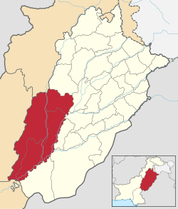
Dera Ghazi Khan is a district in the Punjab province of Pakistan. Its capital is the Dera Ghazi Khan city.

The four provinces, capital territory, and two autonomous territories of Pakistan are subdivided into 39 administrative "divisions", which are further subdivided into districts, tehsils, and finally union councils. These divisions were abolished in 2000, but restored in 2008.

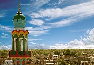
Rajanpur is a district of the Pakistani province of Punjab, with its administrative headquarters the city of Rajanpur. Lying west of the Indus River, its inhabitants are mostly Saraikis and Baloch. According to the 1998 census, the district had a population of 1,100,000, and 14.27% of these were inhabitants of urban areas.

Lahore Division is an administrative division of Punjab Province, Pakistan. It comprises four Districts - Kasur, Lahore, Nankana Sahib and Sheikhupura. The Lahore Division is commanded by a Commissioner to manage the division. Under the Commissioner there are four Additional Commissioners. For each district there is a Deputy Commissioner. Under the reforms of 2000, this tier of government was abolished, but in 2008 divisions were restored.
Multan Division is an administrative division of Punjab Province, Pakistan. Division's recorded population is 14 million in 2023 census report.

Sargodha Division is an administrative division of Punjab province, Pakistan. Sargodha city is the capital of the division. According to the 2017 Census of Pakistan, the total population of the division was 8.18 million. Divisions are the third tier of government below the federal and provincial levels.
Fort Munro, formerly known as Tuman Leghari because of the Leghari tribe who was living here before the British came. It is a hill station which is located at a height of 6,470 feet (1,970 m) above sea level in Dera Ghazi Khan District of Punjab, Pakistan. Fort Munro or formerly 'Tuman leghari' is the head quarter of the Leghari tribe. Fort Munro is part of Sulaiman mountain range. It was developed by British in the late 19th-century as a summer hill town. The town was Named after commissioner Multan division Colonel Munro.

Dera Ismail Khan Division is an administrative division of Khyber Pakhtunkhwa Province, Pakistan. It is the southernmost division of Khyber Pakhtunkhwa. CNIC code of Dera Ismail Khan Division is 12.
Dera Ghazi Khan, is an administrative subdivision (tehsil) of Dera Ghazi Khan District in the Punjab province of Pakistan. The capital of the tehsil is Dera Ghazi Khan.

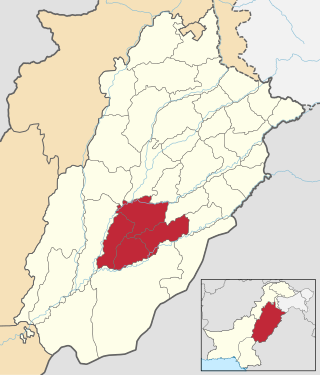
South Punjab, also proposed as Bahawalpur-South Punjab or Sairaikistan, are the names for the proposals to create a new so called province in Pakistan, out of the southern regions of Punjab. The region comprises the Bahawalpur, Multan, Sahiwal and Dera Ghazi Khan divisions. The proposed province would form about 52 percent of the total area and almost 40 percent of the population of the current Punjab province.

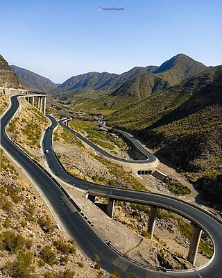
The National Highway 70, or the N-70, is one of the National Highways of Pakistan. It runs from the city of Multan in Punjab to the town of Qilla Saifullah via Dera Ghazi Khan, and Loralai in Balochistan province. Its total length is 440 kilometres (270 mi) divided into 254 kilometres (158 mi) in Balochistan and the remaining 186 km (116 mi) in the Punjab. It is maintained and operated by Pakistan's National Highway Authority.

The divisions of Punjab, are the first-order administrative bodies of the Punjab Province of Pakistan. In total, there are 11 divisions, which are further divided into districts ranging from three to six per division, depending upon area. Divisions are governed by Commissioners while districts are governed by Deputy Commissioners.