Dewar, Oklahoma | |
|---|---|
 Location of Dewar, Oklahoma | |
| Coordinates: 35°27′29″N95°56′54″W / 35.45806°N 95.94833°W | |
| Country | United States |
| State | Oklahoma |
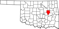
| County | Okmulgee |
| Area | |
• Total | 1.02 sq mi (2.64 km2) |
| • Land | 1.01 sq mi (2.62 km2) |
| • Water | 0.0077 sq mi (0.02 km2) |
| Elevation | 646 ft (197 m) |
| Population (2020) | |
• Total | 763 |
| • Density | 754.1/sq mi (291.17/km2) |
| Time zone | UTC-6 (Central (CST)) |
| • Summer (DST) | UTC-5 (CDT) |
| ZIP code | 74431 |
| Area codes | 539/918 |
| FIPS code | 40-20500 [3] |
| GNIS feature ID | 2412423 [2] |
Dewar is a town in Okmulgee County, Oklahoma, United States. The population was 763 at the 2020 census. [4] Founded in 1909 by workers for the Missouri, Oklahoma and Gulf Railway (MO&G), it was named for William Peter Dewar, a railroad official. It incorporated in 1909. [5]
Contents
Dewar has a history with coal in the large Henryetta Coal Formation: the Thirty-sixth annual report of the Department of Mines and Minerals from 1943 shows production by four coal companies in Dewar— Berkey Coal Company, Coal Creek Coal Company, Dewar Coal Company, and Martin-Geary Coal Company—with a combined total of over 13,600 tons of coal annually. [6] Dewar was along the route of the shortline Coalton Railway, later called the Okmulgee Northern Railway, which operated from Okmulgee south along the Deep Fork River carrying the coal out of the Dewar, Coalton and Schulter producing areas from 1916 to 1964. [7]