
Okmulgee County is a county in the U.S. state of Oklahoma. As of the 2020 census, the population was 36,706. The county seat is Okmulgee. Located within the Muscogee Nation Reservation, the county was created at statehood in 1907. The name Okmulgee is derived from the Hitchita word okimulgi, meaning "boiling waters".
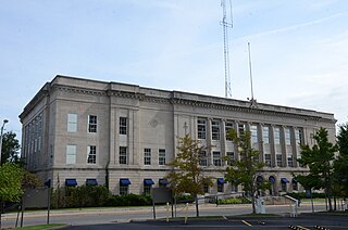
Muskogee County is a county located in the U.S. state of Oklahoma. As of the 2020 census, the population was 66,339. The county seat is Muskogee. The county and city were named for the Muscogee (Creek) Nation. The official spelling of the name was changed to Muskogee by the post office in 1900.
Pumpkin Center may refer to:

Green Country, sometimes referred to as Northeast Oklahoma, is the northeastern portion of the U.S. state of Oklahoma, which lies west of the northern half of Arkansas, the southwestern corner the way of Missouri, and south of Kansas.

The Neosho River is a tributary of the Arkansas River in eastern Kansas and northeastern Oklahoma in the United States. Its tributaries also drain portions of Missouri and Arkansas. The river is about 463 miles (745 km) long. Via the Arkansas, it is part of the Mississippi River watershed. Its name is an Osage word meaning "clear water." The lower section is also known as the Grand River.
Pumpkin Center is an unincorporated community in Muskogee County, Oklahoma, United States. It is about 14 miles east of the city of Muskogee.
Pumpkin Center is an unincorporated community in Comanche County, Oklahoma, United States. It is located at the intersection of state highways 7 and 65, approximately 10 miles east of Lawton in the southwestern portion of the state.
Spelter City is a populated place within the city of Henryetta, Oklahoma. It is located northeast of Henryetta’s town center, and west of Dewar, Oklahoma.
Natura is a populated place in Okmulgee County, Oklahoma. It is located about 10 miles north of the City of Okmulgee off State Highway 16, east of both the town of Beggs and US-75.
Bald Hill, or Baldhill, is a community in Okmulgee County, Oklahoma. It is located about 15 miles northeast of the City of Okmulgee, the county seat, off of Oklahoma State Highway 16. A post office was established here in 1896, but was closed in 1908. Nevertheless, the town was fueled by oil money, and had a population of 150 in 1923.
Dighton is a populated place in Okmulgee County, Oklahoma. It is about 7 miles east-northeast of Henryetta, Oklahoma, and is located south of US Route 266 on Bartlett Road.
Wilson, is an unincorporated community in Okmulgee County, Oklahoma, located about 7 miles northwest of the center of Henryetta, Oklahoma, located off Wilson Road. This is not to be confused with the Wilson in Carter County, Oklahoma southeast of Healdton nor the Wilson in Pushmataha County, Oklahoma.
Pumpkin Center is an unincorporated community in Cherokee County, Oklahoma, United States. It is approximately 7.5 miles northeast of Braggs.
Pumpkin Center is located in Grant Township, Dallas County, Missouri. It is in the Missouri Ozarks at an elevation of 1,130 feet, near the intersection of Missouri Route 64 and Missouri Route 73 off Pumpkin Center Drive. It is approximately 7 miles north-northeast of Buffalo, the Dallas County seat, and about 26 miles west-northwest of Lebanon.
Pumpkin Center is located in White Cloud Township, Nodaway County, Missouri, at an elevation of 1,020 feet, approximately 10 miles south of the Nodaway County seat of Maryville on US Route 71.
Sunrise is an unincorporated place in Okmulgee County, Oklahoma, at an elevation of 610 feet. It is located just to the east of Dewar.
Sunrise is an unincorporated place in Okfuskee County, Oklahoma, at an elevation of 830 feet. It is located about 17 miles southwest of the city of Okmulgee, Oklahoma, and directly south of Dripping Springs Lake.
Gulftown is a unincorporated community in Okmulgee County, Oklahoma, at an elevation of 610 feet. It is located about two miles east of Dewar, Oklahoma. It is centered around the corner of Hackberry Road and Arbeka Road, being both south and east of US Route 266.
Norwood is a census-designated place (CDP) in Cherokee and Muskogee counties, Oklahoma, United States. It was first listed as a CDP prior to the 2020 census.
Pumpkin Hollow is a census-designated place (CDP) in Cherokee County, Oklahoma, United States, within the Cherokee Nation. It was first listed as a CDP prior to the 2020 census.


