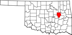
Preston, Oklahoma

Last updated
Preston
USA Oklahoma location map.svg
Red pog.svg
Preston
Location within the state of Oklahoma
Usa edcp location map.svg
Red pog.svg
Preston
Preston (the United States)
Coordinates: 35°42′41″N95°59′20″W / 35.71139°N 95.98889°W / 35.71139; -95.98889
Country United States
State Oklahoma
County Okmulgee
Area
[1]
  Total0.46 sq mi (1.18 km2)
  Land0.46 sq mi (1.18 km2)
  Water0.00 sq mi (0.00 km2)
Elevation
[2]
791 ft (241 m)
Population
 (2020)
  Total169
  Density369.80/sq mi (142.64/km2)
Time zone UTC-6 (Central (CST))
  Summer (DST) UTC-5 (CDT)
FIPS code 40-60650
GNIS feature ID2805349 [2]

Preston is an unincorporated community located in Okmulgee County, Oklahoma, United States. [2] The population was 169 at the 2020 census. [3] The post office was established December 13, 1909. It was named for an Okmulgee oilman, Harry Preston.

Contents

First known as Hamilton Switch, [4] and now unrecognizable from the past, Preston was once a highly prosperous community, thriving mainly from the oil boom, as did many of the surrounding communities. Later on, as the oil industry quieted in Preston, it served as a station for restocking trains and running cattle trails, loading water from Frisco Lake.[ citation needed ]

It currently has two schools, three churches, a single gas station, feed store, a heating and air company, and a hair salon, as well as a fire protection business and the offices of Oklahoma Rural Water District No. 2.

Demographics

Historical population
CensusPop.Note
2020 169
U.S. Decennial Census [5]

Education

Preston Public School is the school district serving the town.

Transportation

Preston is served by U.S. Route 75, [6] a major national north/south artery for much of its length, currently running from the Canada–US border at Noyes, Minnesota to Dallas. [7]

Preston is also on Old Highway 75, being the previous two-lane alignment of US-75 running north to Beggs and south to Okmulgee. [6]

Related Research Articles

<span class="mw-page-title-main">Tulsa County, Oklahoma</span> County in the United States

Tulsa County is located in the U.S. state of Oklahoma. As of the 2020 census, the population was 669,279, making it the second-most populous county in the state, behind only Oklahoma County. Its county seat and largest city is Tulsa, the second-largest city in the state. Founded at statehood, in 1907, it was named after the previously established city of Tulsa. Before statehood, the area was part of both the Creek Nation and the Cooweescoowee District of Cherokee Nation in Indian Territory.

<span class="mw-page-title-main">Okmulgee County, Oklahoma</span> County in Oklahoma, United States

Okmulgee County is a county in the U.S. state of Oklahoma. As of the 2020 census, the population was 36,706. The county seat is Okmulgee. Located within the Muscogee Nation Reservation, the county was created at statehood in 1907. The name Okmulgee is derived from the Hitchita word okimulgi, meaning "boiling waters".

<span class="mw-page-title-main">Okfuskee County, Oklahoma</span> County in Oklahoma, United States

Okfuskee County is a county located in the U.S. state of Oklahoma. As of the 2020 census, its population was 11,310. Its county seat is Okemah. The county is named for a former Muscogee town in present Cleburne County, Alabama, that in turn was named for the Okfuskee, a Muscogee tribe.

<span class="mw-page-title-main">McIntosh County, Oklahoma</span> County in Oklahoma, United States

McIntosh County is a county located in the U.S. state of Oklahoma. As of the 2020 census, the population was 18,941. Its county seat is Eufaula. The county is named for an influential Muscogee Creek family, whose members led the migration of the Lower Towns to Indian Territory and served as leaders for generations.

<span class="mw-page-title-main">Carson, California</span> City in California, United States

Carson is a city in Los Angeles County, California, United States, in The Harbor region of Los Angeles, located 13 miles (21 km) south of downtown Los Angeles and approximately 14 miles (23 km) away from Los Angeles International Airport. It was Incorporated on February 20, 1968. The city is locally known for its plurality of Filipino-Americans and immigrants. As of 2019, it was estimated that the city had a population of 91,394.

<span class="mw-page-title-main">Atoka, Oklahoma</span> City in Oklahoma, United States

Atoka is a city in and the county seat of Atoka County, Oklahoma, United States. The population was 3,107 at the 2010 census, an increase of 4.0 percent from the figure of 2,988 in 2000. As of 2021, the population has grown to 3,188.

<span class="mw-page-title-main">Durant, Oklahoma</span> City in Oklahoma, United States

Durant is a city in Bryan County, Oklahoma, United States that serves as the headquarters of the Choctaw Nation of Oklahoma. The population was 18,589 in the 2020 census. Durant is the principal city of the Durant Micropolitan Statistical Area, which had a population of 46,067 in 2020. The city is the largest in the Choctaw Nation, ranking ahead of McAlester and Poteau. Durant is also part of the Dallas–Fort Worth Combined Statistical Area, anchoring the northern edge.

<span class="mw-page-title-main">Ardmore, Oklahoma</span> City in Oklahoma, United States

Ardmore is the county seat of Carter County, Oklahoma, United States. The population was 24,725 at the time of the 2020 census, a 1.8% increase over the 2010 census figure of 24,283. The Ardmore micropolitan statistical area had an estimated population of 48,491 in 2013. Ardmore is 90 miles (140 km) from both Oklahoma City and Dallas/Fort Worth, Texas, at the junction of Interstate 35 and U.S. Highway 70, and is generally considered the hub of the 13-county region of South Central Oklahoma, also known by state tourism pamphlets as "Chickasaw Country" and previously "Lake and Trail Country". It is also a part of the Texoma region. Ardmore is situated about 9 miles (14 km) south of the Arbuckle Mountains and is located at the eastern margin of the Healdton Basin, one of the most oil-rich regions of the United States.

<span class="mw-page-title-main">Mounds, Oklahoma</span> Town in Oklahoma, United States

Mounds is a town in Creek County, Oklahoma, United States. It is located just south of Tulsa; the town's population was 932 at the 2020 census.

<span class="mw-page-title-main">Beggs, Oklahoma</span> City in Oklahoma, United States

Beggs is a city in Okmulgee County, Oklahoma, United States. The population was 1,179 as of the 2020 census. Beggs was named for C.H. Beggs, vice president of the St. Louis-San Francisco (Frisco) Railway.

<span class="mw-page-title-main">Henryetta, Oklahoma</span> City in Oklahoma, United States

Henryetta is a city in Okmulgee County, Oklahoma, United States. The population was 5,640 at the 2020 census.

<span class="mw-page-title-main">Okmulgee, Oklahoma</span> City in Oklahoma, United States

Okmulgee is a city in, and the county seat of, Okmulgee County, Oklahoma. The name is from the Mvskoke word okimulgee, which means "boiling waters". The site was chosen because of the nearby rivers and springs. Okmulgee is 38 miles south of Tulsa and 13 miles north of Henryetta via US-75.

<span class="mw-page-title-main">Schulter, Oklahoma</span> Town in Oklahoma, United States

Schulter is a town in Okmulgee County, Oklahoma, United States. The population was 422 at the time of the 2020 census.

<span class="mw-page-title-main">Jenks, Oklahoma</span> City in Oklahoma, United States

Jenks is a city in Tulsa County, Oklahoma, United States, and a suburb of Tulsa, in the northeastern part of the state. It is situated between the Arkansas River and U.S. Route 75. Jenks is one of the fastest-growing cities in Oklahoma. The city's population was 16,924 in the 2010 census, but by 2020, this had grown to 25,949. The Census estimated Jenks' population as 27,141 in 2022.

<span class="mw-page-title-main">Copan, Oklahoma</span> Town in Oklahoma, United States

Copan is a town in Washington County, Oklahoma, United States. The population was 733 at the 2010 census, a decline of 7.9 percent from the figure of 796 recorded in 2000.

<span class="mw-page-title-main">Andrews, Texas</span> City in Texas, United States

Andrews is the county seat of Andrews County in the Permian Basin of West Texas. Andrews sits to the far southwest within the Texas Panhandle's plains, about 30 miles east of New Mexico.

<span class="mw-page-title-main">Drumright, Oklahoma</span> City in Oklahoma, United States

Drumright is a city in Creek and Payne counties in the U.S. state of Oklahoma. It began as an oil boom town. However, the population has declined as oil production has waned in the area. The population was 2,907 at the 2010 census, a figure almost unchanged from 2,905 in 2000. Drumright and nearby Cushing were at the center of the large, productive Cushing-Drumright Oil Field in the 1910s and 1920s. Now Drumright is home to a festival called The Drumright Monthly Market, where hundreds of visitors come, seeking crafts and delicacies from all over the region. First Saturday of every month.

<span class="mw-page-title-main">Owasso, Oklahoma</span> City in Oklahoma, United States

Owasso is a city in Rogers and Tulsa Counties in the U.S. state of Oklahoma, and the largest northern suburb of Tulsa. The population was 39,328 persons as of the 2022 census estimate, compared to 28,915 at the 2010 census, a gain of 36 percent. Originally settled in 1881 in Indian Territory, the town was incorporated in 1904 just before Oklahoma statehood and was chartered as a city in 1972.

<span class="mw-page-title-main">Tulsa metropolitan area</span> Metropolitan area in northeastern Oklahoma

The Tulsa metropolitan area, officially defined as the Tulsa metropolitan statistical area is a metropolis in northeastern Oklahoma centered around the city of Tulsa and encompassing Tulsa, Rogers, Wagoner, Osage, Creek, Okmulgee and Pawnee counties. It had a population of 1,034,123 according to the 2022 U.S. census estimates.

<span class="mw-page-title-main">Liberty, Oklahoma</span> Town in Oklahoma, United States

Liberty is a town that sits astride the line dividing Okmulgee and Tulsa counties in the U.S. state of Oklahoma. As of the 2020 census, the population is 153.

References

  1. "ArcGIS REST Services Directory". United States Census Bureau. Retrieved September 20, 2022.
  2. 1 2 3 U.S. Geological Survey Geographic Names Information System: Preston, Oklahoma
  3. "Preston (CDP), Oklahoma". US Census Bureau. Retrieved October 15, 2023.
  4. Carson, Mary L. (1987). A Guide to Treasure in Oklahoma, Volume 3. Carson Enterprises Inc. p. 336-339. ISBN   0-941620-38-7.
  5. "Census of Population and Housing". Census.gov. Retrieved June 4, 2016.
  6. 1 2 "Preston, Oklahoma". MapQuest. Retrieved September 27, 2019.
  7. "U.S. Highway 75 Endpoints". Archived from the original on 2011-07-03. Retrieved 2011-06-15.