Diamondville, Wyoming

Last updated

Diamondville, Wyoming
Motto: 
"A Diamond in the Rough"
Lincoln County Wyoming Incorporated and Unincorporated areas Diamondville Highlighted 5620110.svg
Location of Diamondville in Lincoln County, Wyoming.
Usa edcp location map.svg
Red pog.svg
Diamondville, Wyoming
Location in the United States
Coordinates: 41°46′31″N110°32′17″W / 41.77528°N 110.53806°W / 41.77528; -110.53806
Country United States
State Wyoming
County Lincoln
Area
[1]
  Total1.17 sq mi (3.03 km2)
  Land1.17 sq mi (3.02 km2)
  Water0.00 sq mi (0.01 km2)
Elevation
6,893 ft (2,101 m)
Population
 (2020)
  Total520
  Density648.67/sq mi (250.53/km2)
Time zone UTC-7 (Mountain (MST))
  Summer (DST) UTC-6 (MDT)
ZIP code
83116
Area code 307
FIPS code 56-20110 [2]
GNIS feature ID1587599 [3]
Website www.diamondvillewyo.com

Diamondville is a town in Lincoln County, Wyoming, United States, often used as a suburb of neighboring Kemmerer. The population was 520 at the 2020 census.

Contents

History

Harrison Church discovered coal near the Hams Fork River in 1868. He gathered financial backing from a group in Minneapolis, and they formed the Hams Fork River Coal Company. Diamondville was built to house the miners, and the town was incorporated in 1896. [4]

The town was named for the superior-grade coal that came from the local mines. The coal resembled black diamonds. [4]

Geography

Diamondville is located at 41°46′31″N110°32′17″W / 41.77528°N 110.53806°W / 41.77528; -110.53806 (41.775192, -110.537989). [5]

According to the United States Census Bureau, the town has a total area of 1.17 square miles (3.03 km2), all land. [6]

Demographics

Historical population
CensusPop.Note
1910 696
1920 7264.3%
1930 81211.8%
1940 586−27.8%
1950 415−29.2%
1960 398−4.1%
1970 48521.9%
1980 1,000106.2%
1990 864−13.6%
2000 716−17.1%
2010 7372.9%
2020 520−29.4%
U.S. Decennial Census [7]

2010 census

As of the census [8] of 2010, there were 737 people, 320 households, and 203 families living in the town. The population density was 629.9 inhabitants per square mile (243.2/km2). There were 363 housing units at an average density of 310.3 per square mile (119.8/km2). The racial makeup of the town was 93.4% White, 0.1% African American, 0.7% Native American, 0.4% Asian, 0.3% Pacific Islander, 2.8% from other races, and 2.3% from two or more races. Hispanic or Latino of any race were 9.1% of the population.

There were 320 households, of which 27.2% had children under the age of 18 living with them, 51.3% were married couples living together, 6.3% had a female householder with no husband present, 5.9% had a male householder with no wife present, and 36.6% were non-families. 30.0% of all households were made up of individuals, and 12.2% had someone living alone who was 65 years of age or older. The average household size was 2.30 and the average family size was 2.86.

The median age in the town was 42.5 years. 21% of residents were under the age of 18; 7.5% were between the ages of 18 and 24; 23.5% were from 25 to 44; 33.5% were from 45 to 64; and 14.5% were 65 years of age or older. The gender makeup of the town was 49.5% male and 50.5% female.

See also

Related Research Articles

<span class="mw-page-title-main">West Havre, Montana</span> Census-designated place in Montana, United States

West Havre is a census-designated place (CDP) in Hill County, Montana, United States. The population was 316 at the 2010 census, up from 284 in 2000.

<span class="mw-page-title-main">Cairo, West Virginia</span> Town in West Virginia, United States

Cairo is a town in Ritchie County, West Virginia, United States, along West Virginia Route 31, the North Fork of the Hughes River, and the North Bend Rail Trail. The population was 174 at the 2020 census.

<span class="mw-page-title-main">Oceana, West Virginia</span> Town in West Virginia, United States

Oceana is a town in Wyoming County, West Virginia. The population was 1,462 at the time of the 2020 census. Oceana is the oldest city in Wyoming County and was the county seat until 1907.

<span class="mw-page-title-main">Rock River, Wyoming</span> Town in Wyoming, United States

Rock River is a town in Albany County, Wyoming, United States. As of the 2010 census, the town population was 245.

<span class="mw-page-title-main">Wright, Wyoming</span> Town in Wyoming, United States

Wright is a town in Campbell County, Wyoming, United States. The population was 1,807 at the 2010 census.

<span class="mw-page-title-main">Dixon, Wyoming</span> Town in Wyoming, United States

Dixon is a town in Carbon County, Wyoming, United States. The population was 97 at the 2010 census.

<span class="mw-page-title-main">Encampment, Wyoming</span> Town in Wyoming, United States

Encampment is a town in southern Carbon County, Wyoming, United States. The population was 450 at the 2010 census.

<span class="mw-page-title-main">Hanna, Wyoming</span> Town in Wyoming, United States

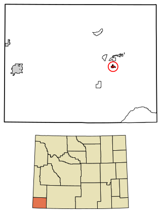
Hanna is a town in Carbon County, Wyoming, United States. The population was 683 at the 2020 census. The town was started as a coal supply location for the Union Pacific Railroad. Much of the old town is built on top of the former workings of the Hanna No. 4 mine. On December 18, 1979, the Town of Hanna annexed the adjacent Town of Elmo. The population peaked at 2,288 in 1980 and has declined as local coal mines have ceased operation.

<span class="mw-page-title-main">Riverside, Wyoming</span> Town in Wyoming, United States

Riverside is a town in Carbon County, Wyoming, United States. The population was 52 at the 2010 census.

<span class="mw-page-title-main">Glenrock, Wyoming</span> Town in Wyoming, United States

Glenrock is a town in Converse County, Wyoming, United States. The population was 2,576 at the 2010 census.

<span class="mw-page-title-main">Burns, Wyoming</span> Town in Laramie County, Wyoming, United States

Burns is a town in Laramie County, Wyoming, United States. It is part of the Cheyenne, Wyoming Metropolitan Statistical Area. The population was 301 at the 2010 census.

<span class="mw-page-title-main">Cokeville, Wyoming</span> Town in Wyoming, United States

Cokeville is a town in Lincoln County, Wyoming, United States. The population was 502 at the 2020 census. The town is known for the Cokeville Elementary School hostage crisis.

<span class="mw-page-title-main">Kemmerer, Wyoming</span> City in Wyoming, United States

Kemmerer is the largest city in and the county seat of Lincoln County, Wyoming, United States. Its population was 2,415 at the 2020 census.

Oakley is a census-designated place (CDP) in Lincoln County, Wyoming, United States. The population was 49 at the 2010 census.

<span class="mw-page-title-main">Opal, Wyoming</span> Town in Wyoming, United States

Opal is a town in Lincoln County, Wyoming, United States. The population was 64 at the 2020 census.

<span class="mw-page-title-main">Glendo, Wyoming</span> Town in Wyoming, United States

Glendo is a town in Platte County, Wyoming, United States. The population was 205 at the 2010 census.

<span class="mw-page-title-main">Superior, Wyoming</span> Town in Wyoming, United States

Superior is a town in Sweetwater County, Wyoming, United States. The population was 336 at the 2010 census.

<span class="mw-page-title-main">Hoback, Wyoming</span> CDP in Wyoming, United States

Hoback is a census-designated place (CDP) in Teton County, Wyoming, United States. The population was 1,176 at the 2010 census. It is part of the Jackson, WY–ID Micropolitan Statistical Area. The town is named for John Hoback, a mountain man who guided the Astor party through the area in 1811.

<span class="mw-page-title-main">Lyman, Wyoming</span> Town in Wyoming, United States

Lyman is a town in Uinta County, Wyoming, United States. The population was 2,115 at the 2010 census.

<span class="mw-page-title-main">Mountain View, Wyoming</span> Town in Wyoming, United States

Mountain View is a town in Uinta County, Wyoming, United States. The population was 1,286 at the 2010 census.

References

  1. "2019 U.S. Gazetteer Files". United States Census Bureau. Retrieved August 7, 2020.
  2. "U.S. Census website". United States Census Bureau . Retrieved January 31, 2008.
  3. "US Board on Geographic Names". United States Geological Survey. October 25, 2007. Retrieved January 31, 2008.
  4. 1 2 "Historic Diamondville". The Town Of Diamondville, Wyoming. Archived from the original on April 25, 2018. Retrieved July 17, 2012.
  5. "US Gazetteer files: 2010, 2000, and 1990". United States Census Bureau. February 12, 2011. Retrieved April 23, 2011.
  6. "US Gazetteer files 2010". United States Census Bureau. Archived from the original on July 2, 2012. Retrieved December 14, 2012.
  7. "Census of Population and Housing". Census.gov. Retrieved June 4, 2015.
  8. "U.S. Census website". United States Census Bureau . Retrieved December 14, 2012.