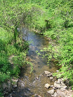
The St. Joseph River is an 86.1-mile-long (138.6 km) tributary of the Maumee River in northwestern Ohio and northeastern Indiana in the United States, with headwater tributaries rising in southern Michigan. It drains a primarily rural farming region in the watershed of Lake Erie.

The Cacapon River, located in the Appalachian Mountains of West Virginia's Eastern Panhandle region, is an 81.0-mile-long (130.4 km) river known for its fishing, boating, wildlife, and scenery. As part of the Potomac River watershed, it is an American Heritage River.

Intermont is an unincorporated community in Hampshire County, West Virginia, United States, located along West Virginia Route 259 on the Cacapon River. It was originally known as Mutton Run until 1920, when its name was changed to Intermont. Because of Mutton Run's location on the Winchester and Western Railroad, it may have been renamed after the Intermountain Construction Company that completed the railroad from Winchester to Wardensville. Their post office is closed.

Neals Run is an unincorporated community in Hampshire County in the U.S. state of West Virginia. Neals Run is located south of Little Cacapon near the confluence of the Little Cacapon River and Neals Run on Spring Gap-Neals Run Road. The community derives its name from the stream.
Millbrook is an unincorporated community in Hampshire County, West Virginia, United States. Millbrook is located along Dillons Run on Dillons Run Road in southeastern Hampshire County.
Rada is an unincorporated community in Hampshire County in the U.S. state of West Virginia. Rada is located on U.S. Highway 220/West Virginia Route 28 between Junction and Purgitsville in southwest Hampshire County along Mill Creek. It lies at an intersection of US 220/WV 28 with Rada Road.

Dillons Run is a 12.9-mile-long (20.8 km) tributary stream of the Cacapon River, belonging to the Potomac River and Chesapeake Bay watersheds. The stream is located in Hampshire County in the U.S. state of West Virginia's Eastern Panhandle.
Cold Stream is an unincorporated community in Hampshire County in the U.S. state of West Virginia. Cold Stream is located north of Capon Bridge on Cold Stream Road. Referred to as Edwards Run in its past, the community of Cold Stream is in proximity to where Edwards Run empties into the Cacapon River. The community most likely took its name from a nearby stream of the same name noted for the cold water it contains. Their post office has been closed.
West Virginia Route 218 is a north–south state highway located in Marion and Mononagalia counties in northern West Virginia, United States, that connects U.S. Route 19 (US 19) with the Pennsylvania state line.
Green Spring Run is an 8.9-mile-long (14.3 km) tributary stream of the North Branch Potomac River in Hampshire County in the U.S. state of West Virginia. Green Spring Run rises in Greenwood Hollow north of Springfield and meanders northeast through Green Spring Valley. The South Branch Valley Railroad and Green Spring Road run parallel to the stream. It runs through the community of Green Spring, from which the stream takes its name. From Green Spring, Green Spring Run flows east where it reaches its confluence with the North Branch Potomac shortly before the North Branch joins with the South Branch Potomac River to form the Potomac River.
Ridings Mill is an unincorporated community in southern Frederick County, Virginia. Ridings Mill takes its name from the mill on West Run there. The community is located to the east of Middletown at the crossroads of Ridings Mill and Huttle Roads. Named for the mill located on West Run on Ridings Mill Road, this is a rural area consisting mainly of farms.

Seneca Creek is a 19.6-mile-long (31.5 km) tributary of the North Fork of the South Branch of the Potomac River located entirely within Pendleton County, West Virginia, USA.
Schaffenaker Mountain is a forested mountain ridge of the Ridge-and-valley Appalachians in Hampshire County in the U.S. state of West Virginia. The ridge runs southwest northeast between Edwards Run and Dillons Run. Schaffenaker Mountain takes its name from the Schaffenaker family that settled in the immediate area. The Northwestern Turnpike climbs Schaffenaker Mountain to the west of the town of Capon Bridge offering a bird's eye view of the community and of the Cacapon River. Until recently, the mountain had remained mostly undeveloped but its views and proximity to Capon Bridge have made it a prime location for real estate development by companies such as the North American Land Corporation.

Five Forks is an unincorporated community in Calhoun County, West Virginia, United States. It lies along West Virginia Route 16 to the north of the town of Grantsville, the county seat of Calhoun County. Its elevation is 1,106 feet (337 m). The Five Forks Post Office is closed.
Flatwoods is an unincorporated community in northwestern Jackson County, West Virginia, United States. It lies at the intersection of Crooked Run and Harpold Roads, northwest of the city of Ripley, the county seat of Jackson County. Its elevation is 755 feet (230 m).
Mill Run is a 9.1-mile-long (14.6 km) tributary stream of the South Branch Potomac River, belonging to the Potomac River and Chesapeake Bay watersheds. The stream is located in Hampshire County in the Eastern Panhandle of the U.S. state of West Virginia. Mill Run rises on Nathaniel Mountain and flows northeast, then northwest into the South Branch south of Romney near Hampshire Park on South Branch River Road.
Skull Run is an unincorporated community in Jackson County, West Virginia, United States. Their Post Office no longer is in service.
Dillon is an unincorporated community in Raleigh County, West Virginia, United States. It was also known as Irish Mountain and is the location of St. Colman's Roman Catholic Church and Cemetery, which is on the National Register of Historic Places.
Pedlar is an unincorporated community in Monongalia County, West Virginia, United States. Its post office has been closed.
Jordan Run is an unincorporated community in Grant County, West Virginia, United States. Its post office is closed. It was also known as Jordon Run.


