
Hampshire County is a county in the U.S. state of West Virginia. As of the 2020 census, the population was 23,093. Its county seat is Romney, West Virginia's oldest town (1762). The county was created by the Virginia General Assembly in 1754, from parts of Frederick and Augusta Counties (Virginia) and is the state's oldest county. The county lies in both West Virginia's Eastern Panhandle and Potomac Highlands regions.

Romney is a town in and the county seat of Hampshire County, West Virginia, United States. The population was 1,722 at the 2020 census. It is part of the Winchester, Virginia metropolitan area. Established in 1762 along with Shepherdstown, they are the oldest towns in West Virginia.
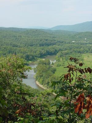
The South Branch Potomac River has its headwaters in northwestern Highland County, Virginia near Hightown along the eastern edge of the Allegheny Front. After a river distance of 139 miles (224 km), the mouth of the South Branch lies east of Green Spring in Hampshire County, West Virginia where it meets the North Branch Potomac River to form the Potomac.
The Northwestern Turnpike is a historic road in West Virginia, important for being historically one of the major roads crossing the Appalachians, financed by the Virginia Board of Public Works in the 1830s. In modern times, west of Winchester, Virginia, U.S. Route 50 follows the path of the Northwestern Turnpike into West Virginia, whose major Corridor D project follows the western section of the original Northwestern Turnpike.

Kirby is an unincorporated community in Hampshire County in the U.S. state of West Virginia situated along Grassy Lick Run, a tributary of North River. Kirby is located south of Romney at the crossroads of Grassy Lick Road and Rock Oak Road.

Green Spring is a census-designated place (CDP) and railroad town in Hampshire County, West Virginia, United States. As of the 2010 census, its population was 218. Green Spring is located north of Springfield on Green Spring Road near the confluence of the North and South Branches of the Potomac River. Green Spring is also the location of the South Branch Valley Railroad's terminus with the old Baltimore & Ohio Railroad mainline. Green Spring is the site of a one-lane low-water toll bridge that connects Green Spring Road to Maryland Route 51 in Oldtown, Allegany County, Maryland. This bridge is one of only 17 privately owned toll bridges in the United States. The toll for the bridge is currently US$1.50.

Okonoko is an unincorporated community in Hampshire County in the U.S. state of West Virginia. Okonoko is located north of Levels on the Potomac River at Bright's Hollow. The community's placename is the only one of its kind within the United States.
Purgitsville is an unincorporated community in Hampshire County in the U.S. state of West Virginia. According to the 2000 census, the ZCTA for Purgitsville had a population of 813. Purgitsville is located on U.S. Highway 220/West Virginia Route 28 at its intersection with Huffman Road south of Junction. An elementary school, Mill Creek Elementary, was open here until 1993 when it was consolidated with Romney Elementary.
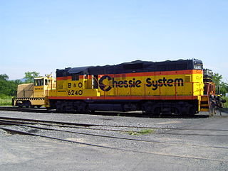
The South Branch Valley Railroad is a 52.4-mile-long (84.3 km) railroad in the Eastern Panhandle of West Virginia. The branch line, which parallels the South Branch Potomac River, runs north from Petersburg to Green Spring, where it connects to the national rail network at a junction with the CSX Cumberland Subdivision.

Indian Mound Cemetery is a cemetery located along the Northwestern Turnpike on a promontory of the "Yellow Banks" overlooking the South Branch Potomac River and Mill Creek Mountain in Romney, West Virginia, United States. The cemetery is centered on a Hopewellian mound, known as the Romney Indian Mound. Indian Mound Cemetery is also the site of Fort Pearsall, the Confederate Memorial, Parsons Bell Tower, and reinterments from Romney's Old Presbyterian Cemetery. The cemetery is currently owned and maintained by the Indian Mound Cemetery Association, Inc.

Mill Creek is a 14.0-mile-long (22.5 km) tributary stream of the South Branch Potomac River, belonging to the Potomac River and Chesapeake Bay watersheds. The stream is located in Hampshire County in West Virginia's Eastern Panhandle. Mill Creek flows into the South Branch west of Romney Bridge near Vanderlip along the Northwestern Turnpike.
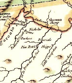
Piss Pot Island is an island on the South Branch Potomac River west of Romney in Hampshire County, West Virginia. Piss Pot Island received its name before 1755, the year it was included on Joshua Fry's and Peter Jefferson's Carte de la Virginie et du Maryland. Uncommon for islands of its size and geologic nature, Piss Pot Island has remained approximately the same size since the eighteenth century. The island is forested primarily with American sycamores and silver maples. It continues to be popular with fishermen and canoers on the South Branch Potomac River. Mill Creek empties into the South Branch to its western shore and Wergman Run enters the river to its northeast.
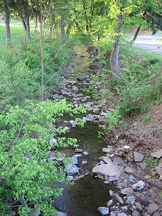
Big Run is a 4.4-mile-long (7.1 km) tributary stream of the South Branch Potomac River, belonging to the Potomac River and Chesapeake Bay watersheds. Big Run flows through the city of Romney and the campus of the West Virginia Schools for the Deaf and Blind in Hampshire County, West Virginia. The stream is known by local residents as Town Run and Town Creek.
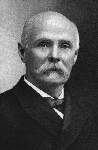
Robert White was an American military officer, lawyer, and politician in the U.S. state of West Virginia. White served as Attorney General of West Virginia (1877–1881) and served two terms in the West Virginia House of Delegates, representing Ohio County in 1885 and 1891.

Wappocomo is a late 18th-century Georgian mansion and farm overlooking the South Branch Potomac River north of Romney, Hampshire County, West Virginia, USA. It is located along Cumberland Road and the South Branch Valley Railroad.

Marshall Silas Cornwell was a 19th-century American newspaper publisher and editor, writer and poet in the U.S. state of West Virginia. Cornwell was a younger brother of railroad and timber executive William B. Cornwell (1864–1926) and West Virginia Governor John Jacob Cornwell (1867–1953).

William Benjamin Cornwell was an American lawyer, businessperson, newspaper editor and publisher, and railroad and timber executive in the U.S. state of West Virginia. He was an older brother of writer and newspaper publisher Marshall S. Cornwell (1871–1898) and of West Virginia Governor John J. Cornwell (1867–1953).

Valley View is a mid-19th-century Greek Revival residence and farm overlooking the South Branch Potomac River northwest of Romney, West Virginia. The house is atop a promontory where Depot Valley joins the South Branch Potomac River valley.
Valley was a populated place and post office on the South Branch line of the Baltimore and Ohio Railroad in the U.S. state of West Virginia. It was centered near the intersection of West Sioux Lane and Depot Valley Road, now located within the present-day corporate boundaries of Romney. Valley developed in 1884 following the completion of the South Branch line when the rail line's original southern terminus and corresponding Romney Depot were built there. The United States Post Office Department established a post office at Valley on May 19, 1928, remaining in operation until its disestablishment on June 15, 1937. Following the closure of Valley's post office, its mail was routed through the post office in Romney.


