Dunnockshaw

Last updated

Dunnockshaw
Sunset January 2008 at Clowbridge Reservoir - geograph.org.uk - 661883.jpg
Sunset at Clowbridge Reservoir
Location map United Kingdom Borough of Burnley.svg
Red pog.svg
Dunnockshaw
Shown within Burnley Borough
Lancashire UK location map.svg
Red pog.svg
Dunnockshaw
Location within Lancashire
Area1.02 sq mi (2.6 km2)  [1]
Population185 (2011) [1]
  Density 181/sq mi (70/km2)
OS grid reference SD821280
Civil parish
  • Dunnockshaw
District
Shire county
Region
Country England
Sovereign state United Kingdom
Post town BURNLEY
Postcode district BB11
Dialling code 01282
Police Lancashire
Fire Lancashire
Ambulance North West
UK Parliament
List of places
UK
England
Lancashire
53°44′53″N2°16′16″W / 53.748°N 2.271°W / 53.748; -2.271

Dunnockshaw or Dunnockshaw and Clowbridge is a civil parish in the borough of Burnley, in Lancashire, England. The parish is situated between Burnley and Rawtenstall. According to the United Kingdom Census 2011, the parish has a population of 185. [1]

Contents

It contains the hamlets of Clowbridge and Dunnockshaw, both located on the A682 road. Clowbridge Reservoir is situated in the east of parish on the boundary with Rossendale. The reservoir, operated by United Utilities, is used as a location for water sports. It was built in 1866 resulting in the de-population of the village of Gambleside.

The parish adjoins the Burnley parishes of Hapton and Habergham Eaves and the Gambleside and Loveclough areas of the Borough of Rossendale.

History

The name Dunnockshaw probably comes from the words "dunnock", a small bird known locally as a hedge sparrow, and "shaw" (Old English sceaga), a small woodland or thicket. [2]

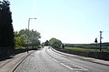
Dunnockshaw was one of the booths in the Forest of Rossendale. By the 17th century it was the property of the Towneleys of Hurstwood, probably by inheritance from the Ormerod family. [3] The road that is now the A682 was built by the Burnley and Edenfield Turnpike Trust following a 1795 act of Parliament, to improve transport to Manchester. [4]

The three-storey Oak Mill was erected as a combined spinning and weaving mill in 1840 for a colliery owner and quarry master named Peter Pickup. Subsequently, extended, a fire in 1907 gutted much of the building and the interior was reconstructed. It has not been used by the textile industry since at least the early 1970s, when glass fibre products began being produced here. [5]

Burnt Hills Colliery was owned by the Executors of John Hargreaves, operating from the 1840s until official closure in 1920. It worked the Upper and Lower Mountain mines [lower-alpha 1] and in 1842 employed 20 men and boys. A surface tramroad connected to Porters Gate Colliery on the north side of the hill by about 1863. In 1880 the tramroad was extended from Porters Gate to connect to the system at Hapton Valley Colliery, creating an almost 4.8-kilometre (3 mi) long route that reached the Leeds and Liverpool Canal at Gannow in Burnley. In 1892 it had two 44-metre (48 yd) shafts with a single-cylinder winding engine along with an underground engine which drove a 3.2-kilometre (2 mi) long haulage system that raised the coal through a surface drift. It is uncertain when production stopped, as after 1910 any output was recorded with Hapton Valley. The coal staithe next to Cotton Row and tramroad continued to operate for some time after 1920. [6]

Permission to construct the reservoir at Clowbridge—historically known as the Hapton Reservoir—on the Limy Water, was contained in the 1853 that act created the Haslingden and Rawtenstall Waterworks Company. [7] [8] 18 months after starting construction under the supervision of Thomas Hawksley, work was suspended as the company expended all its capital. After a three-year hiatus work recommenced under the direction of Joseph Jackson, and although nearing completion in 1863, a series of landslips meant work was not completed until August 1865. The total cost was at least £46,547 (the equivalent of £4.73 million as of 2024 [lower-alpha 2] ). [9] Later taken-over by the Bury Corporation, in 1898 it was recorded to cover an area of 88 acres (36 ha) and have a capacity of 350 million imperial gallons (1.6 million cubic metres; 1.6 billion litres). Some of its water supply is pumped from an old mineshaft belonging to the Gambleside Colliery. At the end of the 19th century a total population of 110 lived in 22 houses within the "gathering ground" of the reservoir, with Cronkshaw Hill farmhouse located very close to the shoreline. Concerns over pollution lead to increased restrictions on farming in the area. [10]

During World War II a Starfish site bombing decoy was constructed on Hameldon hill near Heights Farm, part of a network designed to protect Accrington. [11] Its site is protected as a Scheduled monument. [12]

Governance

Dunnockshaw was once a township in the ancient parish of Whalley. This became a civil parish in 1866, forming part of the Burnley Rural District from 1894. At that time the Clowbridge area, previously part of Hapton, [lower-alpha 3] transferred to Dunnockshaw but a detached area on Hameldon called Dunnockshaw Close moved to Hapton in 1935. [14] Since 1974 Dunnockshaw has formed part of the Borough of Burnley. Another change which took effect at the start of 1983, transferred part of Habergham Eaves lying west of Limey Lane into this civil parish. [15]

Along with Habergham Eaves and a small part of Burnley, the parish forms the Coalclough with Deerplay ward of the borough council. [16] The ward elects three councillors, currently Gordon Birtwistle and Howard Baker of the Liberal Democrats, and Bill Brindle (Labour). [17] The parish is represented on Lancashire County Council as part of the Padiham & Burnley West division, represented since 2017 by Alan Hosker (Conservative). [18]

The Member of Parliament for Burnley, the constituency into which the parish falls, is Antony Higginbotham (Conservative), who was first elected in 2019.

Demography

According to the United Kingdom Census 2011, the parish has a population of 185, a decrease from 212 in the 2001 census. This represents a decline of

In 2011 the average (mean) age of residents was 42.9 years, with a roughly even distribution between males and females. The racial composition was 98.9% White (all White British) with just two people of mixed ethnic groups. 67% reported there religion as Christian. 71.9% of adults between the ages of 16 and 74 were classed as economically active and in work. [1]

Year19011911192119311951196120012011
Population518517489429331309212185
[14] [19] [1]

See also

Related Research Articles

<span class="mw-page-title-main">Burnley</span> Town in England

Burnley is a town and the administrative centre of the wider Borough of Burnley in Lancashire, England, with a 2001 population of 73,021. It is 21 miles (34 km) north of Manchester and 20 miles (32 km) east of Preston, at the confluence of the River Calder and River Brun.

<span class="mw-page-title-main">Borough of Rossendale</span> Borough and non-metropolitan district in Lancashire, England

Rossendale is a local government district with borough status in Lancashire, England. Its council is based in Bacup and its largest town is Rawtenstall. It also includes the towns of Haslingden and Whitworth. The borough is named after the Rossendale Valley, the upper part of the River Irwell.

<span class="mw-page-title-main">Borough of Burnley</span> Borough in Lancashire, England

The Borough of Burnley is a local government district with the borough status in Lancashire, England. It has an area of 42.7 square miles (110.7 km2) and a population of 94,721 (2021), and is named after its largest town, Burnley. The borough also contains the town of Padiham along with several villages and surrounding rural areas.

<span class="mw-page-title-main">Blackburn Hundred</span> Former sub-division of Lancashire, UK

Blackburn Hundred is a historic sub-division of the county of Lancashire, in northern England. Its chief town was Blackburn, in the southwest of the hundred. It covered an area similar to modern East Lancashire, including the current districts of Ribble Valley, Pendle, Burnley, Rossendale, Hyndburn, Blackburn with Darwen, and South Ribble.

<span class="mw-page-title-main">Gambleside</span> Abandoned village in Lancashire, England

Gambleside is an abandoned village located in northern Rossendale close to the boundary with Burnley's Dunnockshaw parish.

<span class="mw-page-title-main">Rossendale Valley</span> River valley in Lancashire, England

The Rossendale Valley is in the Rossendale area of Lancashire, England, between the West Pennine Moors and the main range of the Pennines. The area includes the steep-sided valleys of the River Irwell and its tributaries, which flow southwards into Greater Manchester. The rivers cut through the moorland of the Rossendale Hills, generally characterized by open unwooded land, despite the ancient designation of "forest".

<span class="mw-page-title-main">Rawtenstall</span> Town in Rossendale, Lancashire, England

Rawtenstall is a town in the borough of Rossendale, Lancashire, England. The town lies 15 miles north of Manchester, 22 miles east of Preston and 45 miles south east of Lancaster. The town is at the centre of the Rossendale Valley. It had a population of 23,000.

Burnley was a Rural district of Lancashire, England from 1894 to 1974. It was named after but did not include the large town of Burnley, which was a county borough.

<span class="mw-page-title-main">Ightenhill</span> Parish in Burnley, England

Ightenhill is a civil parish in the Borough of Burnley in Lancashire, England, with a population of 1,975.

<span class="mw-page-title-main">Hapton, Lancashire</span> Human settlement in England

Hapton is a village and civil parish in the Borough of Burnley in Lancashire, England, 3 miles (4.8 km) west of Burnley, with a railway station on the East Lancashire Line. At the United Kingdom Census 2011, it had a population of 1,979.

<span class="mw-page-title-main">Burnley Way</span> Long-distance footpath in Lancashire, England

The Burnley Way is a 40-mile (64 km) long distance footpath in Lancashire, England. As a circular walk it can be walked from any point, but it is common to start and finish at the Weavers' Triangle Visitor Centre in Burnley. It covers a range of terrain from canal towpaths to open moorland.

<span class="mw-page-title-main">Habergham Eaves</span> Human settlement in England

Habergham Eaves is a civil parish in the borough of Burnley, in Lancashire, England. The parish consists of a rural area south of Burnley, and suburban areas on the outskirts of the town, including a large industrial estate in the north-west corner of the parish. Habergham is also the name of an area west of Burnley, although it is no longer within the parish. According to the United Kingdom Census 2011, the parish has a population of 1,466.

<span class="mw-page-title-main">Worsthorne-with-Hurstwood</span> Human settlement in England

Worsthorne-with-Hurstwood is a civil parish in the Borough of Burnley, in Lancashire, England. Situated on the eastern outskirts of Burnley, in 2011 it had a population of 2,963.

<span class="mw-page-title-main">Loveclough</span> Human settlement in England

Loveclough is a small hamlet at the edge of the Rossendale Valley, in Lancashire, England, near Crawshawbooth and Rawtenstall, 20 miles north of Manchester, 21 miles east of Preston, and 44 miles south east of Lancaster.

<span class="mw-page-title-main">Hameldon Hill</span>

Hameldon Hill is a Carboniferous sandstone hill with a summit elevation of 409 metres (1,342 ft), situated between the towns of Burnley and Accrington in Lancashire, England. It is listed as a "HuMP" or "Hundred Metre Prominence", its parent being Freeholds Top, a Marilyn near Bacup.

<span class="mw-page-title-main">Broadclough</span> Human settlement in England

Broadclough – historically Broad Clough – is a village located to the north of Bacup, previously having been a part of the old borough of Bacup and now with Rossendale borough of Lancashire and part of the Greenclough Ward. It is part of the Rossendale and Darwen constituency, with Jake Berry having been the Member of Parliament since 2010. Like much of Bacup, Broadclough is rapidly becoming a commuter area for cities and towns such as Manchester, Burnley, Accrington, Preston, Blackburn, Rochdale.

<span class="mw-page-title-main">Limy Water</span> River in Lancashire, England

The Limy Water is a minor river in Lancashire, England. It is 4.95 miles (7.96 km) long and has a catchment area of 7.71 square miles (1,996.33 ha).

<span class="mw-page-title-main">Burnley Coalfield</span> Coal mining region in England

The Burnley Coalfield is the most northerly portion of the Lancashire Coalfield. Surrounding Burnley, Nelson, Blackburn and Accrington, it is separated from the larger southern part by an area of Millstone Grit that forms the Rossendale anticline. Occupying a syncline, it stretches from Blackburn past Colne to the Yorkshire border where its eastern flank is the Pennine anticline.

Hapton Valley Colliery was a coal mine on the edge of Hapton near Burnley in Lancashire, England. Its first shafts were sunk in the early 1850s and it had a life of almost 130 years, surviving to be the last deep mine operating on the Burnley Coalfield.

References

Notes

  1. In this part of Lancashire a coal seam is referred to as a mine and the coal mine as a colliery or pit.
  2. UK Retail Price Index inflation figures are based on data from Clark, Gregory (2017). "The Annual RPI and Average Earnings for Britain, 1209 to Present (New Series)". MeasuringWorth. Retrieved 11 June 2022.
  3. The old township boundary with Hapton broadly followed Limy Water and is today beneath Clowbridge Reservoir. [13]

Citations

  1. 1 2 3 4 5 6 UK Census (2011). "Local Area Report – Dunnockshaw Parish (E04005133)". Nomis. Office for National Statistics . Retrieved 28 March 2021.
  2. Ekwall, Eilert (1922). The place-names of Lancashire. Manchester University Press. pp. 16, 100. Retrieved 5 April 2021.
  3. Farrer, William; Brownbill, John, eds. (1911). The Victoria History of the County of Lancaster Vol 6. Victoria County History. Constable & Co. p. 514. OCLC   832215477 . Retrieved 5 April 2021.
  4. "BURNLEY: HISTORIC TOWN ASSESSMENT REPORT" (PDF). Lancashire County Council. 2005. p. 66. Retrieved 11 April 2021.
  5. Historic England. "Oak Mill (1585454)". Research records (formerly PastScape). Retrieved 8 April 2021.
  6. Nadin, Jack (1997), British Mining No. 58 The Coal Mines of East-Lancashire, Northern Mine Research Society, pp. 46, 92, 121, ISBN   0901450480
  7. "Local and Personal Acts Declared Public (1853)". Parliamentary Debates (Hansard) . House of Commons. 20 August 1853. Retrieved 8 April 2021.
  8. "No. 21385". The London Gazette . 26 November 1852. pp. 3368–3369.
  9. "Visit to Goodshaw Chapel and Gambleside, Rossendale". www.chorleyhistorysociety.co.uk. 15 July 2017. Retrieved 11 April 2021.
  10. Bruce Low, R (1898). Report on the sources and circumstances of the water service provided by the Bury Corporation... H.M. Stationery Office. pp. 94, 102. Retrieved 5 April 2021.{{cite book}}: |work= ignored (help)
  11. Historic England. "STARFISH BOMBING DECOY SF35E (1360177)". Research records (formerly PastScape). Retrieved 31 July 2015.
  12. Lancashire and Furness (Map) (1st ed.). 1 : 10,560. County Series. Ordnance Survey. 1848.
  13. 1 2 "Dunnockshaw Tn/CP through time". visionofbritain.org.uk. GB Historical GIS / University of Portsmouth. Retrieved 27 June 2015.
  14. "The Burnley (Parishes) Order 1982" (PDF). LGBCE. 29 September 1982. Retrieved 11 April 2021.
  15. "Wards and parishes map". MARIO. Lancashire County Council. Retrieved 28 March 2021.
  16. "Your Councillors". burnley.moderngov.co.uk. Burnley Borough Council. Retrieved 28 March 2021.
  17. "County Councillors by Local Community". Lancashire County Council. Archived from the original on 13 June 2021. Retrieved 28 March 2021.
  18. 1 2 UK Census (2001). "Local Area Report – Dunnockshaw Parish (30UD003)". Nomis. Office for National Statistics . Retrieved 28 March 2021.