Duxbury (CDP), Massachusetts

Last updated
Duxbury, Massachusetts
John Alden House in Duxbury, Massachusetts.jpg
John Alden House
Plymouth County Massachusetts incorporated and unincorporated areas Duxbury (CDP) highlighted.svg
Location in Plymouth County in Massachusetts
Coordinates: 42°2′34″N70°40′23″W / 42.04278°N 70.67306°W / 42.04278; -70.67306 Coordinates: 42°2′34″N70°40′23″W / 42.04278°N 70.67306°W / 42.04278; -70.67306
Country United States
State Massachusetts
County Plymouth
Area
[1]
  Total2.66 sq mi (6.89 km2)
  Land2.21 sq mi (5.72 km2)
  Water0.45 sq mi (1.17 km2)
Elevation
16 ft (5 m)
Population
 (2020)
  Total1,896
  Density858.70/sq mi (331.58/km2)
Time zone UTC-5 (Eastern (EST))
  Summer (DST) UTC-4 (EDT)
ZIP codes
02331-02332
Area code 781
FIPS code 25-17860
GNIS feature ID0615025

Duxbury is a census-designated place (CDP) in the town of Duxbury in Plymouth County, Massachusetts, United States. The population was 1,802 at the 2010 census. [2]

Contents

Geography

Duxbury is located at 42°2′34″N70°40′22″W / 42.04278°N 70.67278°W / 42.04278; -70.67278 (42.042891, -70.672928). [3]

According to the United States Census Bureau, the CDP has a total area of 6.8 km2 (2.6 mi2), of which 5.6 km2 (2.2 mi2) is land and 1.2 km2 (0.4 mi2) (17.18%) is water.

Demographics

Historical population
CensusPop.
2020 1,896
U.S. Decennial Census [4]

As of the census [5] of 2000, there were 1,426 people, 499 households, and 415 families residing in the CDP. The population density was 253.7/km2 (656.1/mi2). There were 567 housing units at an average density of 100.9/km2 (260.9/mi2). The racial makeup of the CDP was 98.18% White, 0.07% Black or African American, 0.14% Native American, 0.84% Asian, 0.35% from other races, and 0.42% from two or more races. Hispanic or Latino of any race were 0.70% of the population.

There were 499 households, out of which 40.7% had children under the age of 18 living with them, 78.4% were married couples living together, 4.4% had a female householder with no husband present, and 16.8% were non-families. 14.4% of all households were made up of individuals, and 6.0% had someone living alone who was 65 years of age or older. The average household size was 2.86 and the average family size was 3.19.

In the CDP, the population was spread out, with 29.4% under the age of 18, 3.9% from 18 to 24, 20.9% from 25 to 44, 33.1% from 45 to 64, and 12.7% who were 65 years of age or older. The median age was 42 years. For every 100 females, there were 97.0 males. For every 100 females age 18 and over, there were 91.4 males.

The median income for a household in the CDP was $105,683, and the median income for a family was $125,346. Males had a median income of $85,783 versus $45,417 for females. The per capita income for the CDP was $44,589. About 1.6% of families and 2.6% of the population were below the poverty line, including 3.7% of those under age 18 and 5.3% of those age 65 or over.

Related Research Articles

Dot Lake Village is a census-designated place (CDP) in Southeast Fairbanks Census Area, Alaska, United States. The population was 62 at the 2010 census, up from 38 in 2000.

<span class="mw-page-title-main">Cumberland Center, Maine</span> Census-designated place in Maine, United States

Cumberland Center is a census-designated place (CDP) within the town of Cumberland in Cumberland County, Maine, United States. The population was 2,499 at the 2010 census. It is part of the Portland – South Portland – Biddeford, Maine, Metropolitan Statistical Area.

<span class="mw-page-title-main">St. James, Maryland</span> CDP in Maryland, United States

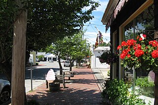
St. James is a census-designated place (CDP) in Washington County, Maryland, United States. The population was 1,657 at the 2000 census. It is also the home of St. James School, Hagerstown, a small, Episcopalian, boarding school. St. James was formerly named "Lydia."

Green Harbor-Cedar Crest was a census-designated place (CDP) in the towns of Duxbury and Marshfield in Plymouth County, United States. It included the village of Green Harbor, on the shore of Massachusetts Bay, and the community of Cedar Crest, occupying a hill on the north side of Careswell Street. The population of the CDP was 2,609 at the 2010 census. Prior to the 2020 census the area was split into two CDPs, Green Harbor and Cedar Crest.

<span class="mw-page-title-main">Marion Center, Massachusetts</span> Census-designated place in Massachusetts, United States

Marion Center is a census-designated place (CDP) in the town of Marion in Plymouth County, Massachusetts, United States. The population was 1,111 at the 2010 census.

<span class="mw-page-title-main">Marshfield Hills, Massachusetts</span> Census-designated place in Massachusetts, United States

Marshfield Hills is a census-designated place (CDP) in the town of Marshfield in Plymouth County, Massachusetts, United States. The population was 2,356 at the 2010 census. The historic center of the village has been designated a historic district and listed on the National Register of Historic Places.

<span class="mw-page-title-main">North Pembroke, Massachusetts</span> Census-designated place in Massachusetts, United States

North Pembroke is a census-designated place (CDP) in the town of Pembroke in Plymouth County, Massachusetts, United States. The population was 3,292 at the 2010 census.

<span class="mw-page-title-main">North Scituate, Massachusetts</span> Census-designated place in Massachusetts, United States

North Scituate is a census-designated place (CDP) in the town of Scituate in Plymouth County, Massachusetts, United States. The population was 5,077 at the 2010 census. It was formerly known as Gannet Corner.

<span class="mw-page-title-main">South Duxbury, Massachusetts</span> Census-designated place in Massachusetts, United States

South Duxbury is a census-designated place (CDP) in the town of Duxbury in Plymouth County, Massachusetts, United States. The population was 3,360 at the 2010 census.

<span class="mw-page-title-main">Wareham Center, Massachusetts</span> Census-designated place in Massachusetts, United States

Wareham Center is a census-designated place (CDP) in the town of Wareham in Plymouth County, Massachusetts, United States. The population was 2,896 at the 2010 census.

<span class="mw-page-title-main">Leisure Knoll, New Jersey</span> Census-designated place in New Jersey, United States

Leisure Knoll is an unincorporated community and census-designated place (CDP) located within Manchester Township, in Ocean County, New Jersey, United States. As of the 2010 United States Census, the CDP's population was 2,490.

<span class="mw-page-title-main">Rowley (CDP), Massachusetts</span> Census-designated place in Massachusetts, United States

Rowley is a census-designated place (CDP) in the town of Rowley in Essex County, Massachusetts, United States. The population was 1,416 at the 2010 census.

<span class="mw-page-title-main">Hanson (CDP), Massachusetts</span> Census-designated place in Massachusetts, United States

Hanson is a census-designated place (CDP) in the town of Hanson in Plymouth County, Massachusetts, United States. The population was 2,118 at the 2010 census.

<span class="mw-page-title-main">Hingham (CDP), Massachusetts</span> Census-designated place in Massachusetts, United States

Hingham is a census-designated place (CDP) in the town of Hingham in Plymouth County, Massachusetts, United States. The population was 5,650 at the 2010 census.

<span class="mw-page-title-main">Marshfield (CDP), Massachusetts</span> Census-designated place in Massachusetts, United States

Marshfield is a census-designated place (CDP) in the town of Marshfield in Plymouth County, Massachusetts, United States. The population was 4,335 at the 2010 census.

<span class="mw-page-title-main">Scituate (CDP), Massachusetts</span> Census-designated place in Massachusetts, United States

Scituate is a census-designated place (CDP) in the town of Scituate in Plymouth County, Massachusetts, United States. The population was 5,245 at the 2010 census.

<span class="mw-page-title-main">Athol (CDP), Massachusetts</span> CDP in Massachusetts, United States

Athol is a census-designated place (CDP) in the town of Athol in Worcester County, Massachusetts, United States. The population was 8,265 at the 2010 census.

<span class="mw-page-title-main">Barre (CDP), Massachusetts</span> CDP in Massachusetts, United States

Barre is a census-designated place (CDP) in the town of Barre in Worcester County, Massachusetts, United States. The population was 1,009 at the 2010 census.

<span class="mw-page-title-main">Rib Mountain (CDP), Wisconsin</span> CDP in Wisconsin, United States

Rib Mountain is a census-designated place (CDP) in the town of Rib Mountain in Marathon County, Wisconsin, United States. The population was 5,651 at the 2010 census.

<span class="mw-page-title-main">Pepperell (CDP), Massachusetts</span> Census-designated place in Massachusetts, United States

Pepperell is a census-designated place (CDP) in the town of Pepperell in Middlesex County, Massachusetts, United States. The population was 2,504 at the 2010 census.

References

  1. "2020 U.S. Gazetteer Files". United States Census Bureau. Retrieved May 21, 2022.
  2. "Profile of General Population and Housing Characteristics: 2010 Demographic Profile Data (DP-1): Duxbury CDP, Massachusetts". United States Census Bureau . Retrieved March 22, 2012.
  3. "US Gazetteer files: 2010, 2000, and 1990". United States Census Bureau. 2011-02-12. Retrieved 2011-04-23.
  4. "Census of Population and Housing". Census.gov. Retrieved June 4, 2016.
  5. "U.S. Census website". United States Census Bureau . Retrieved 2008-01-31.