East Camp

Last updated

East Camp
Mallory Close, East Camp - St Athan.jpg
Mallory Close, East Camp
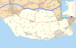
Vale of Glamorgan UK location map.svg
Red pog.svg
East Camp
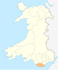
Location within the Vale of Glamorgan
Principal area
Ceremonial county
Country Wales
Sovereign state United Kingdom
Post town Barry
Postcode district CF62
Dialling code 01446
Police South Wales
Fire South Wales
Ambulance Welsh
UK Parliament
Senedd Cymru – Welsh Parliament
List of places
UK
Wales
Vale of Glamorgan
51°24′43″N3°24′54″W / 51.412°N 3.415°W / 51.412; -3.415 Coordinates: 51°24′43″N3°24′54″W / 51.412°N 3.415°W / 51.412; -3.415

East Camp is an Ex-MOD housing estate opposite the MOD St Athan main east entrance within St Athan. The housing estate sits between the village of St Athan and Flemingston but does not constitute a village itself. It falls under the Flemingston & Eglwys Brewis electoral ward. [1]

Contents

Due to it being Ex-MOD property there are some particular arrangements regarding build and service supply to the properties. The Sewage is handled by Kelda Water Services (Defence) Limited [2] and fresh water, management of the private parking, street lighting and areas of play is handled by a society called the East Vale Residents Co. Ltd. [3] who outsource to Cadarn, the parent group of Newydd Housing Association. [4]

East Camp houses a Food Bank. [5]

The St Athan Golf Club is to the rear (east) of East Camp, [6] next to a disused running track. [7]

1st St Athan Scout Group meet at East Camp, mainly at The Gathering Place. [8]
History

In World War II East Camp maintenance units were bomb targets because of the RAF activity there. [9] The particular fresh water arrangement [10] to site was also to prevent troops/staff being poisoned as all water was treated on the RAF site.

The buildings are concrete prefabrications said to be built for the 1958 British Empire and Commonwealth Games [11] and later used for the R.A.F. families. Due to their similar design and the way the buildings lock together like blocks, the estate was also nicknamed "Legoland". It also has the nickname Explorers Estate as each of the streets, Scott Close, Shackleton Close, Livingston Way, Drake Close, Clive Road and Mallory Close were named after discoverers, Flemingston Road being a pre-existing road.

The local Spar used to be Naafi (Navy, Army, Air Force, Institutes) as part of the R.A.F.'s stores but later opened to the public as a Spar. This is now closed.

28 April 2016 a Food Bank opened on East Camp's The Gathering Place. [12]

Transport

Taxi [13] and Greenlinks [14] operate to East Camp but the only public transport is a bus service. [15]

There is a bridle path to the north of East Camp, near Flemingston. [16]

Landmarks

The Gathering Place Methodist Church is on the corner of the northern Flemingston Road entrance to East Camp. The Gathering Place is also a community centre. [17]

Related Research Articles

Vale of Glamorgan County borough in Wales

The Vale of Glamorgan, often referred to as The Vale, is a county borough in the south-east of Wales. It borders Bridgend County Borough to the west, Cardiff to the east, Rhondda Cynon Taf to the north, and the Bristol Channel to the south. With an economy based largely on agriculture and chemicals, it is the southernmost unitary authority in Wales. Attractions include Barry Island Pleasure Park, the Barry Tourist Railway, Medieval wall paintings in St Cadoc's Church, Llancarfan, Porthkerry Park, St Donat's Castle, Cosmeston Lakes Country Park and Cosmeston Medieval Village. The largest town is Barry. Other towns include Penarth, Llantwit Major, and Cowbridge. There are many villages in the county borough.

Formby Town in England

Formby is a town and civil parish in the Metropolitan Borough of Sefton, Merseyside, England, which had a population of 22,419 at the 2011 Census.

RAF Halton

Royal Air Force Halton, or more simply RAF Halton, is one of the largest Royal Air Force stations in the United Kingdom. It is located near the village of Halton near Wendover, Buckinghamshire. The site has been in use since the First World War but is due to close by 2025.

Aldridge Town in West Midlands, England

Aldridge is a town and former civil parish in the Walsall borough, West Midlands, England. It is historically a village that was part of Staffordshire until 1974.

MoD Lyneham

Ministry of Defence Lyneham or MOD Lyneham is a Ministry of Defence site in Wiltshire, England, about 7 miles (11 km) northeast of Chippenham and 9 miles (14 km) southwest of Swindon. The site houses the Defence School of Electronic and Mechanical Engineering. Also here is Prince Philip Barracks, housing the regimental headquarters of the Royal Electrical and Mechanical Engineers (REME), 8 Training Battalion REME and the REME Museum.

Bingham, Nottinghamshire Town in Nottinghamshire, England

Bingham is a market town in the Rushcliffe borough of Nottinghamshire, England, 9 miles (14 km) east of Nottingham, 11.7 miles south-west of Newark-on-Trent and 14.5 miles west of Grantham. The town had a population of 9,131 at the 2011 census.

Tadworth Human settlement in England

Tadworth is a large suburban village in Surrey, England in the south-east of the Epsom Downs, part of the North Downs. It forms part of the Borough of Reigate and Banstead. At the 2011 census, Tadworth had a population of 7,123

Shard End Human settlement in England

Shard End is an area of Birmingham, England. It is also a ward within the formal district of Hodge Hill. Shard End borders Castle Bromwich to the north and Kingshurst to the east which are situated in the northern part of the neighbouring Metropolitan Borough of Solihull.

Catterick Garrison Garrison and military town in North Yorkshire, England

Catterick Garrison is a major garrison and military town 3 miles (5 km) south of Richmond, North Yorkshire, England. It is the largest British Army garrison in the world, with a population of around 13,000 in 2017 and covering over 2,400 acres. Under plans announced by the Ministry of Defence (MoD) in November 2005, its population is expected to grow to over 25,000, making it the largest population centre in the local area.

MOD St Athan

Ministry of Defence St Athan or MOD St Athan, formerly known as RAF St Athan, is a large Ministry of Defence unit near the village of St Athan in the Vale of Glamorgan, southern Wales. It was the designated site for the United Kingdom's new defence training academy, but the programme was cancelled on 19 October 2010.

St Athan Human settlement in Wales

St Athan is a village and community in the Vale of Glamorgan in South Wales. The village and its parish church are dedicated to Saint Tathan. The church dates to the 13th–14th century, though an earlier church was dated to the Norman period. The village and the adjacent dormitory village of Eglwys Brewis are known primarily for the MOD St Athan RAF base. There is one pub in the village, as well as a football team at St Athan Football Club and the St Athan Golf Club. The community includes West Aberthaw.

Headley Down is a village within the civil parish of Headley in the East Hampshire district of Hampshire, England, bounded on two sides by Ludshott Common, a National Trust heathland reserve. The village began with a few buildings in the 1870s and became a thriving community that in the 20th century outgrew the parish centre of Headley.

The Defence School of Electronic and Mechanical Engineering (DSEME) is one of four Defence Schools within the Defence College of Technical Training (DCTT) of the British Ministry of Defence. It was formed on 1 Apr 2010 and comprises a Headquarters, the British Army's 8 Training Battalion of the Royal Electrical and Mechanical Engineers (REME), and the REME Arms School all based at MOD Lyneham, and the Royal Air Force's No. 4 School of Technical Training at MOD St Athan.

Eglwys Brewis Human settlement in Wales

Eglwys Brewis is a village in the Vale of Glamorgan in south Wales. It is located just to the north of the village of St Athan, south of Flemingston and northeast of Llantwit Major. Greenlands and St Mary Church lie to the north by road from Eglwys Brewis. The village consists primarily of residential estates which were originally built in the mid-20th century for service families stationed at nearby RAF St Athan. The estates are regularly used by driving instructors in the Vale of Glamorgan. Nant y Stepsau flows in the vicinity.

RAF Cosford Royal Air Force base in Shropshire, England

Royal Air Force Cosford or RAF Cosford is a Royal Air Force station in Cosford, Shropshire, just to the northwest of Wolverhampton and next to Albrighton.

St Athan Road railway station served the village of St Athan in the Vale of Glamorgan in South Wales.

Gileston railway station

Gileston railway station served the village of Gileston in South Wales.

St Athan railway station was a railway station in South Wales.

Military of Wales

The Military of Wales refers to military bases and organisation in Wales or associated with Wales. This includes servicemen and women from Wales and Welsh regiments and brigades of the British Armed Forces.

References

  1. "Councillors - St Athan Community Council". 17 October 2016.
  2. "Welcome to Kelda Water Services".
  3. "EAST VALE RESIDENTS COMPANY LIMITED". Companies House. UK Government. Retrieved 2 January 2017.
  4. "The Cadarn Housing Group: Welcome". Archived from the original on 3 August 2020. Retrieved 10 June 2016.
  5. "Aramark St Athan Barry St. Athan".
  6. "Home".
  7. "RAF St. Athan Track".
  8. "1st St Athan Scout Group - Providing scouting adventures to the young people in the area".
  9. "RadSci Consultancy Ltd - A radiation imaging consultancy - X-Ray Radiography, Neutron Radiography".
  10. "St Athan Development Brief" (PDF). Vale of Glamorgan council website. Metrix. Retrieved 2 January 2017.
  11. "St. Athan (British Empire and Commonwealth Games) (Hansard, 23 July 1958)".
  12. "Foodbank opens at Gathering Place".
  13. "Taxis".
  14. "Greenlinks".
  15. "Archived copy". Archived from the original on 30 June 2016. Retrieved 10 June 2016.{{cite web}}: CS1 maint: archived copy as title (link)
  16. "Footpath, Byway, and Bridleway Map" . Retrieved 12 June 2022.
  17. "The Gathering Place".