East Ipswich, Queensland

Last updated

East Ipswich
Ipswich,  Queensland
East Ipswich Permaculture Gardens 2023.jpg
Permaculture Gardens, 2023
Australia Queensland location map.svg
Red pog.svg
East Ipswich
East Ipswich, Queensland
Coordinates 27°36′24″S152°46′34″E / 27.6066°S 152.7761°E / -27.6066; 152.7761
Population2,410 (2016 census) [1]
 • Density1,420/km2 (3,670/sq mi)
Postcode(s) 4305
Area1.7 km2 (0.7 sq mi)
Time zone AEST (UTC+10:00)
Location
LGA(s) City of Ipswich
State electorate(s) Ipswich
Federal division(s) Blair
Suburbs around East Ipswich:
Basin Pocket Moores Pocket Moores Pocket
North Ipswich East Ipswich North Booval
Ipswich Newtown Booval

East Ipswich is a residential inner-city suburb of Ipswich in the City of Ipswich, Queensland, Australia. [2] In the 2016 census, East Ipswich had a population of 2,410 people. [1]

Contents

Geography

East Ipswich Railway Station, 2012 East Ipswich Railway Station, Queensland, Sep 2012.JPG
East Ipswich Railway Station, 2012

One of the older suburbs, East Ipswich is predominantly made up of weatherboard and fibro houses punctuated with larger heritage houses, and newer townhouses and flats. [3]

The suburb is bordered on the north and west by two sections of the Bremer River (split by the small suburb of Basin Pocket); and to the south by Brisbane Road, the city's main arterial link to the Ipswich Motorway.

The Main Line railway passes through the suburb from east (Ipswich) to west (Booval); the suburb is served by the East Ipswich railway station. [4]

A small set of shops on Jacaranda Street provides basic services, while several restaurants line Brisbane Road.

History

On Sunday 12 June 1949, the Apostolic church was officially opened by Apostle Emil Zielke of Bundaberg. The ceremony was attended by almost 1,000 people. It was the first church of the Apostolic Church of Queensland to be established in Ipswich. The church had originally been erected at Waterford, but it was demolished and re-erected in East Ipswich by voluntary labour. [5]

Ipswich East State School opened on 28 January 1958 with an initial enrolment of 166 students rising to 235 students that year. [6] [7]

In August 1980, East Ipswich Uniting Church congregation in Chermside Road joined Trinity Uniting Church in North Booval. [8]

At the 2011 census, East Ipswich had a population of 2,194 people. [9]

In the 2016 census, East Ipswich had a population of 2,410 people. [1]

Transport

East Ipswich railway station provides access to regular Queensland Rail City network services to Brisbane, Ipswich and Rosewood via Ipswich.

Education

Ipswich East State School, 2024 Ipswich East State School, 2024 01.jpg
Ipswich East State School, 2024
Playground, Ipswich East State School, 2024 Playground, Ipswich East State School, 2024.jpg
Playground, Ipswich East State School, 2024

Ipswich East State School is a government primary (Prep-6) school for boys and girls at 18-24 Jacaranda Street ( 27°36′24″S152°46′37″E / 27.6068°S 152.7769°E / -27.6068; 152.7769 (Ipswich East State School) ). [10] [11] In 2017, the school had an enrolment of 373 students with 42 teachers (35 full-time equivalent) and 28 non-teaching staff (17 full-time equivalent). [12] It includes a special education program. [10] [13]

Ipswich Positive Learning Centre is a specific-purpose primary and secondary (5-10) school at 12 Blackwood Street ( 27°36′21″S152°46′41″E / 27.6057°S 152.7781°E / -27.6057; 152.7781 (Ipswich Positive Learning Centre) ). [10]

There is no general purpose secondary school in East Ipswich. The nearest secondary schools are Bremer State High School in Ipswich CBD and Bundamba State Secondary College in Bundamba. [4]

Sports facilities

Places of worship

The Apostolic Church is at 25 Kendall Street. [14]

Heritage listings

The Kyeewa residence dates from around 1890. Kyeewa 2, East Ipswich, Queensland.jpg
The Kyeewa residence dates from around 1890.

East Ipswich has a number of heritage-listed sites, including:

Related Research Articles

<span class="mw-page-title-main">Oxley, Queensland</span> Suburb of Brisbane, Queensland, Australia

Oxley is a south-western suburb in the City of Brisbane, Queensland, Australia. In the 2016 census, Oxley had a population of 8,336 people.

<span class="mw-page-title-main">Goodna, Queensland</span> Suburb of Ipswich, Queensland, Australia

Goodna is a suburb on the eastern edge of the City of Ipswich in Queensland, Australia. In the 2016 census, Goodna had a population of 10,461 people.

<span class="mw-page-title-main">Sherwood, Queensland</span> Suburb of Brisbane, Queensland, Australia

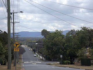
Sherwood is a suburb in the City of Brisbane, Queensland, Australia. In the 2021 census, Sherwood had a population of 6,082 people.

<span class="mw-page-title-main">North Ipswich, Queensland</span> Suburb of Ipswich, Queensland, Australia

North Ipswich is a suburb of Ipswich in the City of Ipswich, Queensland, Australia. In the 2016 census, North Ipswich had a population of 4,515 people.

<span class="mw-page-title-main">Basin Pocket, Queensland</span> Suburb of Ipswich, Queensland, Australia

Basin Pocket is a suburb of Ipswich in the City of Ipswich, Queensland, Australia. In the 2016 census, Basin Pocket had a population of 890 people.

<span class="mw-page-title-main">Bundamba, Queensland</span> Suburb of Ipswich, Queensland, Australia

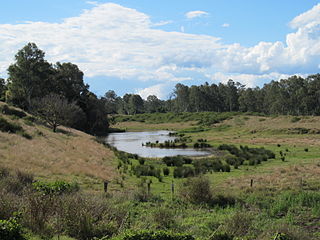
Bundamba is a suburb of Ipswich in the City of Ipswich, Queensland, Australia. In the 2016 census Bundamba had a population of 6,514 people.

<span class="mw-page-title-main">North Booval, Queensland</span> Suburb of Ipswich, Queensland, Australia

North Booval is a suburb of Ipswich in the City of Ipswich, Queensland, Australia. In the 2016 census, North Booval had a population of 3,175 people.

<span class="mw-page-title-main">Newtown, Queensland (Ipswich)</span> Suburb of Ipswich, Queensland, Australia

Newtown is a suburb in the City of Ipswich, Queensland, Australia. In the 2016 census, Newtown had a population of 1,615 people.

<span class="mw-page-title-main">Booval, Queensland</span> Suburb of Ipswich, Queensland, Australia

Booval is a suburb of Ipswich in the City of Ipswich, Queensland, Australia. In the 2016 census Booval had a population of 2,622 people.

<span class="mw-page-title-main">Silkstone, Queensland</span> Suburb of Ipswich, Queensland, Australia

Silkstone is a suburb in the City of Ipswich, Queensland, Australia. In the 2016 census, Silkstone had a population of 3,480 people.

<span class="mw-page-title-main">Blackstone, Queensland</span> Suburb of Ipswich, Queensland, Australia

Blackstone is a suburb of Ipswich in the City of Ipswich, Queensland, Australia. In the 2016 census, Blackstone had a population of 1,024 people.

<span class="mw-page-title-main">Dinmore, Queensland</span> Suburb of Ipswich, Queensland, Australia

Dinmore is a suburb of Ipswich in the City of Ipswich, Queensland, Australia. In the 2016 census, Dinmore had a population of 875 people with an unemployment rate of 16.7%, in comparison to the Australian unemployment rate of 6.9%.

<span class="mw-page-title-main">Riverview, Queensland</span> Suburb of Ipswich, Queensland, Australia

Riverview is a suburb of Ipswich in the City of Ipswich, Queensland, Australia. In the 2016 census, Riverview had a population of 3,073 people and an unemployment rate of 15.7%, compared to the Australian unemployment rate of 6.9%.

<span class="mw-page-title-main">Brassall, Queensland</span> Suburb of Ipswich, Queensland, Australia

Brassall is a suburb in the City of Ipswich, Queensland, Australia. In the 2016 census, Brassall had a population of 10,898 people.

<span class="mw-page-title-main">Sadliers Crossing, Queensland</span> Suburb of Ipswich, Queensland, Australia

Sadliers Crossing is a suburb of Ipswich in the City of Ipswich, Queensland, Australia. In the 2016 census, Sadliers Crossing had a population of 1,366 people.

<span class="mw-page-title-main">Wulkuraka, Queensland</span> Suburb of Ipswich, Queensland, Australia

Wulkuraka is a western suburb of Ipswich in the City of Ipswich, Queensland, Australia. In the 2016 census, Wulkuraka had a population of 1,234 people.

<span class="mw-page-title-main">Redbank, Queensland</span> Suburb of Ipswich, Queensland, Australia

Redbank is a suburb in the City of Ipswich, Queensland, Australia. In the 2016 census, Redbank had a population of 1,834 people.

<span class="mw-page-title-main">South Ripley, Queensland</span> Suburb of Ipswich, Queensland, Australia

South Ripley is a rural locality and suburb of Ipswich in the City of Ipswich, Queensland, Australia. South Ripley is part of the Ecco Ripley urban development area. In the 2016 census, South Ripley had a population of 712 people.

<span class="mw-page-title-main">Hatton Vale</span> Suburb of Lockyer Valley Region, Queensland, Australia

Hatton Vale is a rural locality in the Lockyer Valley Region, Queensland, Australia. In the 2016 census, Hatton Vale had a population of 1,521 people.

<span class="mw-page-title-main">Shire of Bundanba</span>

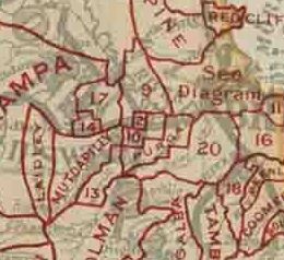
The Shire of Bundanba is a former local government area in the south-east of Queensland, Australia. It existed from 1879 to 1916.

References

  1. 1 2 3 Australian Bureau of Statistics (27 June 2017). "East Ipswich (SSC)". 2016 Census QuickStats. Retrieved 20 October 2018. OOjs UI icon edit-ltr-progressive.svg
  2. "East Ipswich – suburb in City of Ipswich (entry 45042)". Queensland Place Names. Queensland Government . Retrieved 26 January 2020.
  3. "REIQ Suburb profile - East Ipswich".
  4. 1 2 "Queensland Globe". State of Queensland . Retrieved 11 March 2020.
  5. "Big Crowd Sees New Apostolic Church Opened". Queensland Times . No. 19, 484. Queensland, Australia. 13 June 1949. p. 2 (DAILY). Archived from the original on 18 April 2022. Retrieved 18 April 2022 via National Library of Australia.
  6. Queensland Family History Society (2010), Queensland schools past and present (Version 1.01 ed.), Queensland Family History Society, ISBN   978-1-921171-26-0
  7. "History". Ipswich East State School. 27 February 2020. Retrieved 24 February 2024.
  8. "Local History – Trinity Ipswich Uniting Church". Archived from the original on 17 March 2021. Retrieved 28 August 2021.
  9. Australian Bureau of Statistics (31 October 2012). "East Ipswich (State Suburb)". 2011 Census QuickStats. Retrieved 18 October 2011. OOjs UI icon edit-ltr-progressive.svg
  10. 1 2 3 "State and non-state school details". Queensland Government. 9 July 2018. Archived from the original on 21 November 2018. Retrieved 21 November 2018.
  11. "Ipswich East State School". Ipswich East State School. 29 November 2020. Retrieved 24 February 2024.
  12. "ACARA School Profile 2017". Archived from the original on 22 November 2018. Retrieved 22 November 2018.
  13. "Ipswich East SS - Special Education Program". Archived from the original on 1 June 2020. Retrieved 21 November 2018.
  14. Blake, Thom. "Apostolic Church of Queensland, East Ipswich". Queensland religious places database. Archived from the original on 18 April 2022. Retrieved 18 April 2022.
  15. "Kyeewa (entry 600602)". Queensland Heritage Register . Queensland Heritage Council. Retrieved 9 July 2013.