Moores Pocket, Queensland

Last updated

Moores Pocket
Ipswich,  Queensland
Moores Pocket 2023.jpg
Moores Pocket Road, 2023
Australia Queensland location map.svg
Red pog.svg
Moores Pocket
Coordinates 27°35′56″S152°46′57″E / 27.5988°S 152.7825°E / -27.5988; 152.7825 (Moores Pocket (centre of suburb))
Population736 (2016 census) [1]
 • Density820/km2 (2,120/sq mi)
Postcode(s) 4305
Area0.9 km2 (0.3 sq mi)
Time zone AEST (UTC+10:00)
Location
LGA(s) City of Ipswich
State electorate(s) Ipswich West
Federal division(s) Blair
Suburbs around Moores Pocket:
Tivoli North Booval North Booval
Basin Pocket Moores Pocket North Booval
East Ipswich North Booval North Booval

Moores Pocket is a suburb in the City of Ipswich, Queensland, Australia. [2] In the 2016 census, Moores Pocket had a population of 736 people. [1]

Contents

Geography

As the name suggests, Moores Pocket is bounded by the winding Bremer River on all sides except the north-west where it is separated from the suburb of Tivoli by Boundary Road. [3]

History

The origin of the suburb name is from Thomas Moore, an early blacksmith in the area. [2]

The suburb was greatly damaged in the 1893 Brisbane River flood. [4]

The suburb was flooded in the 2011 Queensland floods. [5]

In the 2016 census, Moores Pocket had a population of 736 people. [1]

Related Research Articles

<span class="mw-page-title-main">Brisbane River</span> River in Queensland, Australia

The Brisbane River is the longest river in South East Queensland, Australia, and flows through the city of Brisbane, before emptying into Moreton Bay on the Coral Sea. John Oxley, the first European to explore the river, named it after the Governor of New South Wales, Sir Thomas Brisbane in 1823. The penal colony of Moreton Bay later adopted the same name, eventually becoming the present city of Brisbane. The river is a tidal estuary and the water is brackish from its mouth through the majority of the Brisbane metropolitan area westward to the Mount Crosby Weir. The river is wide and navigable throughout the Brisbane metropolitan area.

<span class="mw-page-title-main">Ipswich, Queensland</span> City in Queensland, Australia

Ipswich is a city in South East Queensland, Australia. Situated on the Bremer River, it is approximately 40 kilometres (25 mi) west of the Brisbane central business district. The city is renowned for its architectural, natural and cultural heritage. Ipswich preserves and operates from many of its historical buildings, with more than 6000 heritage-listed sites and over 500 parks. Ipswich was founded in 1827 as a mining settlement.

<span class="mw-page-title-main">Oxley, Queensland</span> Suburb of Brisbane, Queensland, Australia

Oxley is a south-western suburb in the City of Brisbane, Queensland, Australia. In the 2016 census, Oxley had a population of 8,336 people.

<span class="mw-page-title-main">Fairfield, Queensland</span> Suburb of Brisbane, Queensland, Australia

Fairfield is a suburb of the City of Brisbane, Queensland, Australia. In the 2021 census, Fairfield had a population of 3,106 people.

<span class="mw-page-title-main">Chuwar, Queensland</span> Town in Queensland, Australia

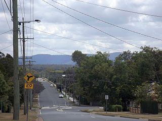
Chuwar is a town and suburb of Ipswich in the City of Ipswich and a locality of the City of Brisbane in South East Queensland, Australia. In the 2016 census, the suburb of Chuwar had a population of 2,244 people.

<span class="mw-page-title-main">Amberley, Queensland</span> Suburb of Ipswich, Queensland, Australia

Amberley is a suburb in the City of Ipswich, Queensland, Australia. In the 2016 census, Amberley had a population of 253 people.

<span class="mw-page-title-main">North Ipswich, Queensland</span> Suburb of Ipswich, Queensland, Australia

North Ipswich is a suburb of Ipswich in the City of Ipswich, Queensland, Australia. In the 2016 census, North Ipswich had a population of 4,515 people.

<span class="mw-page-title-main">Basin Pocket, Queensland</span> Suburb of Ipswich, Queensland, Australia

Basin Pocket is a suburb of Ipswich in the City of Ipswich, Queensland, Australia. In the 2016 census, Basin Pocket had a population of 890 people.

<span class="mw-page-title-main">Tivoli, Queensland</span> Suburb of Ipswich, Queensland, Australia

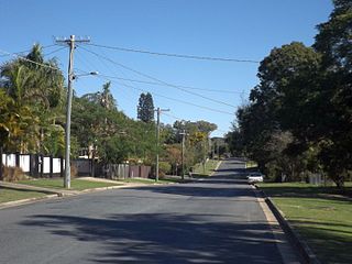
Tivoli is a suburb in the City of Ipswich, Queensland, Australia. In the 2016 census, Tivoli had a population of 1,487 people.

<span class="mw-page-title-main">North Tivoli, Queensland</span> Suburb of Ipswich, Queensland, Australia

North Tivoli is a suburb of Ipswich in the City of Ipswich, Queensland, Australia. In the 2016 census, North Tivoli had a population of 96 people.

<span class="mw-page-title-main">North Booval, Queensland</span> Suburb of Ipswich, Queensland, Australia

North Booval is a suburb of Ipswich in the City of Ipswich, Queensland, Australia. In the 2016 census, North Booval had a population of 3,175 people.

<span class="mw-page-title-main">East Ipswich, Queensland</span> Suburb of Ipswich, Queensland, Australia

East Ipswich is a residential inner-city suburb of Ipswich in the City of Ipswich, Queensland, Australia. In the 2016 census, East Ipswich had a population of 2,410 people.

<span class="mw-page-title-main">Leichhardt, Queensland</span> Suburb of Ipswich, Queensland, Australia

Leichhardt is a suburb of Ipswich in the City of Ipswich, Queensland, Australia. In the 2016 census, Leichhardt had a population of 3,912 people.

<span class="mw-page-title-main">Woodend, Queensland</span> Suburb of Ipswich, Queensland, Australia

Woodend is an inner suburb of Ipswich in the City of Ipswich, Queensland, Australia. In the 2021 census, Woodend had a population of 1,483 people.

<span class="mw-page-title-main">Sadliers Crossing, Queensland</span> Suburb of Ipswich, Queensland, Australia

Sadliers Crossing is a suburb of Ipswich in the City of Ipswich, Queensland, Australia. In the 2016 census, Sadliers Crossing had a population of 1,366 people.

<span class="mw-page-title-main">Wulkuraka, Queensland</span> Suburb of Ipswich, Queensland, Australia

Wulkuraka is a western suburb of Ipswich in the City of Ipswich, Queensland, Australia. In the 2016 census, Wulkuraka had a population of 1,234 people.

<span class="mw-page-title-main">Barellan Point, Queensland</span> Suburb of Ipswich, Queensland, Australia

Barellan Point is a rural residential suburb in the City of Ipswich, Queensland, Australia. In the 2016 census Barellan Point had a population of 1,159 people.

<span class="mw-page-title-main">Karalee, Queensland</span> Suburb of Ipswich, Queensland, Australia

Karalee is a rural residential suburb of Ipswich in the City of Ipswich, Queensland, Australia. In the 2016 census, Karalee had a population of 4352 people.

<span class="mw-page-title-main">Vernor, Queensland</span> Suburb of Somerset Region, Queensland, Australia

Vernor is a rural locality in the Somerset Region, Queensland, Australia. In the 2016 census, Vernor had a population of 233 people.

<span class="mw-page-title-main">Calvert, Queensland</span> Suburb of Ipswich, Queensland, Australia

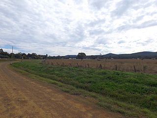
Calvert is a rural town and locality in the City of Ipswich, Queensland, Australia. In the 2016 census, the locality of Calvert had a population of 313 people.

References

  1. 1 2 3 Australian Bureau of Statistics (27 June 2017). "Moores Pocket (SSC)". 2016 Census QuickStats. Retrieved 20 October 2018. OOjs UI icon edit-ltr-progressive.svg
  2. 1 2 "Moores Pocket – suburb in City of Ipswich (entry 45057)". Queensland Place Names. Queensland Government . Retrieved 20 July 2021.
  3. "Queensland Globe". State of Queensland . Retrieved 1 January 2022.
  4. "MOORE'S POCKET". Queensland Times, Ipswich Herald And General Advertiser . Vol. XXXIV, no. 4932. Queensland, Australia. 11 February 1893. p. 5. Archived from the original on 1 January 2022. Retrieved 1 January 2022 via National Library of Australia.
  5. "Aerial view of flood waters at Bremer Waters Residential Resort, Moore's Pocket Road, Tivoli, Ipswich, 2011". Picture Ipswich. Archived from the original on 1 January 2022. Retrieved 1 January 2022.