East Porterville, California

Last updated

East Porterville
Nickname(s): 
East Side
Tulare County California Incorporated and Unincorporated areas East Porterville Highlighted.svg
Location in Tulare County and the state of California
Usa edcp location map.svg
Red pog.svg
East Porterville
Location in the United States
Coordinates: 36°3′22″N118°59′2″W / 36.05611°N 118.98389°W / 36.05611; -118.98389 Coordinates: 36°3′22″N118°59′2″W / 36.05611°N 118.98389°W / 36.05611; -118.98389
Country Flag of the United States.svg  United States
State Flag of California.svg  California
County Tulare
Government
   State legislators Sen. Melissa Hurtado (D)
Assm. Devon Mathis (R)
   U. S. rep. Kevin McCarthy (R) [1]
Area
[2]
  Total2.999 sq mi (7.767 km2)
  Land2.981 sq mi (7.720 km2)
  Water0.018 sq mi (0.047 km2)  0.60%
Elevation
486 ft (148 m)
Population
 (2011)
  Total7,331
  Density2,400/sq mi (940/km2)
Time zone UTC-8 (Pacific (PST))
  Summer (DST) UTC-7 (PDT)
ZIP code
93257, 93258
Area code(s) 559
FIPS code 06-21012
GNIS feature ID 1867018

East Porterville is an unincorporated community in Tulare County, California, United States. Adjacent to the city of Porterville, the community lies by the Sierra Nevada foothills. The population was 7,331 at the 2010 census, up from 6,730 at the 2000 census. For statistical purposes, the United States Census Bureau has defined East Porterville as a census-designated place (CDP). The census definition of the area may not precisely correspond to local understanding of the area with the same name.

Contents

Geography

East Porterville is located at 36°3′22″N118°59′2″W / 36.05611°N 118.98389°W / 36.05611; -118.98389 (36.056101, -118.983836). [3]

According to the United States Census Bureau, the CDP has a total area of 3.0 square miles (7.8 km2), of which, 3.0 square miles (7.8 km2) of it is land and 0.02 square miles (0.052 km2) of it (0.60%) is water.

Demographics

Historical population
CensusPop.
U.S. Decennial Census [4]

2010

The 2010 United States Census [5] reported that East Porterville had a population of 7,331. The population density was 2,256.6 inhabitants per square mile (871.3/km2). The racial makeup of East Porterville was 3,660 (54.1%) White, 65 (1.0%) African American, 153 (2.3%) Native American, 102 (1.5%) Asian, 58 (0.9%) Pacific Islander, 2,431 (35.9%) from other races, and 298 (4.4%) from two or more races. Hispanic or Latino of any race were 4,930 persons (72.9%).

The Census reported that 6,760 people (99.9% of the population) lived in households, 7 (0.1%) lived in non-institutionalized group quarters, and 0 (0%) were institutionalized.

There were 1,637 households, out of which 993 (60.7%) had children under the age of 18 living in them, 884 (54.0%) were opposite-sex married couples living together, 325 (19.9%) had a female householder with no husband present, 179 (10.9%) had a male householder with no wife present. There were 173 (10.6%) unmarried opposite-sex partnerships, and 9 (0.5%) same-sex married couples or partnerships. 173 households (10.6%) were made up of individuals, and 61 (3.7%) had someone living alone who was 65 years of age or older. The average household size was 4.13. There were 1,388 families (84.8% of all households); the average family size was 4.36.

The population was spread out, with 2,476 people (36.6%) under the age of 18, 858 people (12.7%) aged 18 to 24, 1,683 people (24.9%) aged 25 to 44, 1,326 people (19.6%) aged 45 to 64, and 424 people (6.3%) who were 65 years of age or older. The median age was 25.4 years. For every 100 females, there were 106.0 males. For every 100 females age 18 and over, there were 108.1 males.

There were 1,750 housing units at an average density of 583.6 per square mile (225.3/km2), of which 775 (47.3%) were owner-occupied, and 862 (52.7%) were occupied by renters. The homeowner vacancy rate was 1.3%; the rental vacancy rate was 4.7%. 3,072 people (45.4% of the population) lived in owner-occupied housing units and 3,688 people (54.5%) lived in rental housing units.

2000

As of the census [6] of 2000, there were 6,730 people, 1,709 households, and 1,413 families residing in the CDP. The population density was 2,198.6 inhabitants per square mile (848.9/km2). There were 1,853 housing units at an average density of 605.3 per square mile (233.7/km2). The racial makeup of the CDP was 45.79% White, 0.68% African American, 2.79% Native American, 2.66% Asian, 0.39% Pacific Islander, 43.12% from other races, and 4.56% from two or more races. Hispanic or Latino of any race were 64.14% of the population.

There were 1,709 households, out of which 50.6% had children under the age of 18 living with them, 53.2% were married couples living together, 19.6% had a female householder with no husband present, and 17.3% were non-families. 12.3% of all households were made up of individuals, and 5.6% had someone living alone who was 65 years of age or older. The average household size was 3.93 and the average family size was 4.20.

In the CDP, the population was spread out, with 37.9% under the age of 18, 13.0% from 18 to 24, 27.2% from 25 to 44, 14.8% from 45 to 64, and 7.1% who were 65 years of age or older. The median age was 24 years. For every 100 females, there were 106.2 males. For every 100 females age 18 and over, there were 105.9 males.

The median income for a household in the CDP was $25,022, and the median income for a family was $25,481. Males had a median income of $19,004 versus $18,854 for females. The per capita income for the CDP was $9,475. About 33.2% of families and 38.6% of the population were below the poverty line, including 49.3% of those under age 18 and 18.9% of those age 65 or over.

Infrastructure

In August 2014 during 2012–14 North American drought, East Porterville was experiencing "Exceptional" [7] drought conditions, [8] as was the entirety of Tulare County. The Fresno Bee reported that close to 1000 homes were without water due to a declining water table and dependence on shallow wells. [9] Although scores of people had been calling public agencies such as the county, the next-door city of Porterville, and the local water district to report dry wells, authorities have not realized the extent of the problem since the agencies did not track private wells. [10]

Government

In the California State Legislature, East Porterville is in the 14th Senate District , represented by Democrat Melissa Hurtado, and the 26th Assembly District , represented by Republican Devon Mathis. [11]

In the United States House of Representatives, East Porterville is in California's 23rd congressional district , represented by Republican Kevin McCarthy [1]

Related Research Articles

Whiteriver, Arizona Census designated place in Arizona, United States

Whiteriver is a census-designated place (CDP) located on the Fort Apache Indian Reservation in Navajo County, Arizona, United States. The population was 4,104 at the 2010 census, making it the largest settlement on the Reservation.

Cordes Lakes, Arizona CDP in Yavapai County, Arizona

Cordes Lakes is a census-designated place (CDP) in Yavapai County, Arizona, United States. The population was 2,058 at the 2000 census. The Agua Fria National Monument lies to the east and south of the community and Arcosanti is to the north.

Oroville East, California Census-designated place in California, United States

Oroville East or Kelly Ridge is a census-designated place (CDP) in Butte County, California, United States. The population was 8,280 at the 2010 census, down from 8,680 at the 2000 census. Most citizens are dependent on the commerce of Oroville, and the vast majority of high school students in Kelly Ridge attend Las Plumas High School. The community of Kelly Ridge sits at Lake Oroville and offers direct access to boating, camping, fishing and a variety of water sports. Some of Oroville's most beautiful and modern properties can be found here and this neighborhood is also a popular place to retire and enjoy the outdoors.

East Rancho Dominguez, California Census designated place in California, United States

East Rancho Dominguez, also known as East Compton, is an unincorporated community and census-designated place (CDP) located in southern Los Angeles County, California. The population was 15,135 at the 2010 census, up from 9,286 at the 2000 census. East Rancho Dominguez is an accepted city name according to the USPS, and shares the 90221 ZIP Code with Compton.

East Pasadena, California Place in California, United States

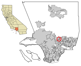
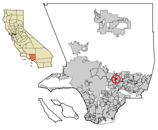
East Pasadena is an unincorporated community in Los Angeles County, California, United States. The population was 6,144 at the 2010 census, up from 6,045 at the 2000 census. For statistical purposes, the United States Census Bureau has defined East Pasadena as a census-designated place (CDP).

East San Gabriel, California Census-designated place in California, United States

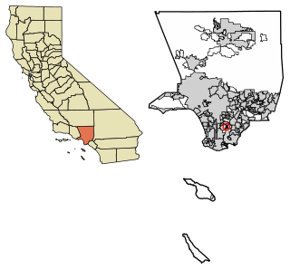
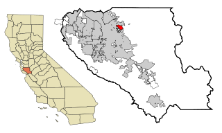
East San Gabriel is a census-designated place (CDP) in Los Angeles County, California, United States. The population was 14,874 at the 2010 census, up from 14,512 at the 2000 census.

Parkwood, California Census-designated place in California, United States

Parkwood is a census-designated place (CDP) in Madera County, California, United States. It is part of the Madera Metropolitan Statistical Area. The population was 2,307 at the 2020 census.

East Quincy, California Census-designated place in California, United States

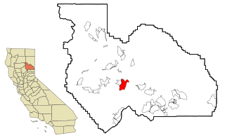
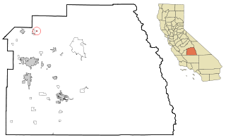
East Quincy is a census-designated place (CDP) in Plumas County, California, United States. The population was 2,489 at the 2010 census, up from 2,398 at the 2000 census.

East Shore, California Census-designated place in California, United States

East Shore is a census-designated place (CDP) in Plumas County, California, United States. The population was 156 at the 2010 census, down from 177 at the 2000 census.

East Hemet, California Census-designated place in California, United States

East Hemet is a census-designated place (CDP) in Riverside County, California, United States, located east of Hemet. East Hemet is in an unincorporated area outside the city limits of Hemet. The population was 17,418 at the 2010 census, up from 14,823 at the 2000 census.

La Presa, California Census-designated place in California, United States

La Presa is a census-designated place (CDP) in the East County region of San Diego County, California, United States. The population was 34,169 at the 2010 census, up from 32,721 at the 2000 census.

Toro Canyon, California Census-designated place in California, United States

Toro Canyon is a census-designated place (CDP) in Santa Barbara County, California, United States. The population was 1,835 at the 2020 census, up from 1,508 at the 2010 census.

East Foothills, San Jose Census designated place in California, United States

East Foothills is a census-designated place (CDP) in Santa Clara County, California, United States and a neighborhood of San Jose. The population was 8,269 at the 2010 census and it is located about 4 miles east of downtown San Jose.

East Oakdale, California Census-designated place in California, United States

East Oakdale is an unincorporated census-designated place (CDP) on the Stanislaus River, located east of the city of Oakdale in Stanislaus County, California.

East Orosi, California Census-designated place in California, United States

East Orosi is a census-designated place (CDP) in Tulare County, California, United States. The population was 495 at the 2010 census, up from 426 in 2000.

Terra Bella, California Census-designated place in California, United States

Terra Bella is a census-designated place (CDP) in Tulare County, California, United States. The population was 3,310 at the 2010 census, down from 3,466 at the 2000 census.

East Freehold, New Jersey Census-designated place in New Jersey, United States

East Freehold is an unincorporated community and census-designated place (CDP) located within Freehold Township, in Monmouth County, New Jersey, United States. As of the 2010 United States Census, the CDP's population was 4,894.

Leisure Village East, New Jersey Census-designated place in New Jersey, United States

Leisure Village East is an unincorporated community and census-designated place (CDP) located within Lakewood Township, in Ocean County, New Jersey, United States. As of the 2010 United States Census, the CDP's population was 4,217. Leisure Village East is one of several active adult communities bearing similar names. Leisure Village and Leisure Village West are the other two communities nearby.

Meridian, Pennsylvania Census-designated place in Pennsylvania, United States

Meridian is a census-designated place (CDP) in Butler County, Pennsylvania, United States. The population was 3,881 at the 2010 census.

Ponderosa is a census-designated place (CDP) in Tulare County, California. Ponderosa sits at an elevation of 7,231 feet (2,204 m). The 2010 United States census reported Ponderosa's population was 16. Ponderosa can be reached from Porterville by 43 curvy miles on a combination of California State Route 190 and the county-maintained Western Divide Highway with an elevation gain of 6,772 feet.

References

  1. 1 2 "California's 23rd Congressional District - Representatives & District Map". Civic Impulse, LLC. Retrieved October 6, 2014.
  2. "2010 Census U.S. Gazetteer Files – Places – California". United States Census Bureau.
  3. "US Gazetteer files: 2010, 2000, and 1990". United States Census Bureau. February 12, 2011. Retrieved April 23, 2011.
  4. "Census of Population and Housing". Census.gov. Retrieved June 4, 2016.
  5. "2010 Census Interactive Population Search: CA - East Porterville CDP". U.S. Census Bureau. Archived from the original on July 15, 2014. Retrieved July 12, 2014.
  6. "U.S. Census website". United States Census Bureau . Retrieved 2008-01-31.
  7. "U.S. Drought Monitor Classification Scheme". University of Nebraska–Lincoln. Archived from the original on August 21, 2014. Retrieved August 23, 2014.
  8. "U.S. Drought Monitor results for August 19th 2014". University of Nebraska–Lincoln. Archived from the original on December 27, 2016. Retrieved August 23, 2014.
  9. Lewis Griswold (August 22, 2014). "Volunteers deliver bottled water to drought-stricken community". The Fresno Bee. Archived from the original on August 24, 2014. Retrieved August 23, 2014.
  10. Marcum, Diana (September 18, 2014). "'HI, DO YOU HAVE WATER?' IN A CENTRAL CALIF. TOWN, ANSWER IS OFTEN NO". Los Angeles Times .
  11. "Statewide Database". Regents of the University of California . Retrieved March 30, 2015.