Poplar-Cotton Center, California

Last updated

Poplar-Cotton Center
Tulare County California Incorporated and Unincorporated areas Poplar-Cotton Center Highlighted.svg
Location in Tulare County and the state of California
Usa edcp location map.svg
Red pog.svg
Poplar-Cotton Center
Location in the United States
Coordinates: 36°3′14″N119°8′41″W / 36.05389°N 119.14472°W / 36.05389; -119.14472
Country Flag of the United States.svg  United States
State Flag of California.svg  California
County Tulare
Area
[1]
  Total1.283 sq mi (3.324 km2)
  Land1.283 sq mi (3.324 km2)
  Water0 sq mi (0 km2)  0%
Population
 (2010)
  Total2,470
  Density1,900/sq mi (740/km2)
Time zone UTC-8 (Pacific (PST))
  Summer (DST) UTC-7 (PDT)
ZIP code
93257
Area code 559
FIPS code 06-58191

Poplar-Cotton Center is a census-designated place (CDP) in Tulare County, California, United States. The population was 2,470 at the 2010 census, up from 1,496 at the 2000 census.

Contents

Geography

Poplar-Cotton Center is located at 36°3′14″N119°8′41″W / 36.05389°N 119.14472°W / 36.05389; -119.14472 (36.053936, -119.144796). [2]

According to the United States Census Bureau, the CDP has a total area of 1.3 square miles (3.4 km2), all of it land.

Demographics

2010

The 2010 United States Census [3] reported that Poplar-Cotton Center had a population of 2,470. The population density was 1,924.6 inhabitants per square mile (743.1/km2). The racial makeup of Poplar was 1,729 (70.0%) White, 1 (0.0%) African American, 15 (0.6%) Native American, 356 (14.4%) Asian, 0 (0.0%) Pacific Islander, 327 (13.2%) from other races, and 42 (1.7%) from two or more races. Hispanic or Latino of any race were 1,809 persons (73.2%).

The Census reported that 2,470 people (100% of the population) lived in households, 0 (0%) lived in non-institutionalized group quarters, and 0 (0%) were institutionalized.

There were 576 households, out of which 366 (63.5%) had children under the age of 18 living in them, 308 (53.5%) were opposite-sex married couples living together, 121 (21.0%) had a female householder with no husband present, 77 (13.4%) had a male householder with no wife present. There were 76 (13.2%) unmarried opposite-sex partnerships, and 9 (1.6%) same-sex married couples or partnerships. 48 households (8.3%) were made up of individuals, and 27 (4.7%) had someone living alone who was 65 years of age or older. The average household size was 4.29. There were 506 families (87.8% of all households); the average family size was 4.48.

The population was spread out, with 958 people (38.8%) under the age of 18, 285 people (11.5%) aged 18 to 24, 616 people (24.9%) aged 25 to 44, 411 people (16.6%) aged 45 to 64, and 200 people (8.1%) who were 65 years of age or older. The median age was 24.8 years. For every 100 females, there were 104.3 males. For every 100 females age 18 and over, there were 100.5 males.

There were 611 housing units at an average density of 476.1 per square mile (183.8/km2), of which 262 (45.5%) were owner-occupied, and 314 (54.5%) were occupied by renters. The homeowner vacancy rate was 1.9%; the rental vacancy rate was 5.1%. 1,132 people (45.8% of the population) lived in owner-occupied housing units and 1,338 people (54.2%) lived in rental housing units.

2000

As of the census [4] of 2000, there were 1,496 people, 349 households, and 314 families residing in the CDP. The population density was 1,172.5 inhabitants per square mile (452.7/km2). There were 367 housing units at an average density of 287.6 per square mile (111.0/km2). The racial makeup of the CDP was 29.55% White, 1.60% Native American, 16.71% Asian, 0.40% Pacific Islander, 48.66% from other races, and 3.07% from two or more races. Hispanic or Latino of any race were 59.69% of the population.

There were 349 households, out of which 57.0% had children under the age of 18 living with them, 64.8% were married couples living together, 18.1% had a female householder with no husband present, and 10.0% were non-families. 9.5% of all households were made up of individuals, and 4.9% had someone living alone who was 65 years of age or older. The average household size was 4.27 and the average family size was 4.46.

In the CDP, the population was spread out, with 40.4% under the age of 18, 11.2% from 18 to 24, 25.2% from 25 to 44, 15.5% from 45 to 64, and 7.6% who were 65 years of age or older. The median age was 24 years. For every 100 females, there were 108.6 males. For every 100 females age 18 and over, there were 99.8 males.

The median income for a household in the CDP was $24,519, and the median income for a family was $25,446. Males had a median income of $22,011 versus $19,306 for females. The per capita income for the CDP was $8,605. About 27.7% of families and 31.2% of the population were below the poverty line, including 41.0% of those under age 18 and 16.5% of those age 65 or over.

Politics

In the state legislature Poplar-Cotton Center is located in the 16th Senate District, represented by Democrat Dean Florez, and in the 30th Assembly District, represented by Republican Danny Gilmore.

In the United States House of Representatives, Poplar-Cotton Center is in California's 23rd congressional district , represented by Republican Jay Obernolte [5]

Related Research Articles

<span class="mw-page-title-main">Derby Acres, California</span> Census-designated place in California, United States

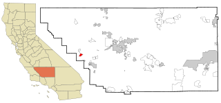
Derby Acres is a census-designated place (CDP) in Kern County, California, United States. Derby Acres is located 5.5 miles (8.9 km) north-northwest of Fellows, at an elevation of 1,375 feet (419 m). The population was 322 at the 2010 census, down from 376 at the 2000 census. The town is on State Route 33 at the northern extremity of the Midway-Sunset Oil Field, about five miles (8 km)five miles southeast of McKittrick.

<span class="mw-page-title-main">Dustin Acres, California</span> Census-designated place in California, United States

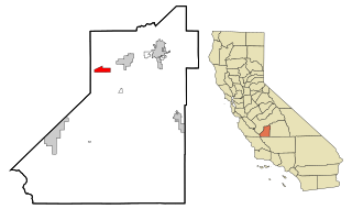
Dustin Acres is a census-designated place (CDP) in Kern County, California, United States. Dustin Acres is located 6.5 miles (10 km) north-northeast of Taft, at an elevation of 384 feet (117 m). The population was 652 at the 2010 census, up from 585 at the 2000 census.

<span class="mw-page-title-main">South Taft, California</span> Census-designated place in California, United States

South Taft is a census-designated place (CDP) in Kern County, California, United States. South Taft is located 0.5 miles (0.8 km) south of Taft, at an elevation of 1,017 feet (310 m). The population was 2,169 at the 2010 census, up from 1,898 at the time of the 2000 census.

<span class="mw-page-title-main">Valley Acres, California</span> Census-designated place in California, United States

Valley Acres is a census-designated place (CDP) in Kern County, California, United States. Valley Acres is located 5.2 miles (8.4 km) north-northeast of Taft, at an elevation of 420 feet (128.02 m). The population was 527 at the 2010 census, up from 512 at the 2000 census.

<span class="mw-page-title-main">Lemoore Station, California</span> Census-designated place in California, United States

Lemoore Station is a census-designated place (CDP) in Naval Air Station Lemoore, Kings County, California, United States. It is part of the Hanford–Corcoran Metropolitan Statistical Area. The population was 7,438 as of the 2010 United States Census.

<span class="mw-page-title-main">Cutler, California</span> Census-designated place in California, United States

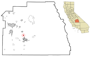
Cutler is a community and census-designated place (CDP) in Tulare County, California, United States. The population was 5,000 at the 2010 census, up from 4,491 at the 2000 census. The population as of 2019 was 5,214.

<span class="mw-page-title-main">Ducor, California</span> Census-designated place in California, United States

Ducor is a census-designated place (CDP) in Tulare County, California, United States. The population was 616 at the 2020 census, up from 612 at the 2010 census. Ducor is an abbreviation of an earlier name, Dutch Corners, which was given because several early settler families were German. The word "Dutch" in this case derives from German deutsch "German".

<span class="mw-page-title-main">Ivanhoe, California</span> Census designated place in California, United States

Ivanhoe is a census-designated place (CDP) in Tulare County, California, United States. The population was 4,495 at the 2010 census, up from 4,474 at the 2000 census.

<span class="mw-page-title-main">Lemon Cove, California</span> Census designated place in California, United States

Lemon Cove is a census-designated place (CDP) in the San Joaquin Valley in Tulare County, California, United States. The population was 308 at the 2010 census, up from 298 at the 2000 census.

<span class="mw-page-title-main">Orosi, California</span> Census-designated place in California, United States

Orosi is a census-designated place (CDP) in Tulare County, California, United States. The population was 8,770 at the 2010 census, up from 7,318 at the 2000 census.

<span class="mw-page-title-main">Pixley, California</span> Census-designated place in California, United States

Pixley is a census-designated place (CDP) in Tulare County, California, United States. The population was 3,310 at the 2010 census, up from 2,586 at the 2000 census.

<span class="mw-page-title-main">Richgrove, California</span> Census-designated place in California, United States

Richgrove is a census-designated place (CDP) in Tulare County, California, United States. The population was 2,358 at the 2020 United States census, down from 2,882 at the 2010 census.

<span class="mw-page-title-main">Strathmore, California</span> Census-designated place in California, United States

Strathmore is a census-designated place (CDP) in Tulare County, California, United States. The population was 2,819 at the 2010 census, up from 2,584 at the 2000 census.

<span class="mw-page-title-main">Traver, California</span> Census-designated place in California, United States

Traver is a census-designated place (CDP) in Tulare County, California, United States. The population was 713 at the 2010 census, down from 732 at the 2000 census.

<span class="mw-page-title-main">Woodville, California</span> Census-designated place in California, United States

Woodville is a census-designated place (CDP) in Tulare County, California, United States. The population was 1,740 at the 2010 census, up from 1,678 at the 2000 census.

<span class="mw-page-title-main">Pine Glen, Pennsylvania</span> Census-designated place in Pennsylvania, United States

Pine Glen is an unincorporated community and census-designated place (CDP) in Centre County, Pennsylvania, United States. It is part of the State College, Pennsylvania Metropolitan Statistical Area. It is part of Burnside Township. The population was 190 at the 2010 census.

<span class="mw-page-title-main">Blue Bell, Pennsylvania</span> Census-designated place in Pennsylvania, United States

Blue Bell is a census-designated place (CDP) in Whitpain Township, Montgomery County, Pennsylvania, United States. As of the 2010 census, its population was 6,067.

<span class="mw-page-title-main">Finley, Washington</span> CDP in Washington, United States

Finley is a census-designated place (CDP) in Benton County, Washington, United States. The population was 6,152 at the 2020 census. It is located to the southeast of the larger city of Kennewick.

<span class="mw-page-title-main">Highland, Washington</span> Unincorporated community in Washington, United States

Highland was a former unincorporated community and former census-designated place (CDP) in Benton County, Washington, United States. The population was 3,388 at the 2000 census. The area was not listed as a CDP for the 2010 census and the inhabited north end from S Olympia Street to Elliot Lake have since been added to Kennewick.

Comobabi is both a census-designated place (CDP) and a populated place in Pima County, Arizona, United States. The population was 8 at the 2010 census. It is located within the Tohono O'odham Indian Reservation.

References

  1. "2010 Census U.S. Gazetteer Files – Places – California". United States Census Bureau.
  2. "US Gazetteer files: 2010, 2000, and 1990". United States Census Bureau. February 12, 2011. Retrieved April 23, 2011.
  3. "2010 Census Interactive Population Search: CA - Poplar CDP". U.S. Census Bureau. Archived from the original on July 15, 2014. Retrieved July 12, 2014.
  4. "U.S. Census website". United States Census Bureau . Retrieved January 31, 2008.
  5. "California's 23rd Congressional District - Representatives & District Map". Civic Impulse, LLC. Retrieved October 6, 2014.