Related Research Articles

Newberry Springs is an unincorporated community in the western Mojave Desert of Southern California, located at the foot of the Newberry Mountains in San Bernardino County, California, United States. Newberry Spring is a spring that in the 19th century supplied water to the local Santa Fe Railway and originally was a camping place. The population at the 2000 census was 2,895.

Willow Springs is a village located around a set of former springs in Kern County, California, United States. It is located 7.5 miles (12 km) west of Rosamond, at an elevation of 2,523 feet (769 m).
Vichy Springs, more fully Napa Vichy Springs is a set of springs in Napa County, California whose water was once bottled and sold in 1898 as Napa Vichy Water. Vichy Springs is situated south of the Silverado Country Club and Milliken Creek on Montecello Road a few miles northeast of Napa.

The Box Spring is a spring in Riverside County, California, around which grew the town of Box Springs. It is in the Moreno Valley, five miles (8.0 km) east-southeast of downtown Riverside on Interstate 215/State Route 60. Box Springs is named on the 7.5 quadrangle map, Riverside East (1967).
Warner Springs is set of springs and a small unincorporated community in northern San Diego County, California.
Wentworth Springs is a set of springs that was once the site of a settlement and a camping resort in El Dorado County, California. It was located 11.5 miles (19 km) west of Meeks Bay.

Alder Springs is a set of springs and an unincorporated community in Glenn County, California. It is located 10.5 miles (17 km) west-northwest of Elk Creek, at an elevation of 4455 feet.
Fish Springs is a set of springs in Inyo County, California.
Bartlett Springs is a set of springs around which a resort was developed in Lake County, California. There were four improved springs, each delivering cool carbonated water with considerable amounts of suspended iron. In 1914 it was the largest such resort in Lake County, capable of accommodating up to 500 guests. There was also a bottling plant designed to maintain the natural carbonation as the bottles were filled and capped. It could fill 10,000 per day during the season from May to October when the roads were passable.

Parramore Springs is a spring in Lake County, California.
Indian Springs is a small set of springs after which a nearby mining settlement was named in the 19th century, in Nevada County, California, located near Rough and Ready. It had a post office from 1858 to 1871, and again from 1892 until 1893. Indian Springs was listed on a map as of 1949.
Duncan Springs is a set of springs and the site of a resort from the 1880s in Mendocino County, California.Waring 1915, p. 167 It is located 1.5 miles (2.4 km) south-southwest of Hopland, at an elevation of 781 feet.
Orrs Springs is a set of springs around which grew a resort and a stagecoach station in Mendocino County, California. It is located 15 miles (24 km) almost directly north of Boonville, at an elevation of 1001 feet. However, it is accessible from Ukiah by following Orr Springs Rd.
Soda Springs is a spring in Mendocino County, California. It is located 5 miles (8 km) northeast of Boonville, at an elevation of 1388 feet.

The Benton Hot Spring is a spring in Mono County, California around which grew the town of Benton . It is located 3 miles (4.8 km) west-southwest of Benton and 31 miles (50 km) north-northwest of Bishop, at an elevation of 5630 feet.

Visalia, California, commonly known in the 1850s as Four Creeks, is the oldest continuously inhabited inland European settlement between Stockton and Los Angeles. The city played an important role in the American colonization of the San Joaquin Valley as the county seat of Old Tulare County, an expansive region comprising most if not all of modern-day Fresno, Kings, and Kern counties.
Napa Soda Springs is a set of springs that was a resort in the 1880s in Napa County, California. It lies at an elevation of 705 feet. Napa Soda Springs is located 5 miles (8.0 km) east-southeast of Yountville.
Soda Springs is a set of springs in Placer County, California that was in the 19th century once the location of a hotel and resort. Soda Springs is located on the North Fork of the American River, 4 miles (6.4 km) north-northwest of Granite Chief. It lies at an elevation of 6047 feet.
The Stockton–Los Angeles Road, also known as the Millerton Road, Stockton–Mariposa Road, Stockton–Fort Miller Road or the Stockton–Visalia Road, was established about 1853 following the discovery of gold on the Kern River in Old Tulare County. This route between Stockton and Los Angeles followed by the Stockton–Los Angeles Road is described in "ITINERARY XXI. From Fort Yuma to Benicia, California", in The Prairie Traveler: A Hand-book for Overland Expeditions by Randolph Barnes Marcy. The Itinerary was derived from the report of Lieutenant R. S. Williamson on his topographical survey party in 1853, that was in search of a railroad route through the interior of California.
Stickneys Ferry was a settlement established in what became Tulare County after the Williamson Expedition of the Pacific Railroad Surveys of 1853 and before 1857, on what became the Stockton - Los Angeles Road and the crossing of the White River. It was probably established sometime between 1854 and 1856 because of the Kern River Gold Rush.
References
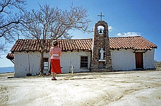
- 1 2 "Fountain Springs". Office of Historic Preservation, California State Parks. Retrieved 2012-10-18.
- ↑ Waring 1915, p. 336.
- ↑ "List of Stations from New York Times, October 14 1858, Itinerary of the Route" (PDF).
Reference bibliography
- Waring, Gerald Ashley (1915). Springs of California. U.S. Geological Survey Water Supply Paper. Vol. 338. U.S. Government Printing Office. doi:10.3133/wsp338.
| | This Tulare County, California-related article is a stub. You can help Wikipedia by expanding it. |