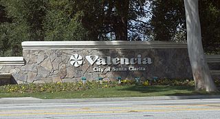
Valencia is a neighborhood in Santa Clarita located within Los Angeles County, California. It is one of the four unincorporated communities that merged to create the city of Santa Clarita in 1987. It is situated in the western part of Santa Clarita, stretching from Lyons Avenue to the south to north of Copper Hill Drive, and from Interstate 5 east to Bouquet Canyon and Seco Canyon Roads. Valencia was founded as a master-planned community with the first development, Old Orchard I, built on Lyons Avenue behind Old Orchard Elementary School.
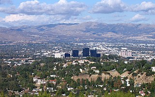
The Santa Susana Mountains are a transverse range of mountains in Southern California, north of the city of Los Angeles, in the United States. The range runs east-west, separating the San Fernando and Simi valleys on its south from the Santa Clara River Valley to the north and the Santa Clarita Valley to the northeast. The Oxnard Plain is to the west of the Santa Susana Mountains.
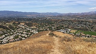
The Santa Clarita Valley (SCV) is part of the upper watershed of the Santa Clara River in Southern California. The valley was part of the 48,612-acre (19,673 ha) Rancho San Francisco Mexican land grant. Located in Los Angeles County, its main population center is the city of Santa Clarita which includes the communities of Canyon Country, Newhall, Saugus, and Valencia. Adjacent unincorporated communities include Castaic, Stevenson Ranch, Val Verde, and the unincorporated parts of Valencia.
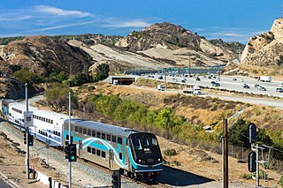
Newhall Pass is a low mountain pass in Los Angeles County, California. Historically called Fremont Pass and San Fernando Pass, with Beale's Cut, it separates the Santa Susana Mountains from the San Gabriel Mountains. Although the pass was visited in August 1769 by Catalan explorer Gaspar de Portolá, it eventually was named for Henry Newhall, a significant businessman in the area during the 19th century.

Newhall is the southernmost and oldest community in the city of Santa Clarita, California. Prior to the 1987 consolidation of Canyon Country, Saugus, Newhall, and Valencia into the city of Santa Clarita, it was an unincorporated area. It was the first permanent town in the Santa Clarita Valley.

Soledad Canyon is a long narrow canyon/valley located in Los Angeles County, California between the cities of Palmdale and Santa Clarita. It is a part of the Santa Clara River Valley, and extends from the top of Soledad Pass to the open plain of the valley in Santa Clarita. The upstream section of the Santa Clara River runs through it.

Canyon Country is a neighborhood in the eastern part of the city of Santa Clarita, in northwestern Los Angeles County, California, United States. It lies along the Santa Clara River between the Sierra Pelona Mountains and the San Gabriel Mountains. It is the most populous of Santa Clarita's four neighborhoods.
The Newhall School District is an elementary school district in the Santa Clarita Valley that serves the Valencia and Newhall communities within the city of Santa Clarita, California, as well as the Stevenson Ranch community in unincorporated Los Angeles County. It currently includes ten schools.
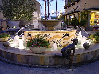
Santa Clarita is a city in northwestern Los Angeles County in the U.S. state of California. With a 2020 census population of 228,673, it is the third-most populous city in Los Angeles County, the 17th-most populous in California, and the 103rd-most populous city in the United States. It is located about 30 miles (48 km) northwest of downtown Los Angeles, and occupies 70.75 square miles (183.2 km2) of land in the Santa Clarita Valley, along the Santa Clara River. It is a classic example of a U.S. edge city, satellite city, or boomburb.

Via Princessa station is a Metrolink (California) train station located in the Canyon Country neighborhood of the city of Santa Clarita, California. It is served by Metrolink's Antelope Valley Line between Los Angeles Union Station and Lancaster station.

Mentryville was an oil drilling town in the Santa Susana Mountains in Los Angeles County, California, USA. It was started by Charles Alexander Mentry in the 1870s around the newly discovered oil reserves in that area. The first oil strike was on September 26, 1876. The town is located at the terminus of Pico Canyon Road, four miles west of the Lyons Avenue exit from I-5 in Santa Clarita. It is currently a part of Stevenson Ranch.
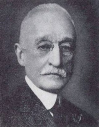
Demetrius Gustavus Scofield was a pioneer of the oil business in California who founded a number of companies in that state and became the first president of Standard Oil of California.
The Stockton–Los Angeles Road, also known as the Millerton Road, Stockton–Mariposa Road, Stockton–Fort Miller Road or the Stockton–Visalia Road, was established about 1853 following the discovery of gold on the Kern River in Old Tulare County. This route between Stockton and Los Angeles followed by the Stockton–Los Angeles Road is described in "Itinerary XXI. From Fort Yuma to Benicia, California", in The Prairie Traveler: A Hand-book for Overland Expeditions by Randolph Barnes Marcy. The Itinerary was derived from the report of Lieutenant R. S. Williamson on his topographical survey party in 1853, that was in search of a railroad route through the interior of California.
San Francisquito Pass is a mountain pass in the Sierra Pelona Mountains, located northeast of Green Valley and Santa Clarita, in northern Los Angeles County, California.
King's Station, also known as Moore's and Hollandsville, was a stagecoach station of the Butterfield Overland Mail 1st Division between 1858 and 1861 in southern California.
William Taylor Barnes Sanford (1814–1863) was an American road builder, a landowner and the second postmaster of Los Angeles, California, after it became a part of the United States. He was a member of the Los Angeles Common Council in 1853–54.
Widow Smith's Station, also known as Major Gordon's Station and Clayton's Station, was a stagecoach station of the Butterfield Overland Mail 1st Division from 1858 to 1861 in southern California.

Beale's Cut Stagecoach Pass is a stagecoach pass built in 1859 in what is now Santa Clarita, California. The Pass was designated a California Historical Landmark on May 11, 1992. The cut provided a route in the pass between the San Gabriel Mountains and the Santa Susana Mountains ranges. It is located near the current interchange of the Interstate 5 and California State Route 14.
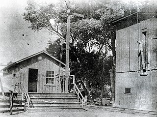
Lang Southern Pacific Station is a former Southern Pacific railway station located in Soledad Canyon near the eastern end of Santa Clarita, California. On September 5, 1876, the first railway to Los Angeles was completed at this site. The Lang Southern Pacific Station was designated a California Historic Landmark on May 22, 1957.

The Pioneer Oil Refinery was the first successful oil refinery in California, built in 1876 off Pine Street in Newhall, Santa Clarita, California. The Pioneer Oil Refinery was designated a California Historic Landmark (No.172) on March 6, 1935. Pioneer Oil Refinery is the oldest existing refinery in the world. The Lang Southern Pacific Station railroad line served the refinery. In 2020, the refinery was added to the National Register of Historic Places; it is the only site on the National Register of Historic Places within the city of Santa Clarita.


