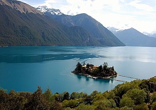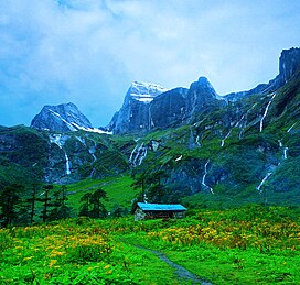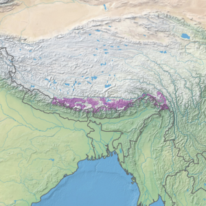
The Eastern Himalayan broadleaf forests is a temperate broadleaf forest ecoregion found in the middle elevations of the eastern Himalayas, including parts of Nepal, India, Bhutan, Myanmar and China. These forests have an outstanding richness of wildlife.

The Western Himalayan alpine shrub and meadows is a montane grasslands and shrublands ecoregion of Nepal, India, and Tibet, which lies between the tree line and snow line in the western portion of the Himalaya Range.

The Northern Triangle temperate forests is a temperate broadleaf and mixed forest ecoregion of thick forest covering the mountains of northern Myanmar.
Kedarnath Wild Life Sanctuary, also called the Kedarnath Musk Deer Sanctuary, is a wildlife sanctuary declared under Wildlife Protection Act, 1972 and located in Uttarakhand, India. Its alternate name comes from its primary purpose of protecting the endangered Himalayan musk deer. Consisting of an area of 975 km2 (376 sq mi), it is the largest protected area in the western Himalayas.It is famous for alpine musk deer, Himalayan Thar, Himalayan Griffon, Himalayan Black bear, Snow Leopard and other flora park and fauna. It is internationally important for the diversity of its flora and fauna.

Uttarakhand has a total geographic area of 53,483 km2, of which 86% is mountainous and 65% is covered by forest. Most of the northern parts of the state are part of Greater Himalaya ranges, covered by the high Himalayan peaks and glaciers, while the lower foothills were densely forested till denuded by the British log merchants and later, after independence, by forest contractors. Recent efforts in reforestation, however, have been successful in restoring the situation to some extent. The unique Himalayan ecosystem plays host to many animals, plants and rare herbs. Two of India's great rivers, the Ganges and the Yamuna take birth in the glaciers of Uttarakhand, and are fed by myriad lakes, glacial melts and streams.

The Western Himalayan broadleaf forests is a temperate broadleaf and mixed forest ecoregion which is found in the middle elevations of the western Himalayas, including parts of Nepal, India, and Pakistan.

The Eastern Himalayan subalpine conifer forests is a temperate coniferous forests ecoregion which is found in the middle and upper elevations of the eastern Middle Himalayas, in western Nepal, Bhutan, northern Indian states including Arunachal Pradesh and Sikkim and adjacent Myanmar and China.

The Northeastern Himalayan subalpine conifer forests are a temperate coniferous forests ecoregion of the middle to upper elevations of the eastern Himalayas and southeast Tibetan Plateau. The ecoregion occurs in southeastern Tibet Autonomous Region, China, in northern and eastern Arunachal Pradesh, India, and extreme eastern Bhutan.

The Northwestern Himalayan alpine shrub and meadows is a montane grasslands and shrublands ecoregion of the elevations of the northwestern Himalaya of China, India, and Pakistan.

The Western Himalayan subalpine conifer forests is a temperate coniferous forests ecoregion of the middle and upper elevations of the western Middle Himalayas of Nepal, India, and Pakistan.
The ecology of the Himalayas varies with climate, rainfall, altitude, and soils. The climate ranges from tropical at the base of the mountains to permanent ice and snow at the highest elevations. The amount of yearly rainfall increases from west to east along the southern front of the range. This diversity of climate, altitude, rainfall and soil conditions supports a variety of distinct plant and animal species, such as the Nepal gray langur
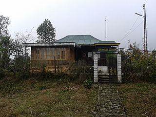
Pangolakha Wildlife Sanctuary is a wildlife reserve in the Pakyong District of the state of Sikkim in India. It is about 28 kilometres (17 mi) east of Rorathang and about 40 kilometres (25 mi) by road from Rangpo city. The total notified area of the park is around 124 square kilometres (48 sq mi) while inside the wildlife sanctuary there are a few hamlets: Aritar, Dakline Lingtam, Phadamchen, Dzuluk, Gnathang Monastery Kupup. This wildlife sanctuary is linked to the forests of Neora Valley National Park of West Bengal as well as forests of Samtse, Bhutan and Haa district Bhutan. The area that comes under this biosphere has been declared in 1999 as a wildlife sanctuary under biogeographic province category 2C.

Fambong Lho Wildlife Sanctuary is a 51 km2 (20 sq mi) large wildlife sanctuary in Gangtok district of the state of Sikkim in India. It is contiguous with Khangchendzonga National Park and located around 30 km (19 mi) west of Gangtok. It hosts a few small hamlets inside, namely Dikchu, Pangthang, and Mangan and is managed by State Forest Department.
Naina Devi Himalayan Bird Conservation Reserve is a wildlife reserve in the Nainital district of the state of Uttarakhand in India. This reserve forest is located in Kumaon region of Uttarakhand and placed inside Nainital forest division. Nainital forest division at present has several birding trails and forest patches consisting of temperate broad-leaf forests to alpine grasslands to rhododendron shrubberies. Wide altitudinal variation supports a very large segment of avian fauna to inhibit in this forest range.

Arunachal Pradesh is primarily a hilly tract nestled in the foothills of the Himalayas in northeast India. It is spread over an area of 83,743 km2 (32,333 sq mi). 98% of the geographical area is land out of which 80% is forest cover; 2% is water. River systems in the region, including those from the higher Himalayas and Patkoi and Arakan Ranges, eventually drain into the Brahmaputra River.


