Elizabeth Street, Melbourne

Last updated

Elizabeth Street

Elizabeth St Melbourne 2010.jpg
Elizabeth Street looking south toward Flinders Street station, April 2010
Elizabeth Street, Melbourne
Australia Victoria metropolitan Melbourne location map.svg
Red pog.svg
Elizabeth Street
Coordinates
General information
TypeStreet
Opened1837
Route number(s) Australian state route 55.svg State Route 55 (2005–present)
(Parkville–Haymarket roundabout)
Former
route number
  • Australian national highway 31.svg National Highway 31 (1988–2005)
    (Parkville–Haymarket roundabout)
  • Australian state route 3.svg State Route 3 (1965–1989)
    (Parkville–Melbourne)
Major junctions
North endAustralian state route 55.svg Royal Parade
Parkville, Melbourne
 
South endAustralian state route 30.svg Flinders Street
Melbourne CBD
Location(s)
Suburb(s) Parkville, Melbourne CBD

Elizabeth Street is one of the main streets in the Melbourne central business district, Victoria, Australia, part of the Hoddle Grid laid out in 1837. It is presumed to have been named in honour of governor Richard Bourke's wife. [1]

Contents

The street is known as a retail shopping precinct. It is connected with key shopping and tourist destinations such as Bourke Street Mall, General Post Office, Melbourne Central Shopping Centre, Emporium Melbourne and Queen Victoria Market.

The intersection of Elizabeth Street and Flinders street has been the site of ongoing social and criminal issues in recent times. Homelessness, drug use and violence have become commonplace. Despite pleas from locals, media organisations, law enforcement, local businesses and commuters, the Melbourne City Council has failed to clean up the site, which is a major transportation hub for people travelling in and outside of the city. [2] [3]

Geography

Elizabeth Street, looking south from the Queen Victoria Market Elizabeth-Street-Melbourne.JPG
Elizabeth Street, looking south from the Queen Victoria Market

The street runs roughly north-south in-between Queen Street and Swanston Street. At the southern end the street terminates at Flinders Street station, whilst the northern end terminates at Grattan Street, north of the Haymarket Roundabout.

Haymarket connects Elizabeth Street to Peel Street towards the south-west, Flemington Road to the north-west, Royal Parade to the north and Grattan Street to the East. This complex, high-traffic roundabout is further complicated by trams travelling through it on varying routes. [4] Traffic lights were installed on the roundabout in 2011 to limit the dangerous complexity of the intersection, it having previously functioned as a normal roundabout. [4]

Floods

Elizabeth Street is the lowest point in the Melbourne central business district, with land rising both to the east and west, and more gradually to the north. The street was built on top of a historic natural creek and has suffered numerous floods in Melbourne's history. [5]

Flash flooding south towards the Yarra River occurred in 1882, 1972 and more recently during the 2010 Victorian storms. [5] The Elizabeth Street drain runs from Carlton in the north to the Yarra River in the south, carrying storm water from the inner northern suburbs and city centre. [6] This drain is a significant source of pollutants entering the lower Yarra. [7]

Notable buildings

Melbourne's GPO is located on the corner of Elizabeth & Bourke Streets GPO, Melbourne, Australia.jpg
Melbourne's GPO is located on the corner of Elizabeth & Bourke Streets

Elizabeth Street is home to many historically important buildings, modern structures and works of art. These various works are listed on both the Victorian Heritage Register and National Trust of Australia.

Victorian Heritage Register

National Trust

Michaels Building corner of Elizabeth & Lonsdale Streets Michaels (Elizabeth Street, Melbourne).jpg
Michaels Building corner of Elizabeth & Lonsdale Streets

Motorcycle and Camera Precincts

Elizabeth Street circa 1960 Elizabeth Street, Melbourne.jpg
Elizabeth Street circa 1960
Elizabeth Sreet in 1870 Elizabeth St. Melbourne 1870.jpg
Elizabeth Sreet in 1870

Elizabeth Street has been home to a number of photography retailers and a considerable number of motorcycle dealers. The street has been the home of motorbike retailing in inner Melbourne since 1903, the longest-existing such area in the world.[ citation needed ]

Transport

As well as Flinders Street station at the southern end, the western exit of Melbourne Central railway station is located at the intersection of Latrobe and Elizabeth Streets. A number of tram services run along the street, including route 19 trams to Coburg North, route 59 trams to Airport West and route 57 trams to West Maribyrnong.

See also

Australia road sign W5-29.svg   Australian Roadsportal

Related Research Articles

<span class="mw-page-title-main">City of Banyule</span> Local government area in Victoria, Australia

The City of Banyule is a local government area in Victoria, Australia in the north-eastern suburbs of Melbourne. It was created under the Local Government Act 1989 and established in 1994 as an amalgamation of former councils. It has an area of 63 square kilometres (24.3 sq mi) and lies between 7 and 21 km from central Melbourne. In 1994 it had a population of 116,000. In June 2018 Banyule had a population of 130,237. The Yarra River runs along the City's southern border while its western border is defined by Darebin Creek.

<span class="mw-page-title-main">Heidelberg, Victoria</span> Suburb of Melbourne, Victoria, Australia

Heidelberg is a suburb of Melbourne, Victoria, Australia, 11 kilometres (7 mi) northeast of Melbourne's central business district, located within the City of Banyule local government area. Heidelberg recorded a population of 7,360 at the 2021 census.
<span class="mw-page-title-main">Malvern railway station, Melbourne</span> Railway station in Melbourne, Australia

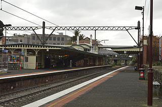
Malvern railway station is a commuter railway station that is part of the Melbourne railway network in Victoria, Australia. The station is located on the southern border of Malvern, a suburb of Melbourne, and was opened on 7 May 1879. The station complex consists of an island platform and two side platforms all accessed by a pedestrian bridge. There are two red brick Edwardian-era station buildings, constructed in 1914 as ticketing and staff offices. The entire complex is listed on the Victorian Heritage Register because of its architectural significance and its role in the development of Malvern as a significant metropolitan centre. The station is only partially accessible because of multiple steep access ramps.

<span class="mw-page-title-main">Melbourne tram route 70</span> Yarra Trams service

Melbourne tram route 70 is operated by Yarra Trams on the Melbourne tram network from Waterfront City to Wattle Park. The 16.5 kilometre route is operated out of Camberwell depot with A and B class trams.

<span class="mw-page-title-main">South Geelong, Victoria</span> Suburb of Geelong, Victoria, Australia

South Geelong, also referred to as Geelong South, is a southern suburb of Geelong, Victoria, Australia. Its local government area is the City of Greater Geelong. At the 2016 census, South Geelong had a population of 993.

<span class="mw-page-title-main">La Trobe Street</span> Street in Melbourne, Victoria

La Trobe Street is a major street and thoroughfare in the Melbourne central business district, Victoria, Australia. It runs roughly east–west and forms the northern boundary of the central business district. The street was laid out as an extension of the original Hoddle Grid in 1839 and was named after Charles La Trobe. La Trobe Street extends from Victoria Street in the east to Harbour Esplanade in the west.

<span class="mw-page-title-main">Spring Street, Melbourne</span> Street in Melbourne, Victoria

Spring Street is a major street in the Melbourne central business district, Australia. It runs roughly north-south and is the easternmost street in the original 1837 Hoddle Grid.

<span class="mw-page-title-main">Russell Street, Melbourne</span> Street in Melbourne, Victoria

Russell Street is a main street and thoroughfare in the Melbourne central business district, Victoria, Australia. It runs roughly north-south and was laid out as a core feature of the Hoddle Grid in 1837.

<span class="mw-page-title-main">Victoria Street, Melbourne</span> Road in Melbourne, Victoria

Victoria Street is one of the major thoroughfares of inner Melbourne, running east–west for over six kilometres between Munster Terrace in North Melbourne and the Yarra River. The road is known as Victoria Parade for over one-and-a-half kilometres of its length, distinguishable with a wide reservation and tramway down the middle.
<span class="mw-page-title-main">King Street, Melbourne</span> Street in Melbourne

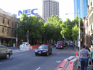
King Street is a main road in the Melbourne central business district, Australia. It is considered a key hub of Melbourne's nightlife and is home to many pubs, nightclubs, restaurants, and adult entertainment venues.

<span class="mw-page-title-main">Melbourne tram route 55</span>

Route 55 was a tram route on the Melbourne tram network. The 12.5 kilometre route operated between Coburg West and Domain Interchange, was operated out of Essendon depot with Z and B-class trams. It ceased on 30 April 2017 and was replaced by route 58.

Flemington Road is a major thoroughfare in the inner suburbs of North Melbourne and Parkville in Melbourne, Victoria, Australia. It runs for 2 km in a northwest–southeast direction, from the southern end of Mount Alexander Road, Flemington, to Haymarket roundabout and the northern end of Elizabeth Street, and provides a main connection between the northern arm of the CityLink tollway and Melbourne's CBD.

<span class="mw-page-title-main">Melbourne tram route 86</span> Tram route in Melbourne, Victoria, Australia

Melbourne tram route 86 is operated by Yarra Trams on the Melbourne tram network from Bundoora RMIT to Waterfront City. The 22.2-kilometre (13.8 mi) route is operated out of Preston depot with E class trams.

<span class="mw-page-title-main">Melbourne tram route 48</span>

Melbourne tram route 48 is operated by Yarra Trams on the Melbourne tram network from Balwyn North to Victoria Harbour. The 13.5-kilometre (8.4 mi) route is operated out of Kew depot with A and C class trams.

<span class="mw-page-title-main">Think Tram</span>

Think Tram was a Victorian Government program aimed at improving Melbourne's tram network. The intended benefits were reduced travel time and better reliability, and better accessibility. The program was run by VicRoads, in partnership with Yarra Trams and Public Transport Victoria. The program targets individual routes or streets with a mixture of different treatments, including the sometimes controversial superstops.

<span class="mw-page-title-main">Queens Bridge (Melbourne)</span> Bridge in Melbourne, Australia

The Queen's Bridge is a historic road bridge over the Yarra River in Melbourne, Victoria, Australia. The bridge was built in 1889 and has five wrought iron plate girder spans and is listed on the Victorian Heritage Register. The bridge was built by contractor David Munro and replaced a timber footbridge built in 1860.

<span class="mw-page-title-main">John Beswicke</span> Architect (1847–1925)

John Beswicke (1847–1925) was an architect who practiced in Melbourne between the 1870s and 1915.

Oakden, Addison and Kemp was an Australian architectural firm in Melbourne, Victoria. While it was short lived, existing from only 1887 to 1892, they designed a number of outstanding projects, and all three members designed many more notable projects in earlier and later partnerships.

<span class="mw-page-title-main">Harbour Esplanade</span> Street in Melbourne, Victoria, Australia

Harbour Esplanade is a waterfront street and thoroughfare in Docklands, an inner suburb of Melbourne, Victoria, Australia. It runs roughly north-south from Navigation Drive in the south to Docklands Drive in the north. The road also forms the eastern boundary of the Victoria Harbour inlet and is adjacent to Victoria Dock.

References

  1. Royal Historical Society of Victoria "Melbourne's streets and lanes: what's in a name?" Archived 10 June 2016 at the Wayback Machine , brochure published 2004 or later, retrieved 4 April 2013
  2. "Is homelessness on Elizabeth St getting worse?". ABC listen. 31 August 2023. Retrieved 25 April 2024.
  3. Juanola, Marta Pascual (25 August 2023). "The Elizabeth Street gateway: How crime crept down the city's spine". The Age. Retrieved 25 April 2024.
  4. 1 2 "Trams DownUnder - Message 147857". tdu.to. Retrieved 21 January 2017.
  5. 1 2 "Melbourne city grid | Ergo". ergo.slv.vic.gov.au. Retrieved 21 January 2017.
  6. "The Elizabeth-Street Drain". The Argus . 22 July 1884. Retrieved 21 January 2017 via Trove.
  7. "Melbourne's underground river: Museum Victoria". museumvictoria.com.au. Archived from the original on 2 February 2017. Retrieved 21 January 2017.
  8. "VHD". vhd.heritagecouncil.vic.gov.au. Retrieved 21 January 2017.
  9. "VHD". vhd.heritagecouncil.vic.gov.au. Retrieved 21 January 2017.
  10. Tom (31 August 2015). "Melbourne's Elizabeth Street in 1870". Cool Old Photos. Retrieved 19 February 2019.

Commons-logo.svg Media related to Elizabeth Street, Melbourne at Wikimedia Commons