Elsmere, Colorado

Last updated

Elsmere is an unincorporated community northwest of Cimarron Hills in El Paso County, Colorado. [1] [2] [3]

Unincorporated area Region of land not governed by own local government

In law, an unincorporated area is a region of land that is not governed by a local municipal corporation; similarly an unincorporated community is a settlement that is not governed by its own local municipal corporation, but rather is administered as part of larger administrative divisions, such as a township, parish, borough, county, city, canton, state, province or country. Occasionally, municipalities dissolve or disincorporate, which may happen if they become fiscally insolvent, and services become the responsibility of a higher administration. Widespread unincorporated communities and areas are a distinguishing feature of the United States and Canada. In most other countries of the world, there are either no unincorporated areas at all, or these are very rare; typically remote, outlying, sparsely populated or uninhabited areas.

El Paso County, Colorado County in the United States

El Paso County is one of the 64 counties of the U.S. state of Colorado. The 2017 census estimate recorded an approximate population of 699,232 for El Paso County. The Census Bureau's 2017 estimate indicates it is the second-most populous county in Colorado, after the City and County of Denver. The county seat is Colorado Springs, the second most populous city in Colorado.

Related Research Articles

Byers, Colorado CDP in State of Colorado, United States

Byers is a census-designated place (CDP) in Arapahoe County, Colorado, United States. The population was 1,160 at the 2010 census. The Byers Post Office has the ZIP Code 80103.

Evans, Colorado Home Rule Municipality in Colorado, United States

The City of Evans is a Home Rule Municipality located in Weld County, Colorado, United States. The population was 9,514 at the 2000 census, and estimated at 18,842 as of July 1, 2008, by the Census Bureau.

Elsmere, Delaware Town in Delaware, United States

Elsmere is a town in New Castle County, Delaware, United States, bordering the city of Wilmington along Wilmington's western border. According to the 2010 Census, the population of the town is 6,131.

Foreston, Minnesota City in Minnesota, United States

Foreston is a city in Mille Lacs County, Minnesota, United States. The population was 533 at the 2010 census.

Glendive, Montana City in Montana, United States

Glendive is a city in and the county seat of Dawson County, Montana, United States, and home to Dawson Community College. Glendive was established by the Northern Pacific Railway when they built the transcontinental railroad across the northern tier of the western United States from Minnesota to the Pacific Coast. The town was the headquarters for the Yellowstone Division that encompassed 875 route miles (1,408 km); 546 (879) in main line and 328 (528) in branches with the main routes from Mandan, North Dakota, to Billings, Montana, and from Billings to Livingston, Montana. The town of Glendive is an agricultural and ranching hub of eastern Montana. The town is tucked between the Yellowstone River and the Badlands, named for the rugged terrain and jagged rock formations that are known to exist in the area. Makoshika State Park is located just east of Glendive.

Pisek, North Dakota City in North Dakota, United States

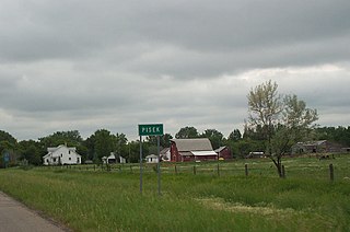
Pisek is a city in Walsh County, North Dakota, United States. The population was 106 at the 2010 census.

Elk Mound is a town in Dunn County, Wisconsin, United States. The population was 1,121 at the 2000 census. The town is named after the Village of Elk Mound, located in the eastern part of the town.

Whitewater, California census-designated place in California, United States

Whitewater is a census-designated place in Riverside County, California. It is directly off Interstate 10 halfway between North Palm Springs and Cabazon on the way from Palm Springs to Los Angeles. It is known as the site of the San Gorgonio Pass Wind Farm. The ZIP Code is 92282, and the community is inside area code 760. The population was 859 at the 2010 census. The elevation is 1,575 feet (480 m).

Saint Marys, Floyd County, Indiana Unincorporated community in Indiana, United States

Saint Marys is an unincorporated community in Lafayette Township, Floyd County, Indiana.

Lake Park, Indiana Unincorporated community in Indiana, United States

Lake Park is an unincorporated community in Hudson Township, LaPorte County, Indiana.

Old Fort Jim, California Unincorporated community in California, United States

Old Fort Jim is an unincorporated community in El Dorado County, California. It is located 3 miles (4.8 km) southwest of Camino, at an elevation of 2247 feet.

Shirley is an unincorporated community located north of Banning Lewis Reservoir Number 1 in El Paso County, Colorado.

Midway is an unincorporated community near the Pikes Peak Cog Railway in El Paso County, Colorado.

Olinger is an unincorporated community in Lee County, Virginia, in the United States.

Grant, Ohio human settlement in United States of America

Grant is an unincorporated community in Hardin County, in the U.S. state of Ohio.

McFarland is an extinct town in Taney County, in the U.S. state of Missouri.

Antioch is an unincorporated community in Claiborne Parish, Louisiana, United States.

References

  1. "Elsmere Populated Place Profile". HTL, Inc. Retrieved 7 Jun 2012.
  2. "Elsmere, United States". Information Technology Associates. Retrieved 7 Jun 2012.
  3. "Elsmere". Geographic Names Information System . United States Board on Geographic Names. Retrieved 7 Jun 2012.

Coordinates: 38°51′53″N104°42′38″W / 38.86472°N 104.71056°W / 38.86472; -104.71056

Geographic coordinate system Coordinate system

A geographic coordinate system is a coordinate system that enables every location on Earth to be specified by a set of numbers, letters or symbols. The coordinates are often chosen such that one of the numbers represents a vertical position and two or three of the numbers represent a horizontal position; alternatively, a geographic position may be expressed in a combined three-dimensional Cartesian vector. A common choice of coordinates is latitude, longitude and elevation. To specify a location on a plane requires a map projection.